
The Great Divide Trail Diary
Ben and Miranda
Our Great Divide Trail hike ran from the American boarder up to Mount Robson at the end of Section F and it was nothing short of a life changing experience! Every step of the way came with spectacular views, a feel of real wilderness and an overwhelming sense of peace. Yes, hiking 700+ miles in the wilderness can give you the mental peace that we severely lack in modern society. Now, if you’re planning on attempting this hike then read on to hopefully learn and also check out our blog about planning the GDT. If you’re here purely for enjoyment… then enjoy! Equally, we encourage anyone reading this to get out there and see the world and take on a challenge you believe is beyond your capability. You might be surprised what you can do!
Section A - Waterton Lakes to Coleman
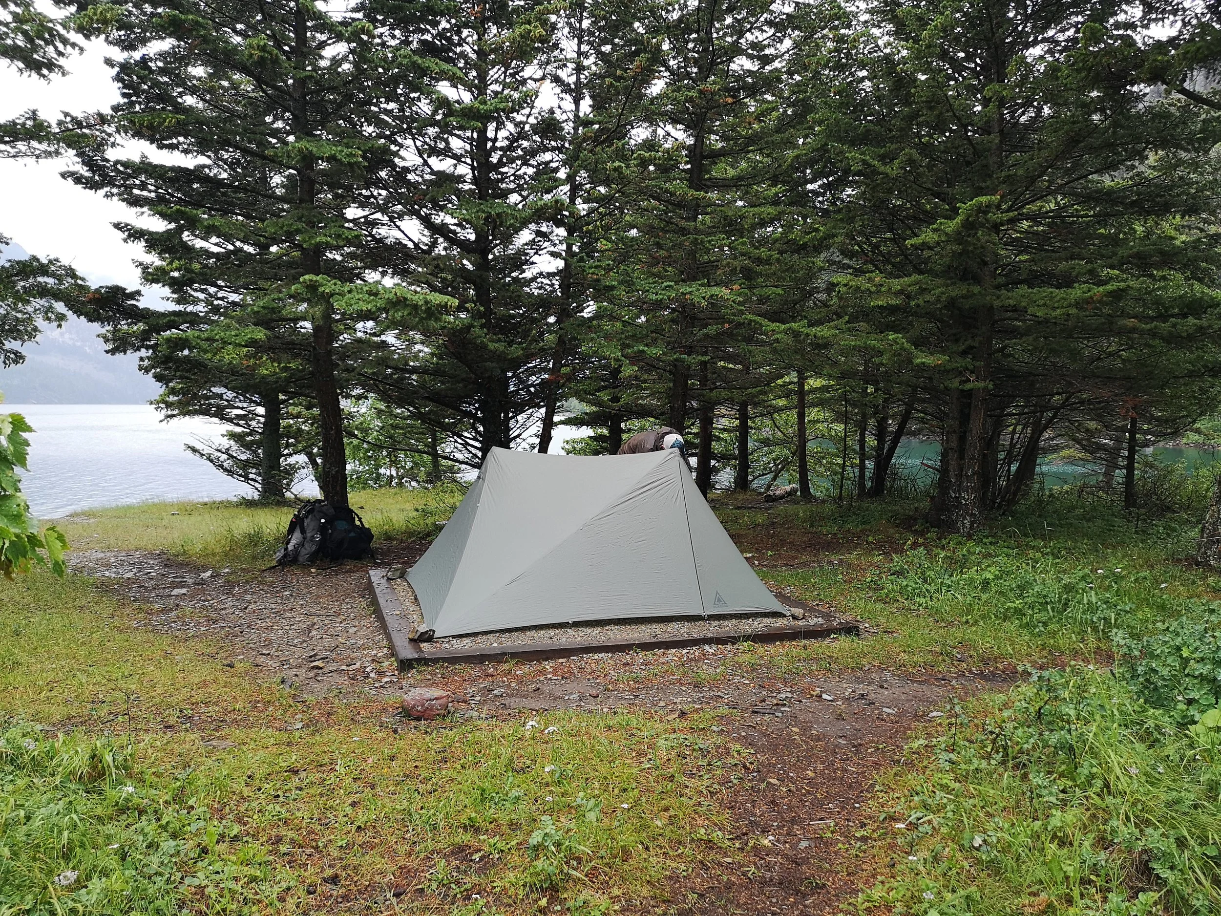
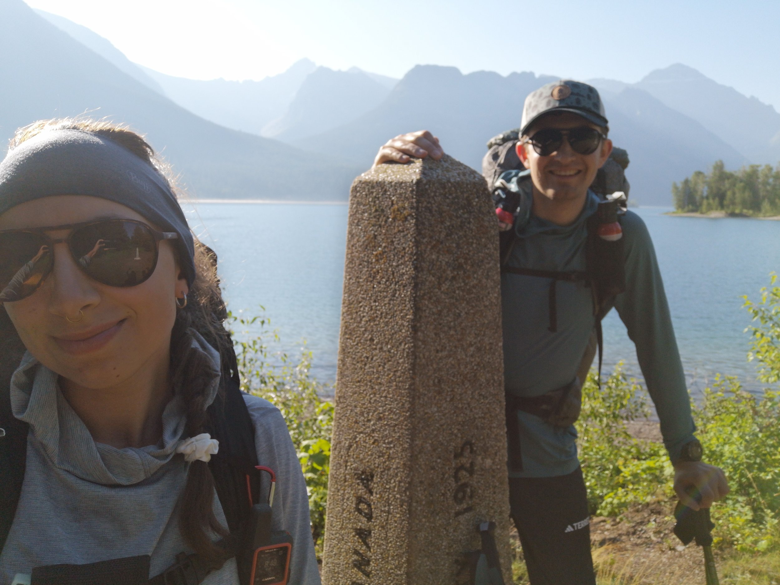
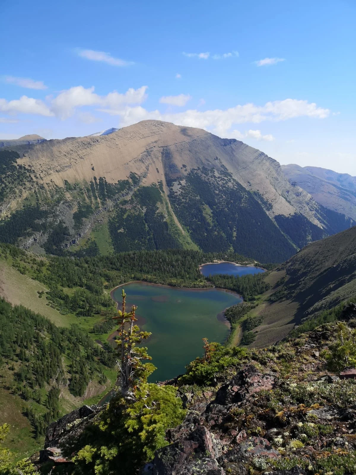
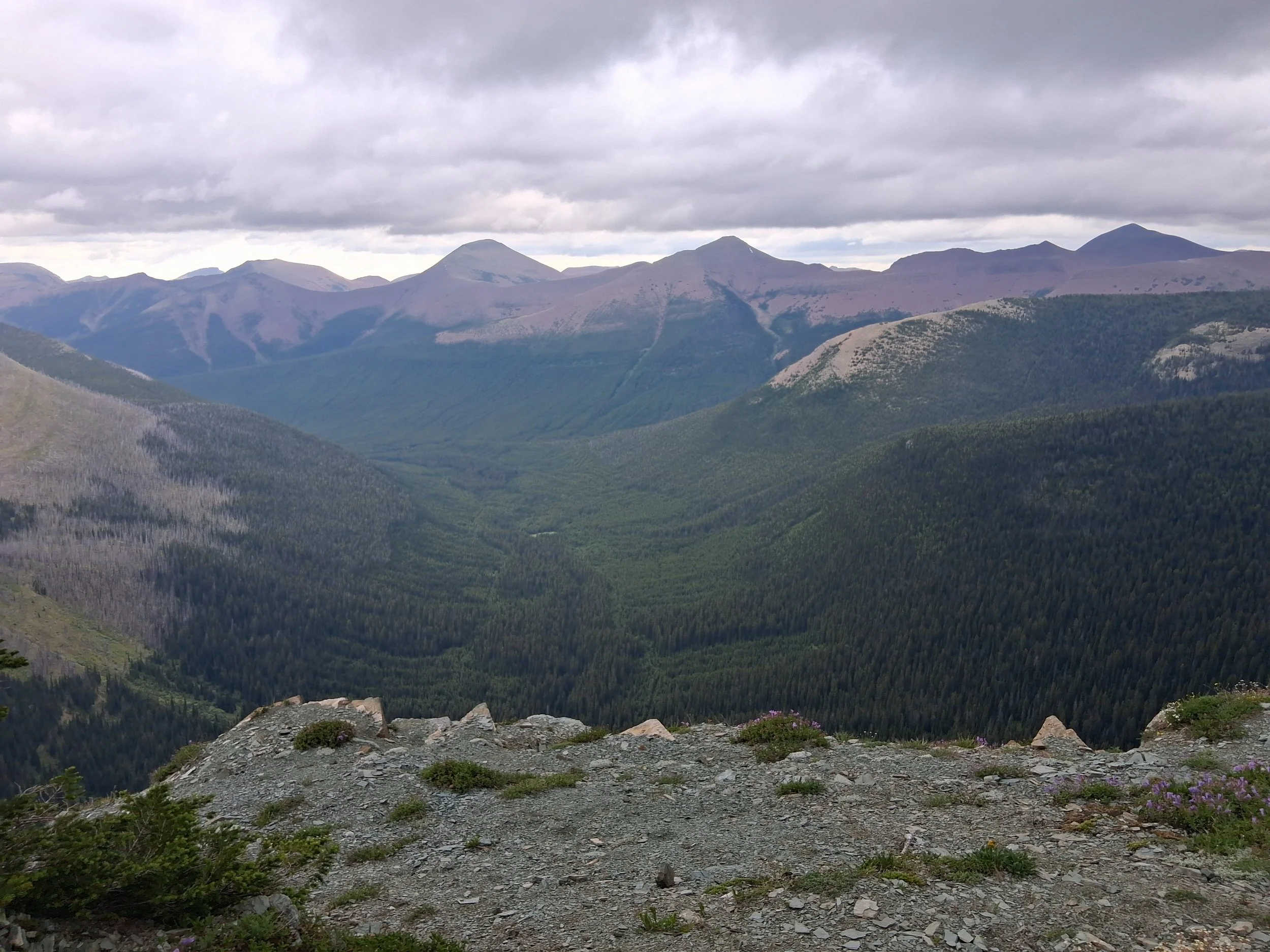
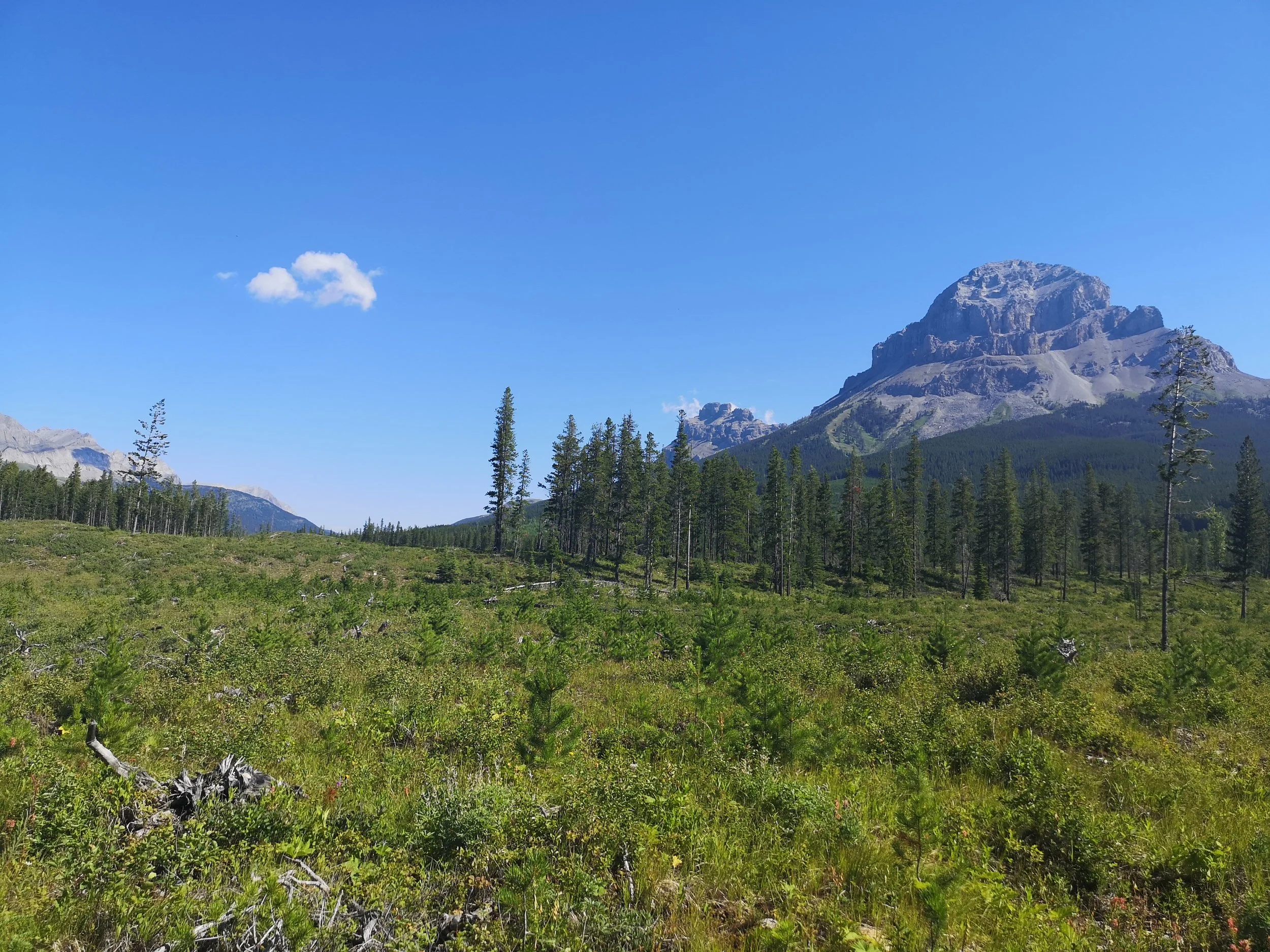
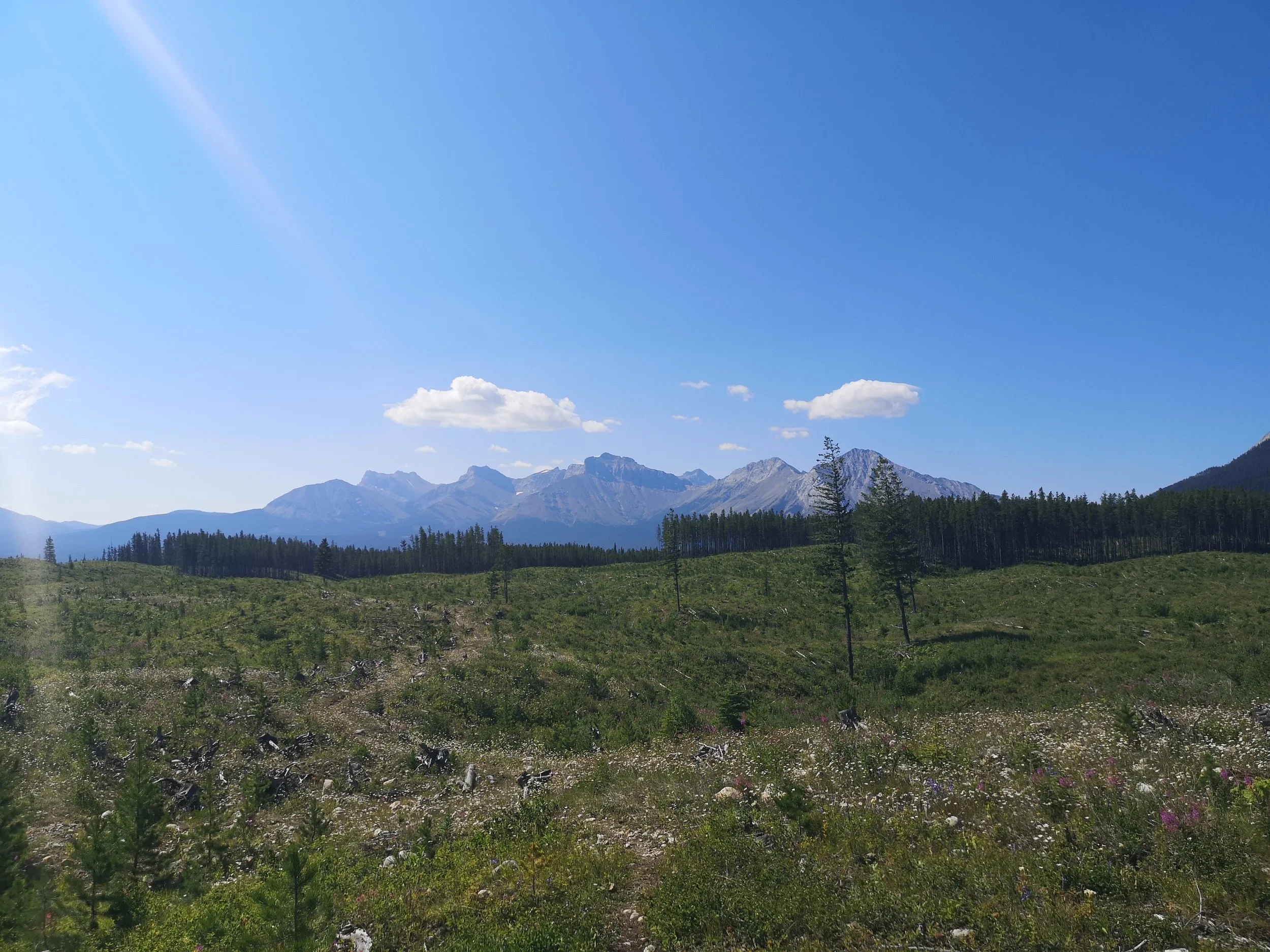
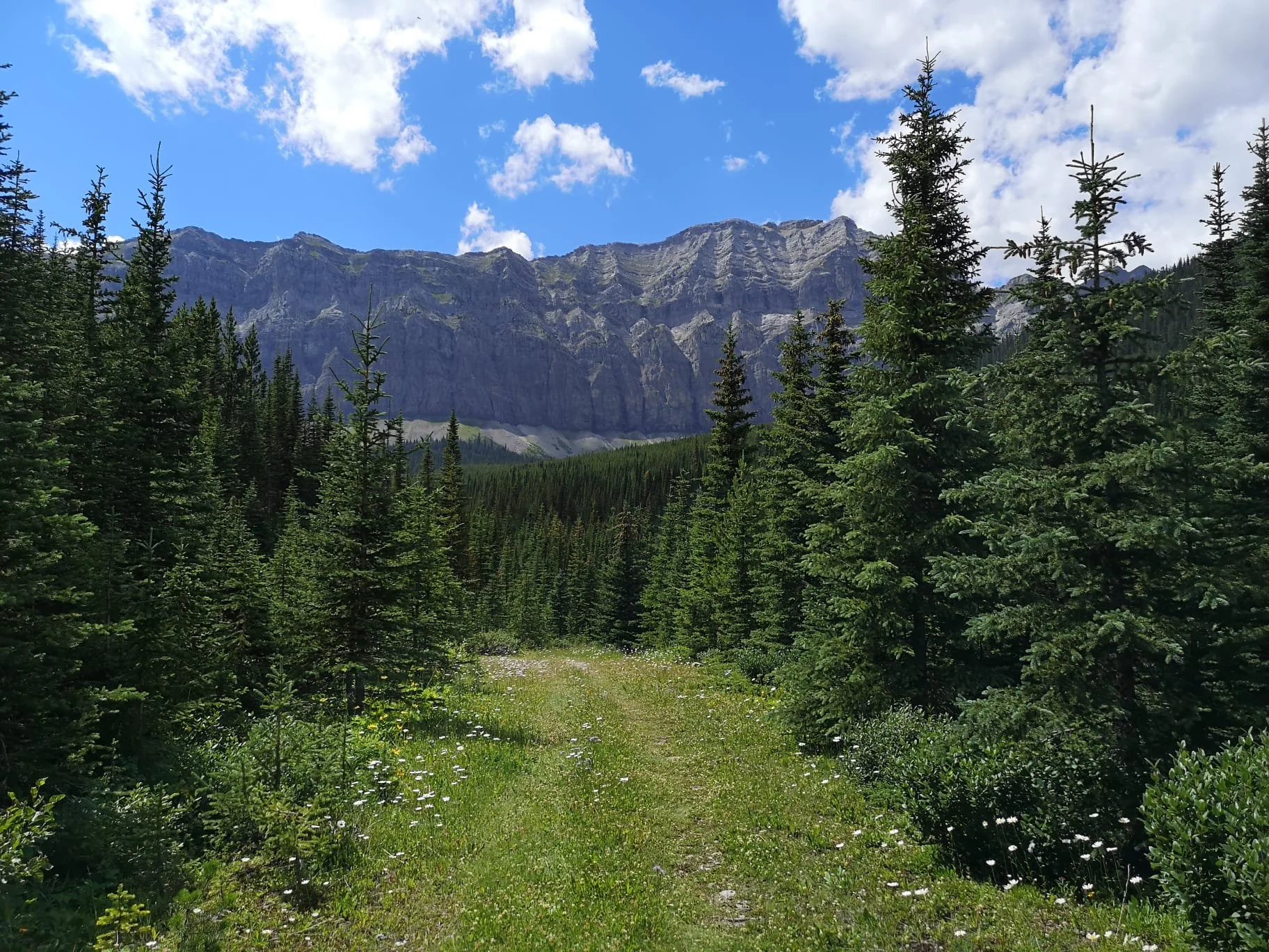
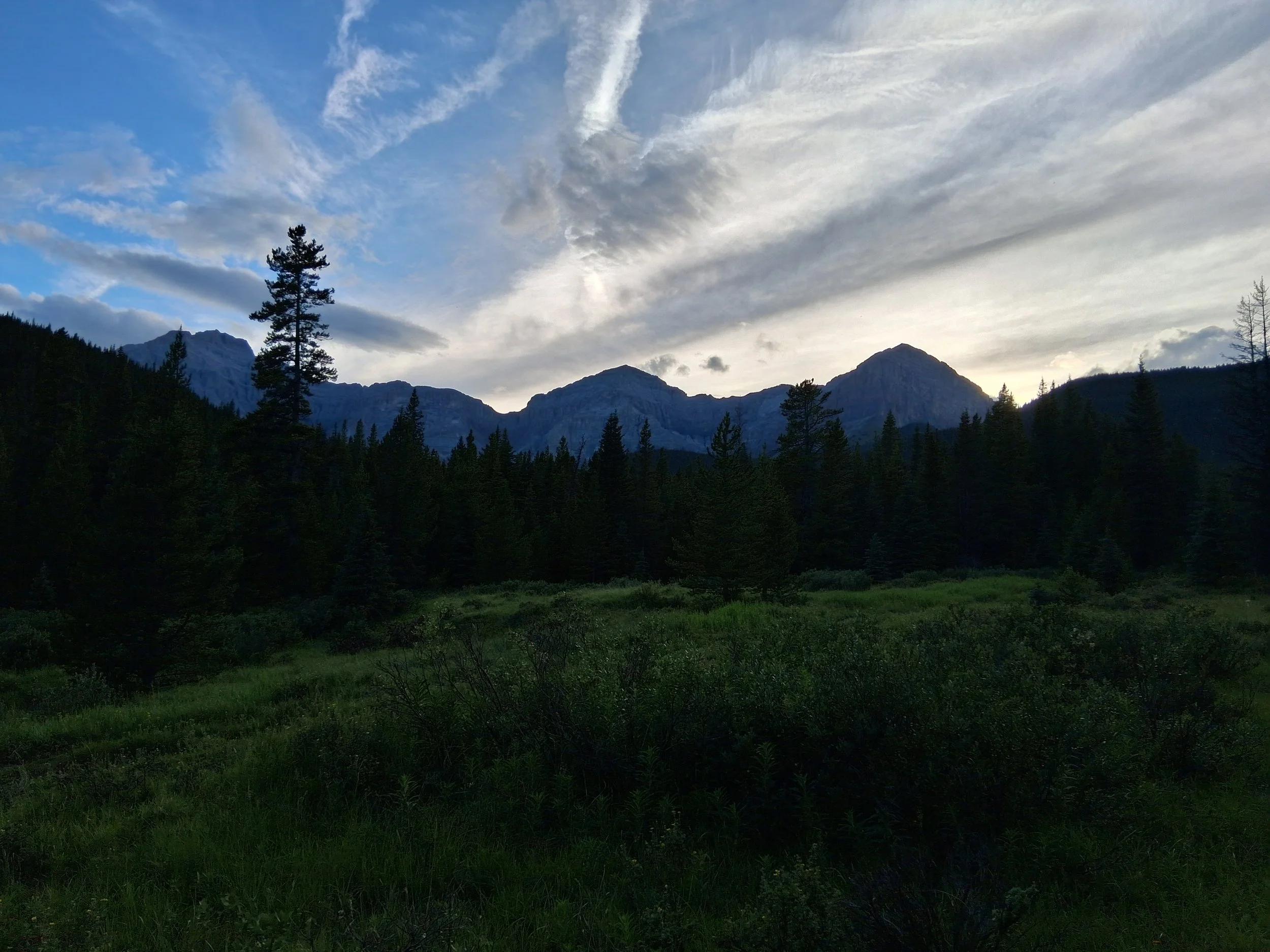
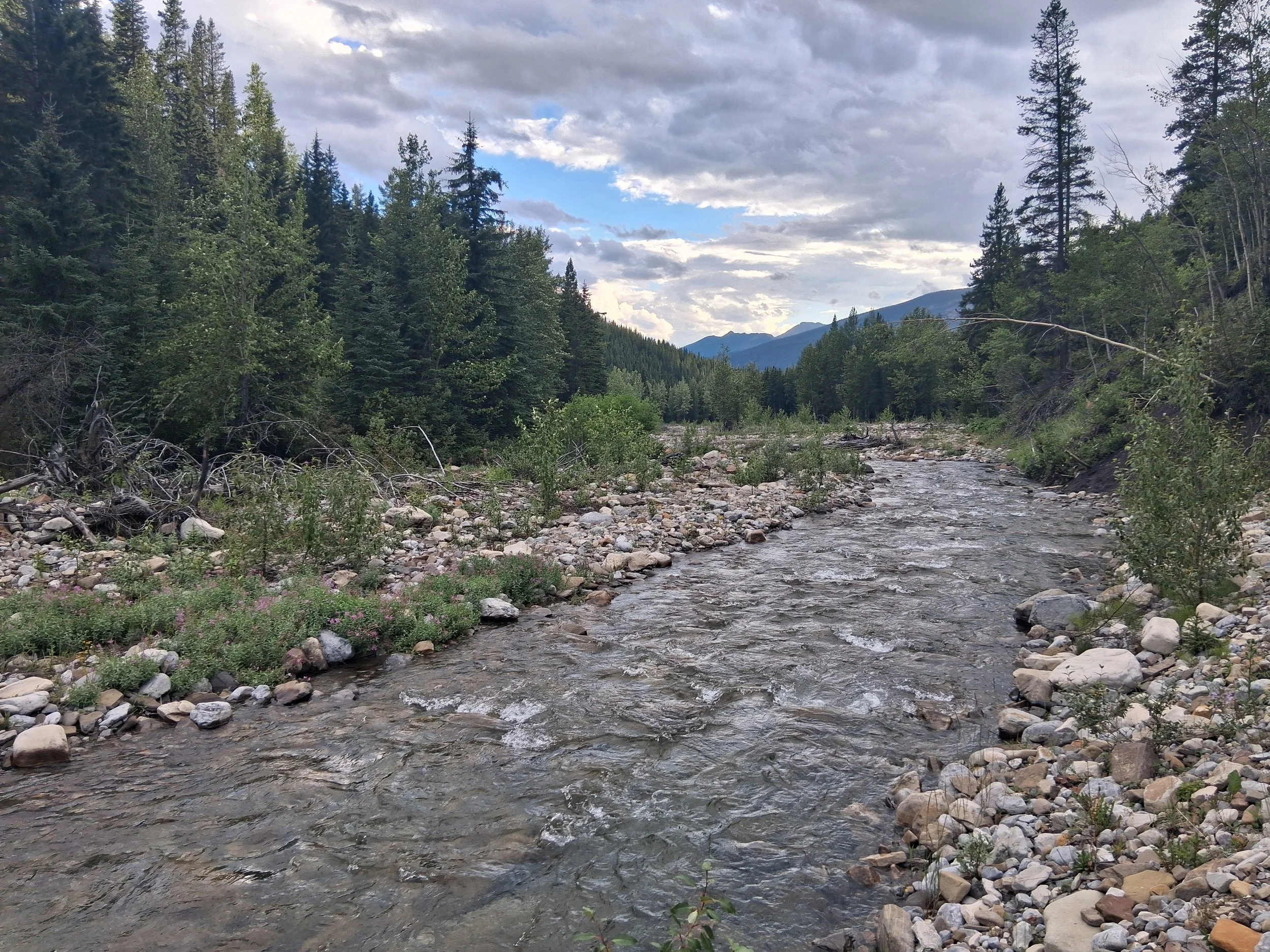
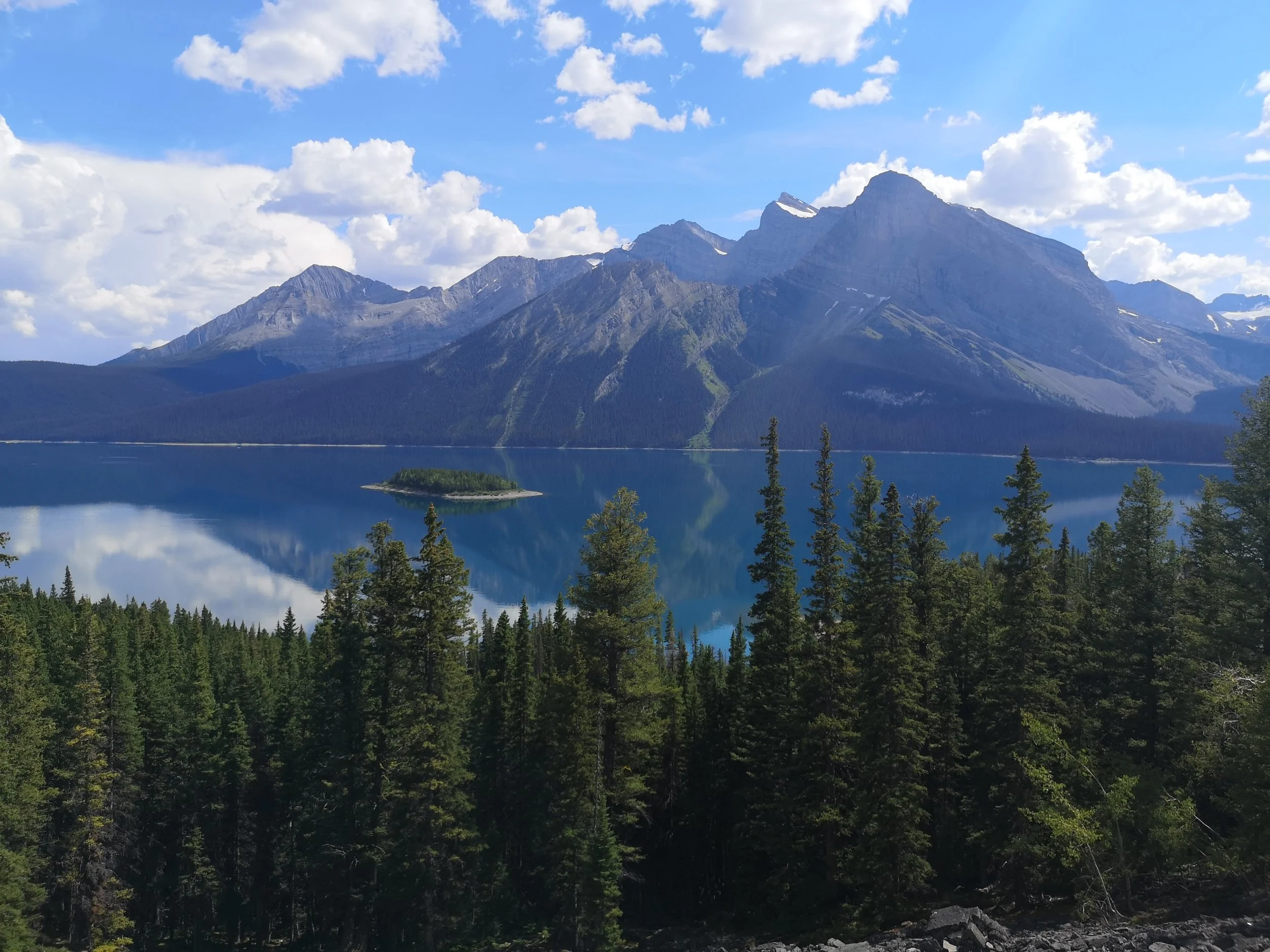
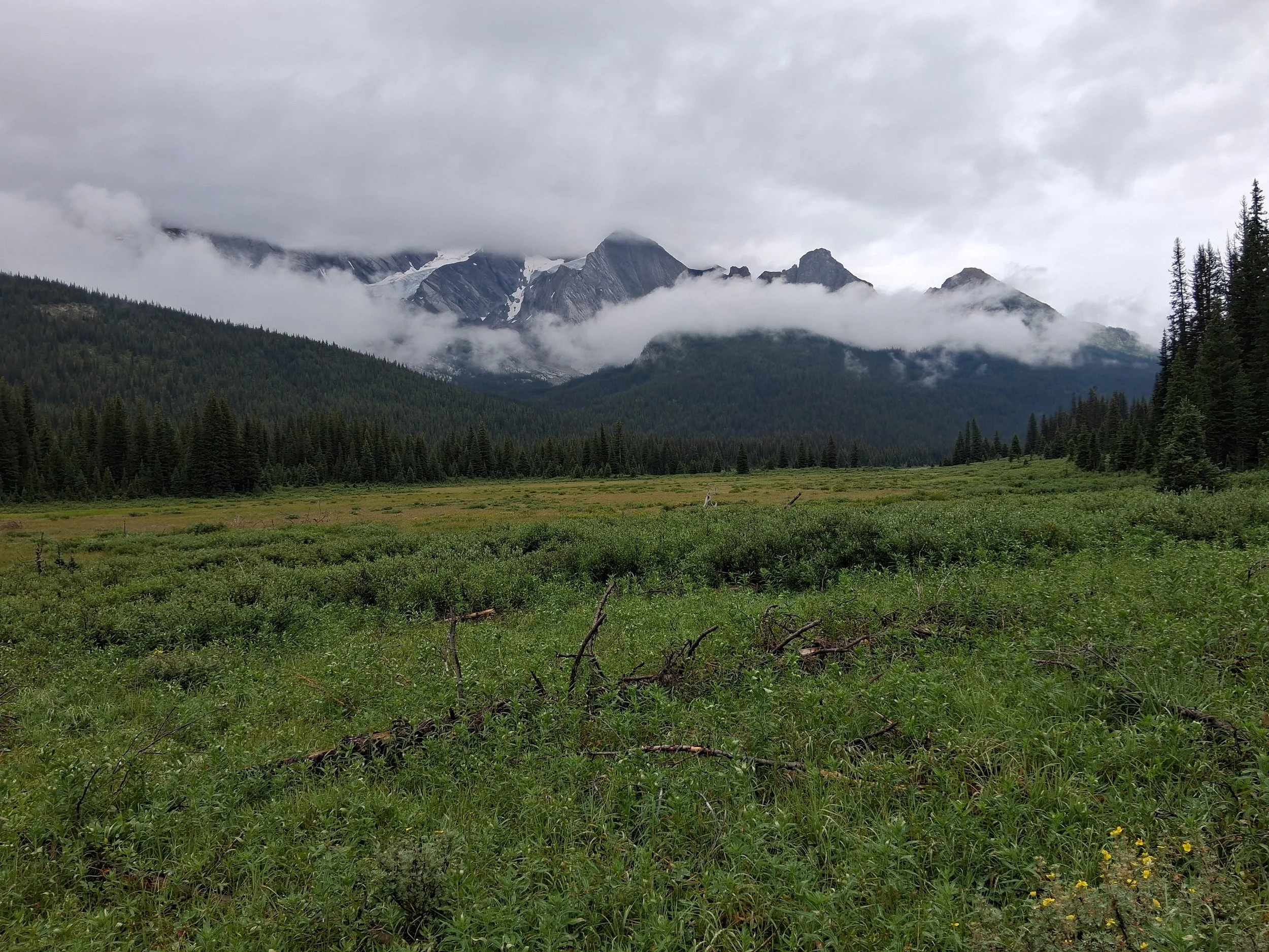
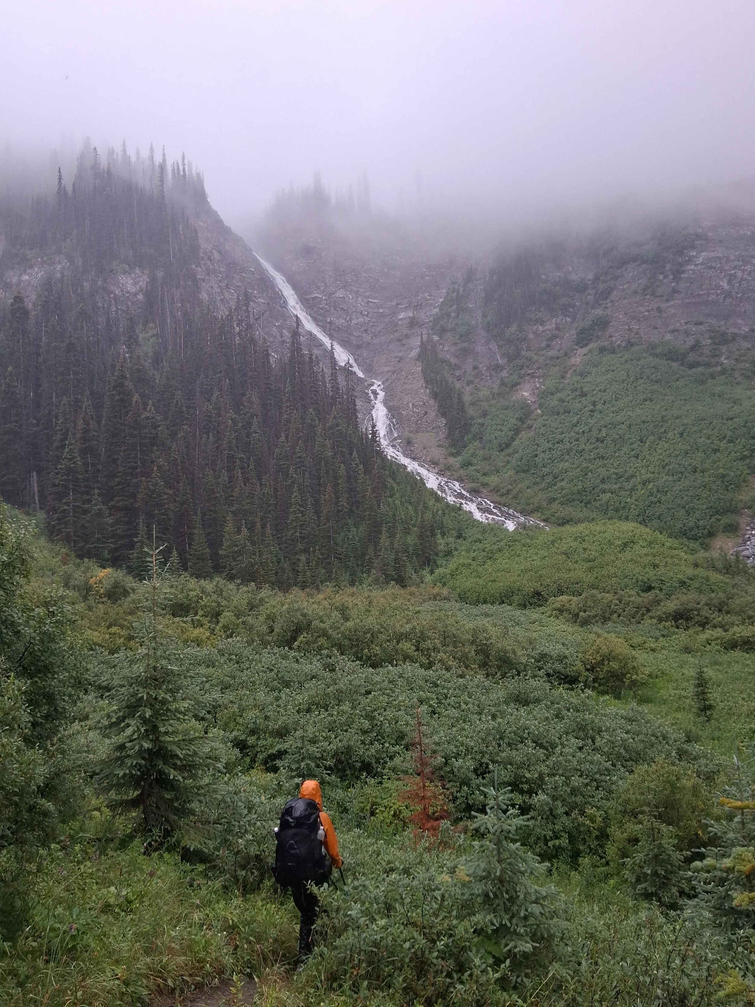
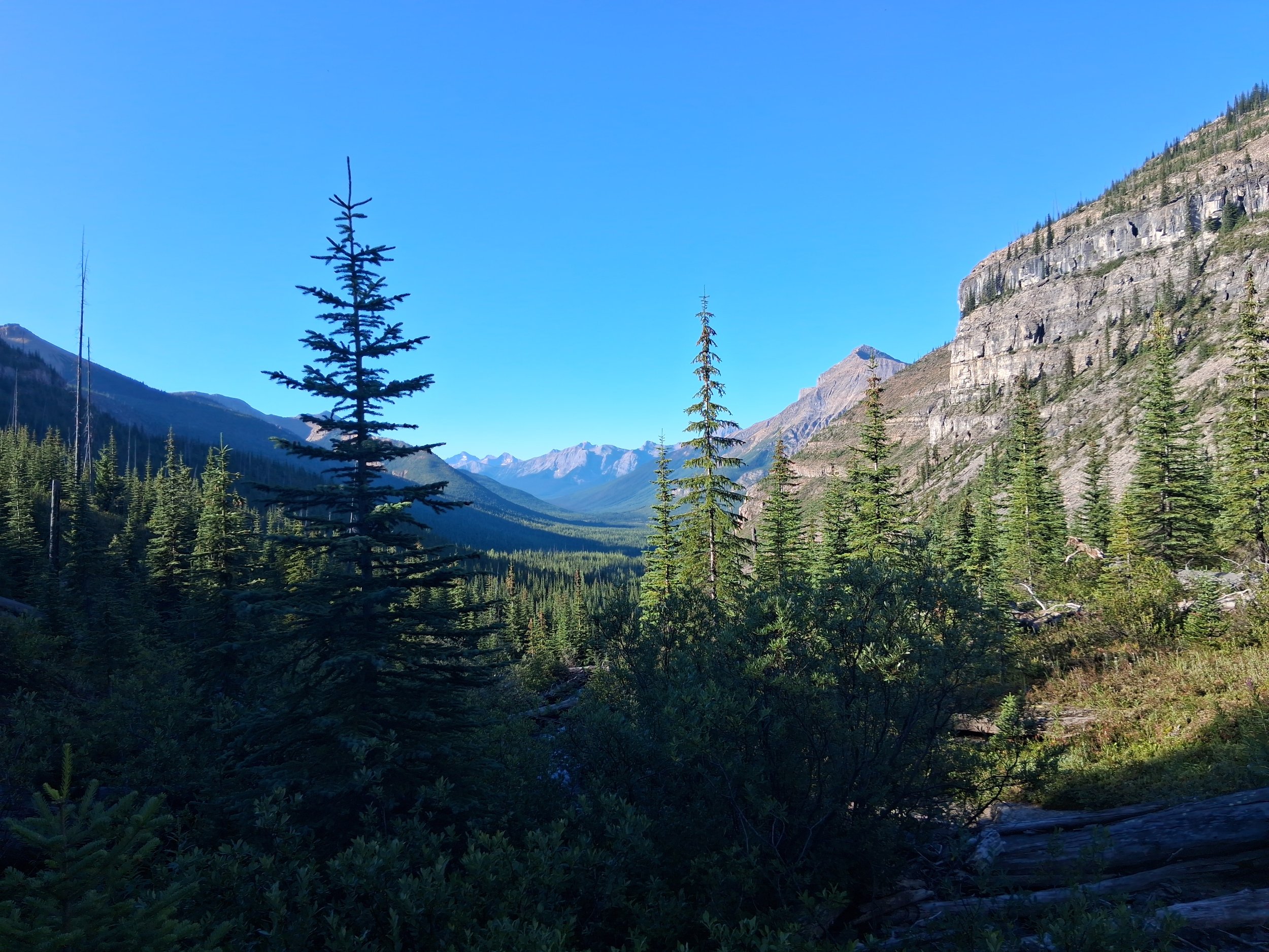
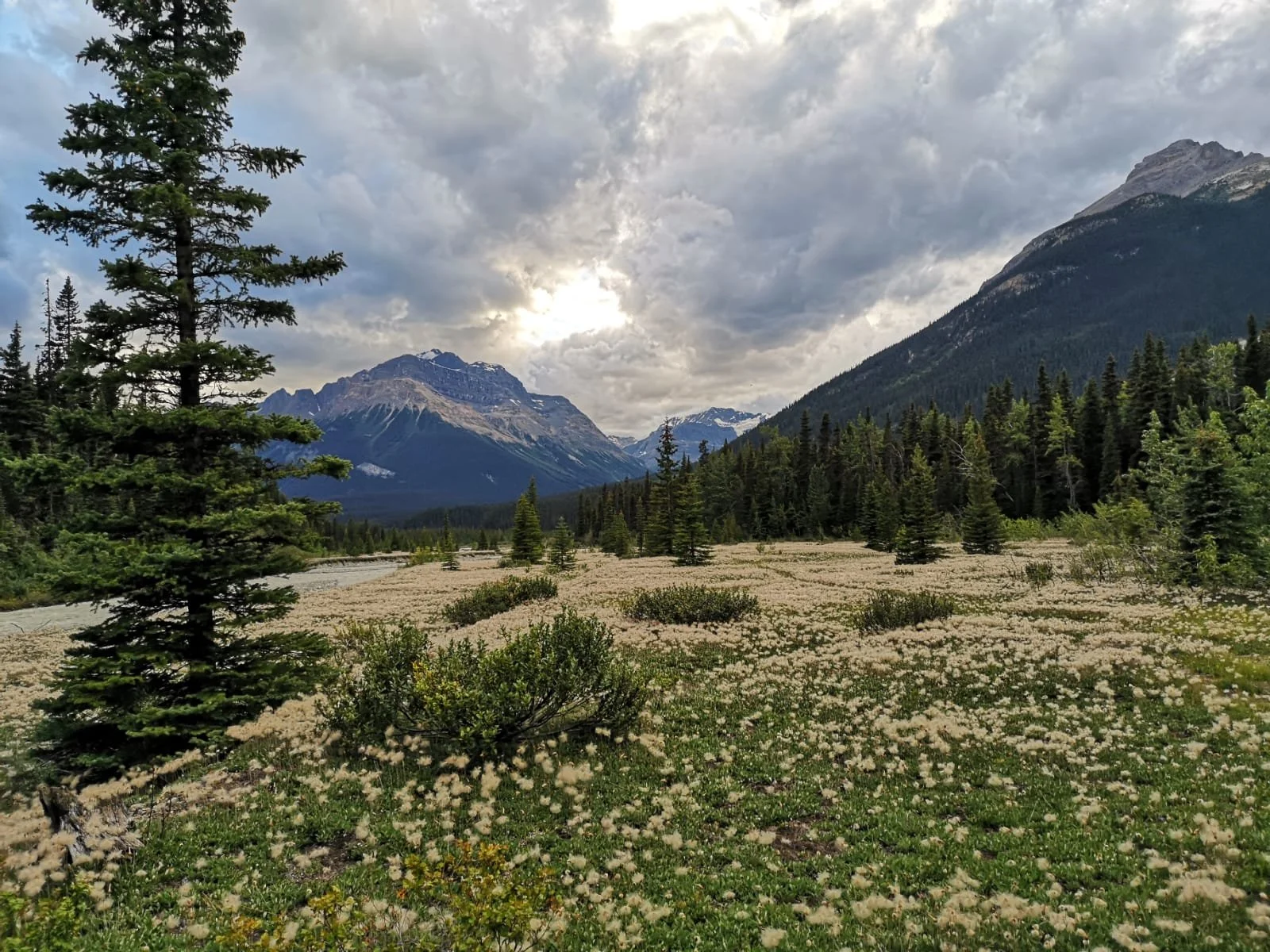
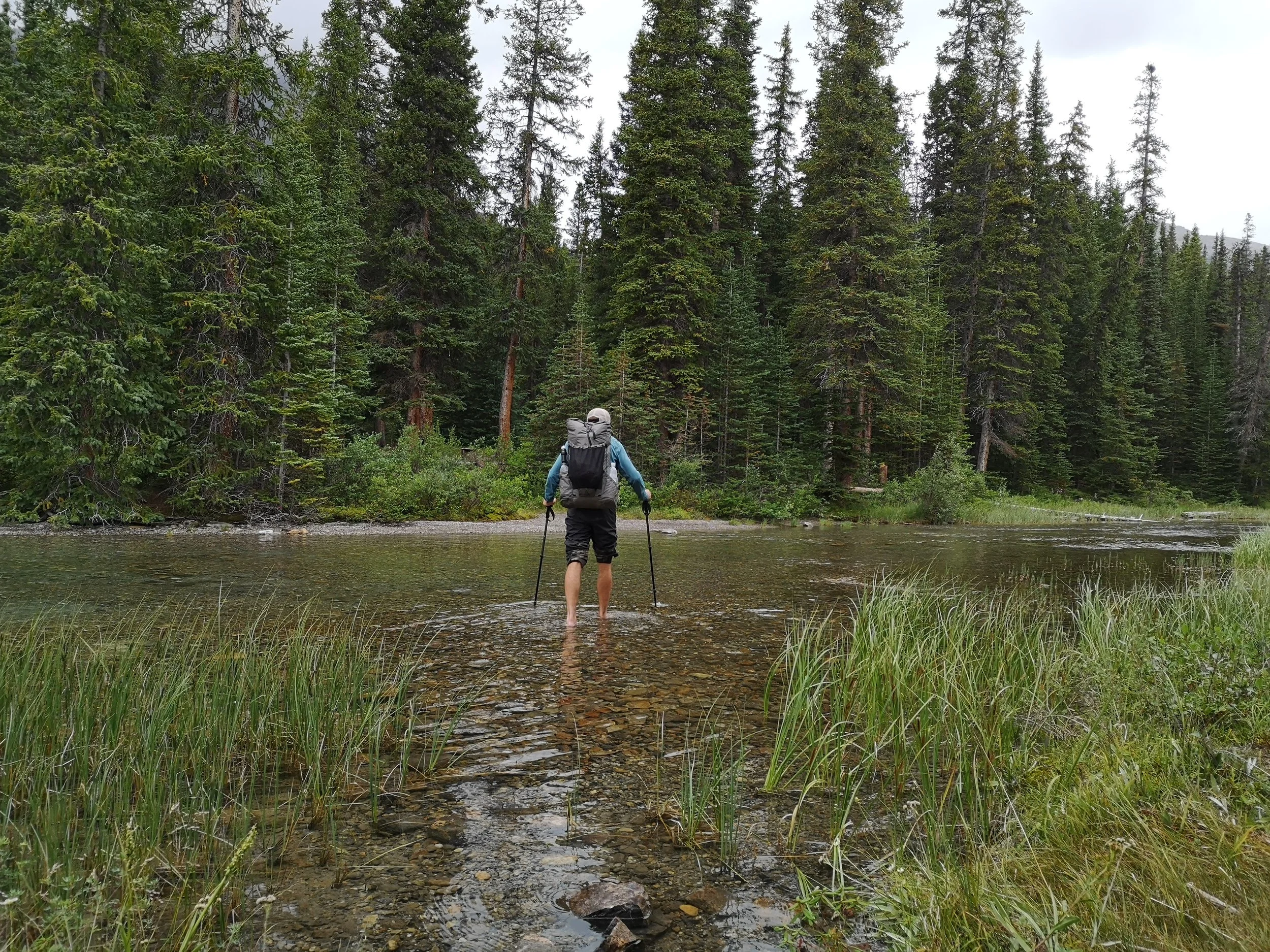
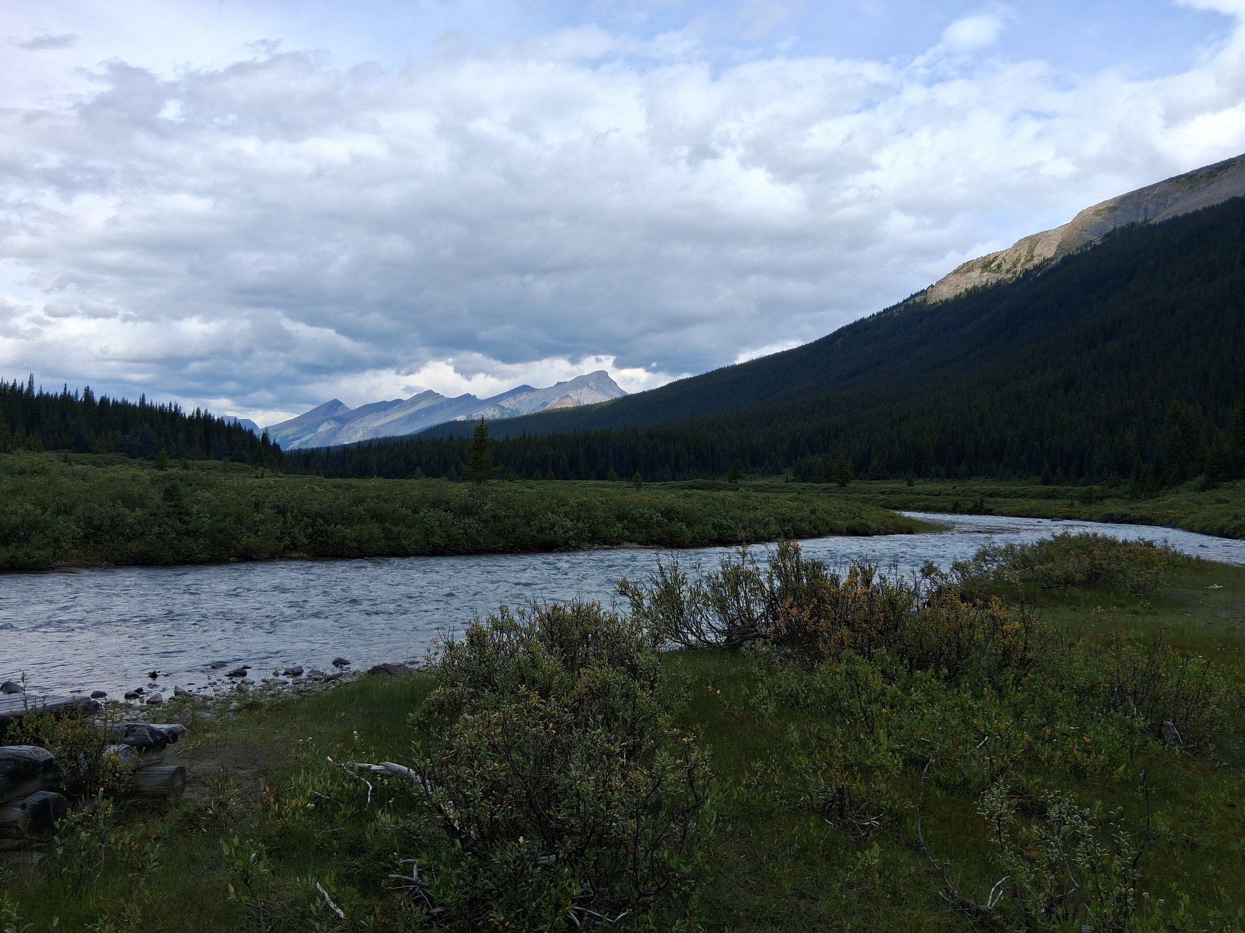
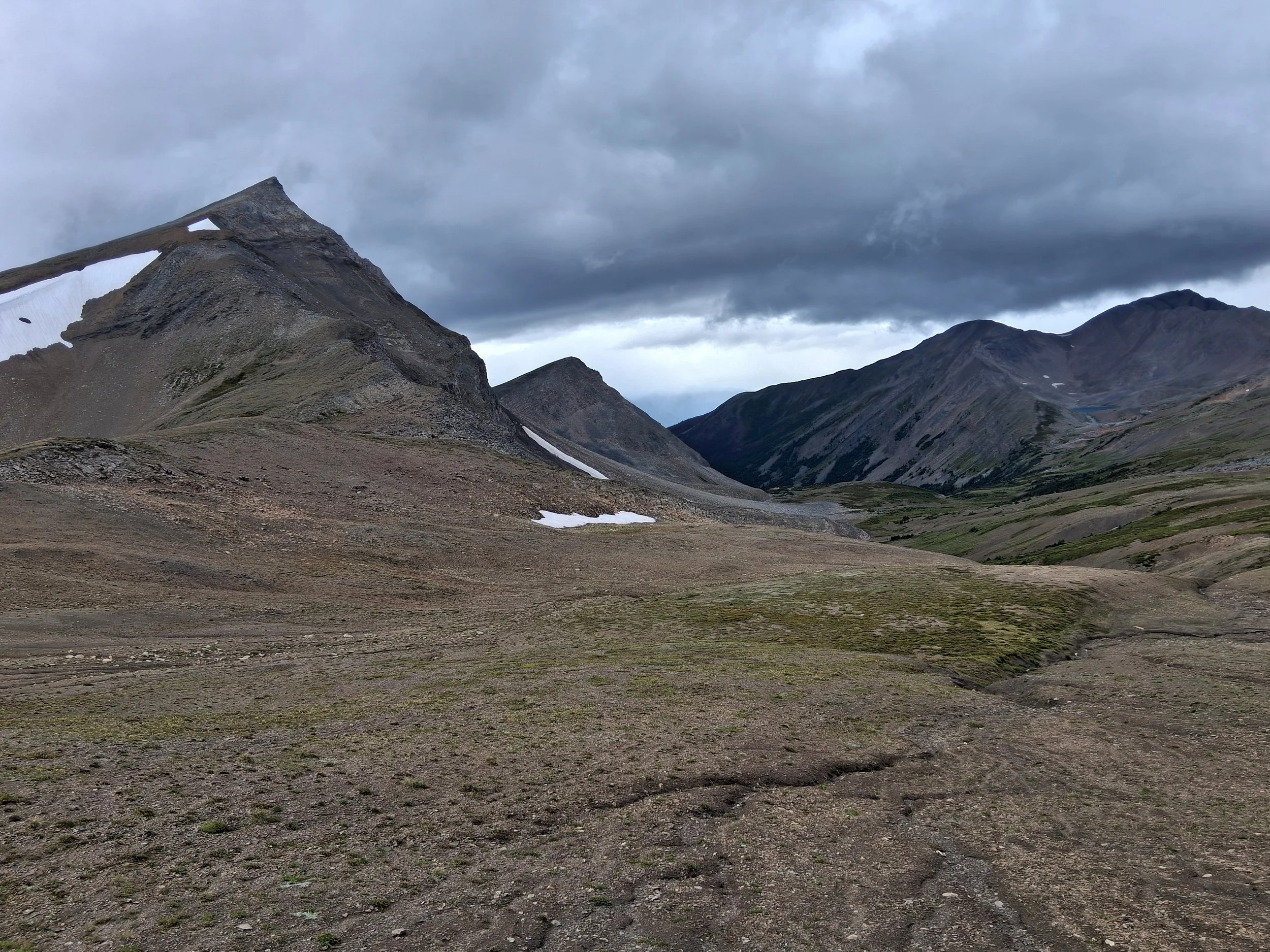
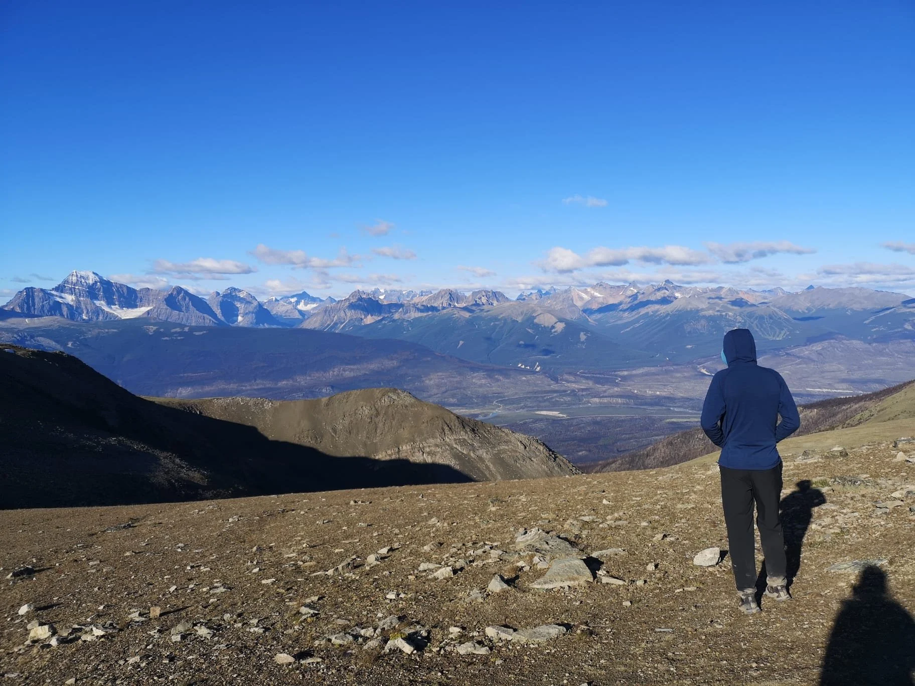
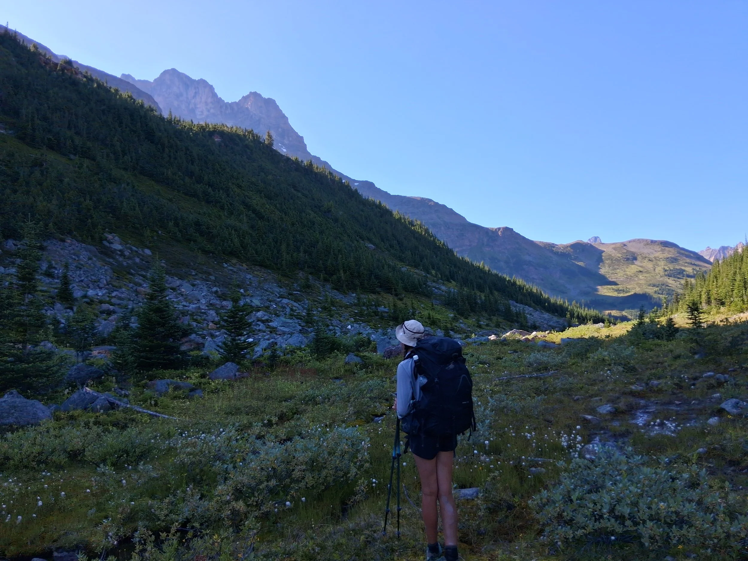
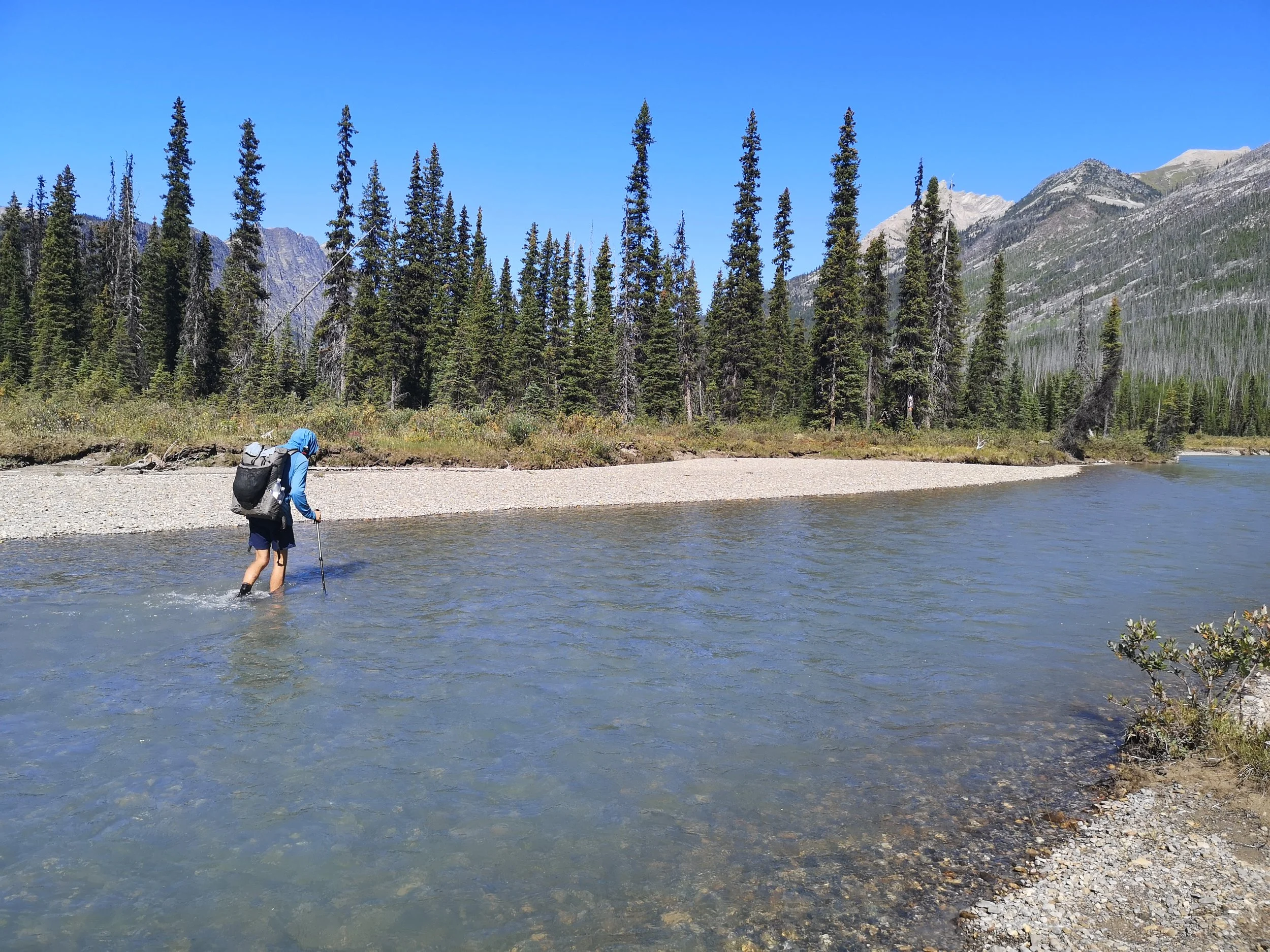
Some Photos from Section A
Section A took us from the Town of Waterton in Waterton Lakes National Park eventually ending in the small town of Coleman for a day of rest and resupply. Our first day took us down to the Canada, US border through a mixture of old growth and burnt forest from the 2017 Wildfire. After a quick photo at the border, we turned and headed north to our first camp spot at Alderson lake. Here we spent the evening with the first GDT hikers we met. A beautiful yet very cold swim in the lake that evening was the perfect way to start off the trail. The next morning was cold and bright as we headed over a series of beautiful and well graded passes, across scree slopes and passing beautiful alpine lakes with stunning views of distant mountain ranges. As we dropped down towards Akamina Creek our bright and beautiful day disappeared. The thunder and lightning soon started, followed by the rain, as we hiked down the switchbacks and took shelter in a nearby visitors centre for lunch, where we met a couple hiking the GDT that we would stay with right through to the end of section E. As the rain eased, we continued on to Akamina Creek camp ground.
The following morning we left early as we chose to take the Sage Pass alternate and started up the Alberta, British Columbia cut line to the ridge. This alternate was our first real challenge, but, if the weather is right, we would highly recommend that you take this alternate. The views were some of the best on the whole trail but the alternate was a real challenge. The drag up to the top of the ridge was bush whacking on loose steep ground which was two steps forward, one step back. A slip near the top could have meant a tumble most of the way down followed by another long slog up to the top. In the end the slog was well worth it and the first bit of the ridge was extremely rewarding both in views and in fairly good progress. Then the going got tough. Rocky undulating ground with sparse trees that require some navigation and seemed to go on forever! We may not be selling it to you, but still highly recommend attempting the alternate. After this was a steep scree bank which did slightly test our head for hights but we managed to comfortably cross, taking our time of course. This was the last major obstacle on the ridge. From here we dropped down to twin lakes and over to Sage Pass where we spent the night camping alone.
Sage Pass is not somewhere we would recommend staying but we had little choice due to all other options being booked up. Sage Pass was burnt in the 2017 wildfire leaving it a sparse, and dare I say, a slightly creepy spot for the night. Now, this wasn’t helped by our experience. We arrived late in the evening to this spot and set up camp in the failing light. We were still very on edge about bears at this point too, having come from the UK, hiking in predator country was entirely new to us. We ended up sat in the near pitch black hurriedly eating our backpacking meal we hadn’t bothered to let fully rehydrate. Our headtorches scanning the remaining bushes and trees around us as deer crashed through making us jump out of our skins. Once in our tent, one of us (Miranda) fell asleep almost immediately after such a tiring day. Those of us who were still awake got treated to the worrying sounds of the forest. Now, we have no real way of knowing what this was, but bears “huff” right? Well a loud, deep huffing sound came from just outside our tent in the early hours of the morning. I (Ben) had not been asleep at all by this point and this ensured I didn’t sleep the rest of the night. The noise was swiftly followed by something crashing through the trees and a shadow running over our tent in the moon light. Needless to say, when Miranda asked if I slept okay the following morning, my answer was no. We were out of there at some speed early the next morning.
Once we had made it out of our nightmare, we traversed a number of passes and beautiful forests to Jutland Creek. We enjoyed the beautiful views and a more relaxed evening, despite a severe hail storm and our X-mid becoming a surprisingly good yacht. Once the tent was moved, all was well. This is the ideal spot to camp to give yourselves an early shot of the La Coulotte ridge. We hiked up to the top for a beautiful breakfast spot where we were once again greeted by our hiking friends we met at Akamina. We continued along the stunning ridge line, which was a dream to hike; a really enjoyable day. We ended up camping in a little meadow near the West Castle River where again, we enjoyed a peaceful evening sat down by the bridge over the river.
We woke up to a constant downpour but knew we had a fairly easy going day. We hiked to a nearby ski resort to dry out some stuff and touch base with the folks at home for an hour or so. We then continued to the Castle camping area, where Miranda mistook a rather large cow as the biggest black bear in the world (probably), then joined our friends at Castle Designated Camping Area 4. The following morning we hiked, again in the rain, to Blairmore, spotting a young Grizzly bear crossing the road up in front of us. The only real good look at a bear we’d get all trip. In Blairmore we upgraded our campsite to a cabin to escape the rain and enjoyed the largest pizza the town had on offer. The next morning, we bought our resupply and hiked on into Coleman where we stayed at Country Encounters. We couldn’t recommend this place more. Lovely rooms and wonderful hosts. We enjoyed an amazing burger at a local restaurant run by a man from our neck of the woods in the UK. What a small world we live in!
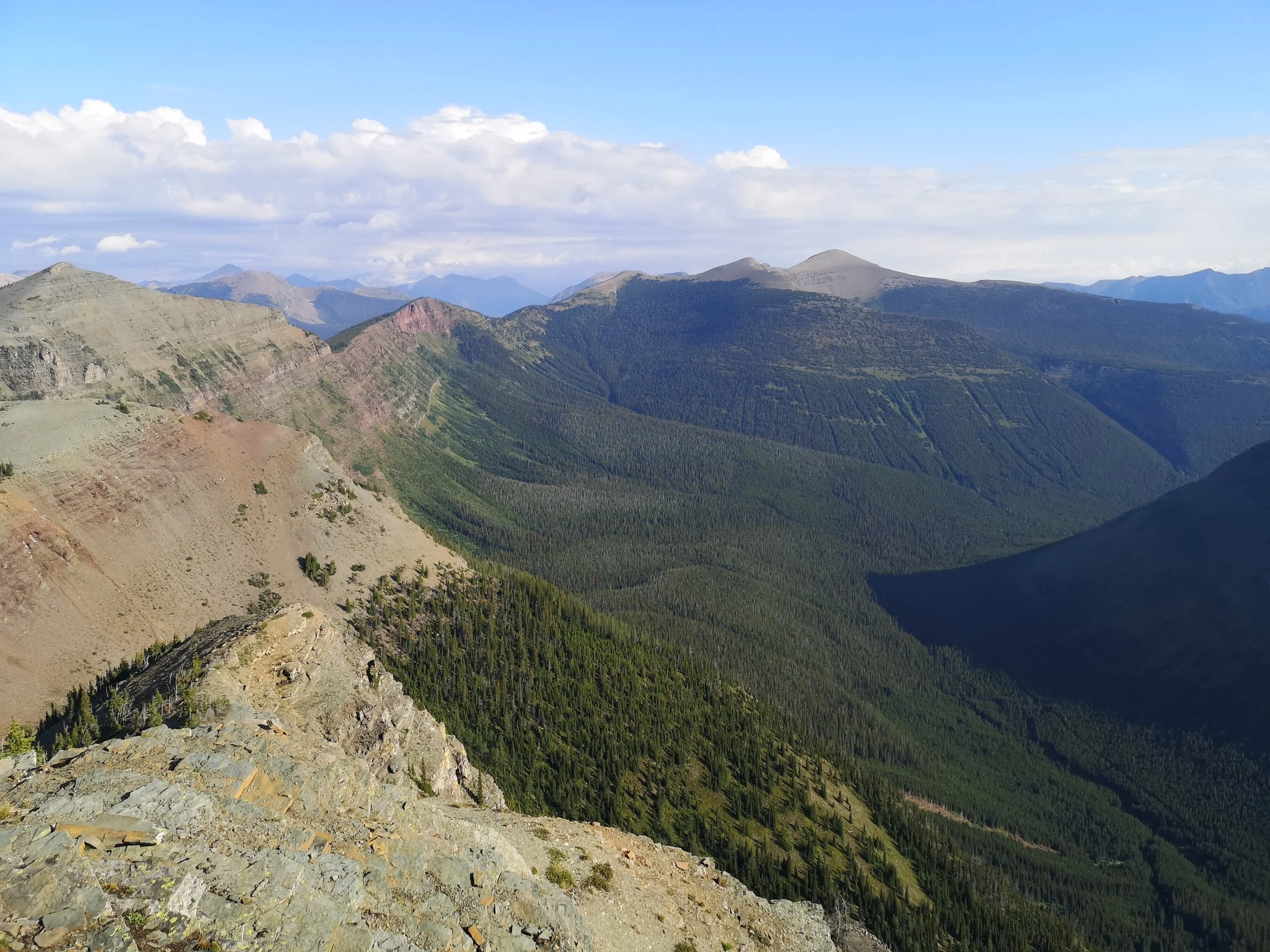
Section B - Coleman to Boulton Creek
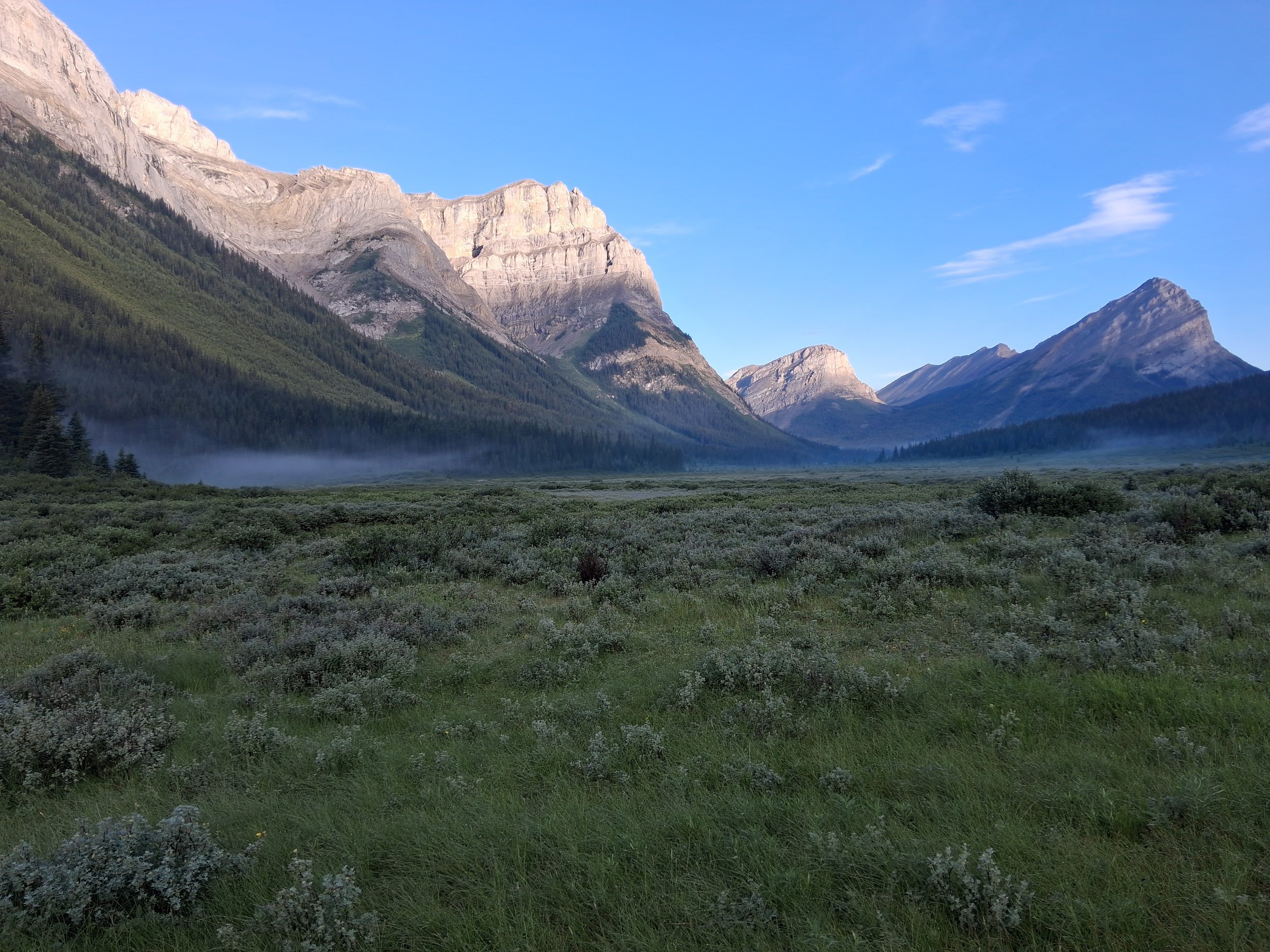
Some Photos from Section B
We began section B on a beautiful sunny morning, fuelled by an excellent large breakfast at Country encounters where we met a fellow GDT hiker. After securing a lift to cut out the first tedious section of road, we arrived at Atlas Staging area and began the section. The first day to Window Mountain Lake campground saw us passing through stunning wide-open spaces, full of wildflowers and distant mountain views which led up to a series of grassy passes through winding forest paths. We stopped for lunch at the side of a path and enjoyed the remainder of the fresh fruit we had packed out from Coleman. Throughout the day we passed several day hikers and overnight campers leading up to Window Mountain Lake campground. The last kilometre to the campsite was particularly steep and narrow, which after a day of hiking in the sun was rather exhausting, but nether the less we made it to the campsite by late afternoon. The campsite itself was stunning, consisting of several pitches around a lake holding the reflection of the nearest mountain, wonder how it got its name? We set up camp on one of the furthest pitches and headed to the cooking area, this was obviously a popular spot as there was a resident chipmunk, which apparently thought we would share our food, it of course had no such luck.
The next morning, we had a steep climb out of the campsite over racehorse pass before descending into forest. After passing over open rugged rocky terrain we dipped in and out of more forested areas. These forest areas featured a maze of ATV tracks, where it was apparently rather easy to select the wrong path. After finding the correct path we discovered we had narrowly missed an encounter with a grizzly bear seen by a fellow GDT hiker who was only a couple of minutes behind. We sat down for lunch and to filter some water, next to a flowing stream before continuing to the campsite. Although we had originally planned to camp at Dutch creek we instead chose to camp at junction where there were spaces off the side of a grass ATV track above a bridged river which provided shelter and a place to cook. Not long after we had finished our meal the heavens opened so we quickly ducked under the bridge for shelter while packing away our Ursacks before dashing back over the bridge and into the tent for shelter.
After an early start we headed out of junction eager to climb tornado saddle. After scabbling up the sparsely forested side of the pass we arrived on an open sloped grass meadow and found a large rock to sit and have lunch at. While we were doing so a small herd of big horn sheep passed by us, as we hadn’t seen that much wildlife so far on trail other than various types of marmots this was a rather exciting spot. After lunch we prepared to climb up the saddle which consisted of steep rocky switch backs. Although it was steep and rather tedious the climb up itself wasn’t too challenging and I (Miranda) personally as someone who struggles with downhill, found going down the other side more of a struggle. Having made it to the bottom we entered woodland and followed the trail into the next campsite, spotting a set of wolf prints along the way. The next morning at hidden creek was rather misty with poor visibility however, after going up the first pass it had mostly cleared and by late morning had become a rather lovely summer’s day. When we reached high rock which had a similar layout to junction, we chose to camp at the bottom under the trees as opposed to at the top of the grassy bank, a decision we were extremely grateful for later. That night we were awoken by the sound of thunder and bright white flashes of lightning, all at the same time. This was terrifying and as we discovered the next morning from some friends who had camped on the grassy bank at the top, the spot we had originally planned to camp at had been hit by lightning. Lightning being a potential danger had never occurred to us up until this point, so our advice would be research lightning safety especially the lightning position, there are some useful tips on the parks Canada website.
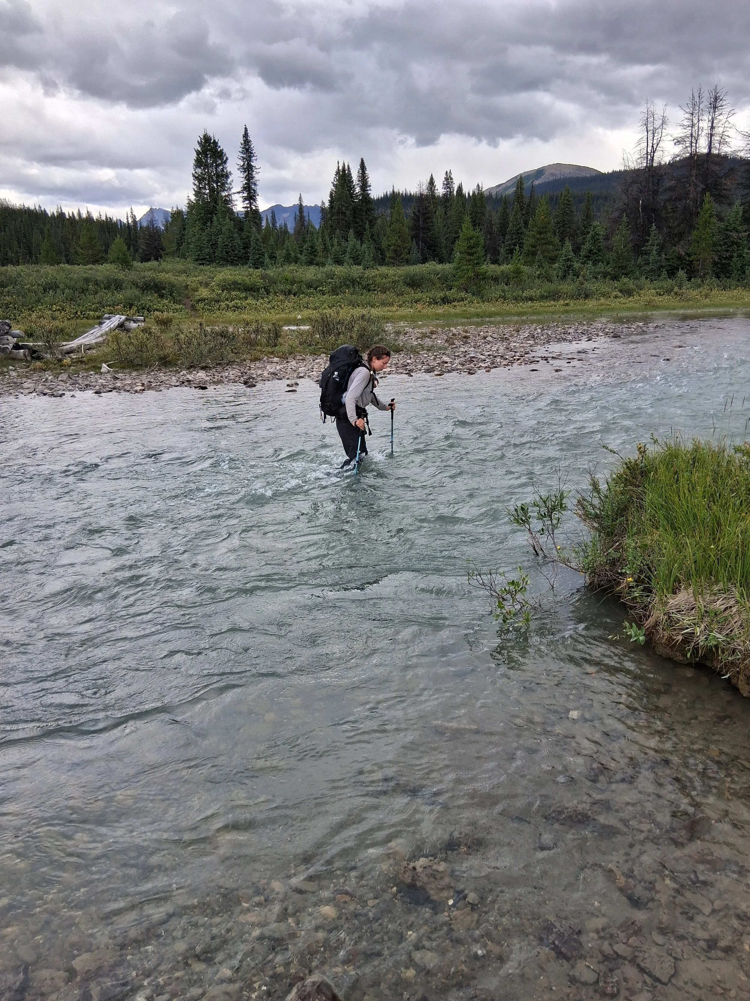
The next day was tiring, having got little sleep during the storm the night before the day dragged a little and our main priority for the next camping spot was somewhere which was not out in the open. Unfortunately, where we had originally planned to camp didn’t fit our new safety criteria, so we pushed on a lot further to Alderidge Creek campsite just to be on the safe side. This was a very long day, and we were so relieved to make it into camp with good weather despite multiple complicate river crossings and badly marked trail along the way.
Shortly after leaving Alderidge Creek, on a bright sunny morning, we arrived at our only river crossing of the day which lay only a short stretch from the campsite. The surrounding banks of the river were heavily covered with fruiting raspberry bushes that we stopped to pick as many as we could carry. Once we had picked and eaten sufficient raspberries, we made our way on, following the gravel ATV track up and over small passes. The majority of the day was spent following the gravel road where we were passed by a few ATVs and spotted some black bear tracks in the dirt. We stopped for lunch at a small picnic site off the side of the road where there were a couple of picnic tables. We then continued to the end of the road where a path leading past a collection of cabins and on to Lower Elk Lake campsite. It was at this point we passed day hikers and overnight campers also on route to the campsite. After arriving and setting up camp we went for a rather chilly swim in the river coming off the lake as the lake itself was rather murky and uninviting.
On our last day of section B, we left Lower Elk Lake campsite and continued upwards through the surrounding woods. We then walked along side a lake on a more open track, which eventually brought us up and out on to a wide grass track which led down to elk trailhead car park, where the GDTA managed resupply lockers. We successfully collected our resupply boxes, binned all our rubbish and headed onto the road to continue the last 2km to Bolton Creek campsite. As this was our first time on a main road, we decided to test our luck with getting a hitch and were successful managing to get a hitch with two trail runners who dropped us off at Bolton Creek campsite. Once we had arrived at the campsite, we immediately headed to the onsite shop to buy whatever food was available. Overall, in terms of logistics section B was the easiest stretch as wild camping was permitted throughout most of the section with very few permits required. This meant you could essentially camp where you wanted to which was helpful for the awful weather changes we experienced.
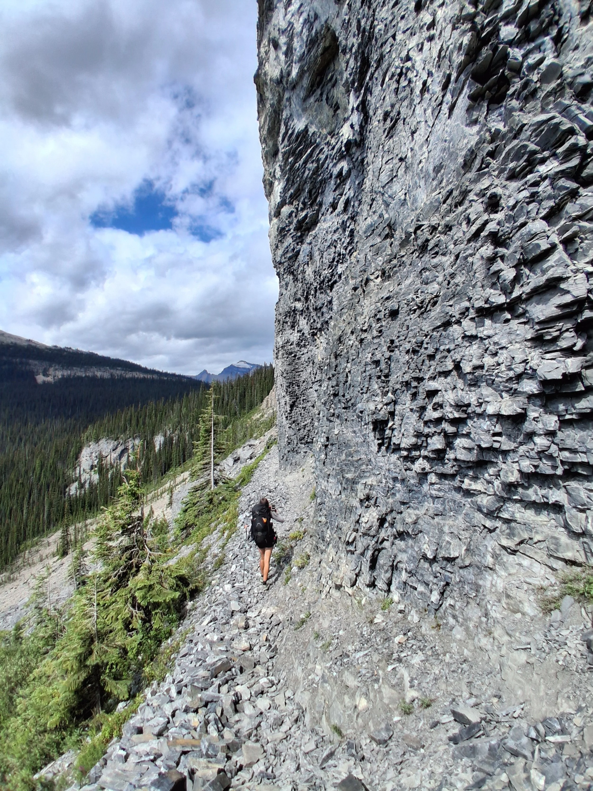
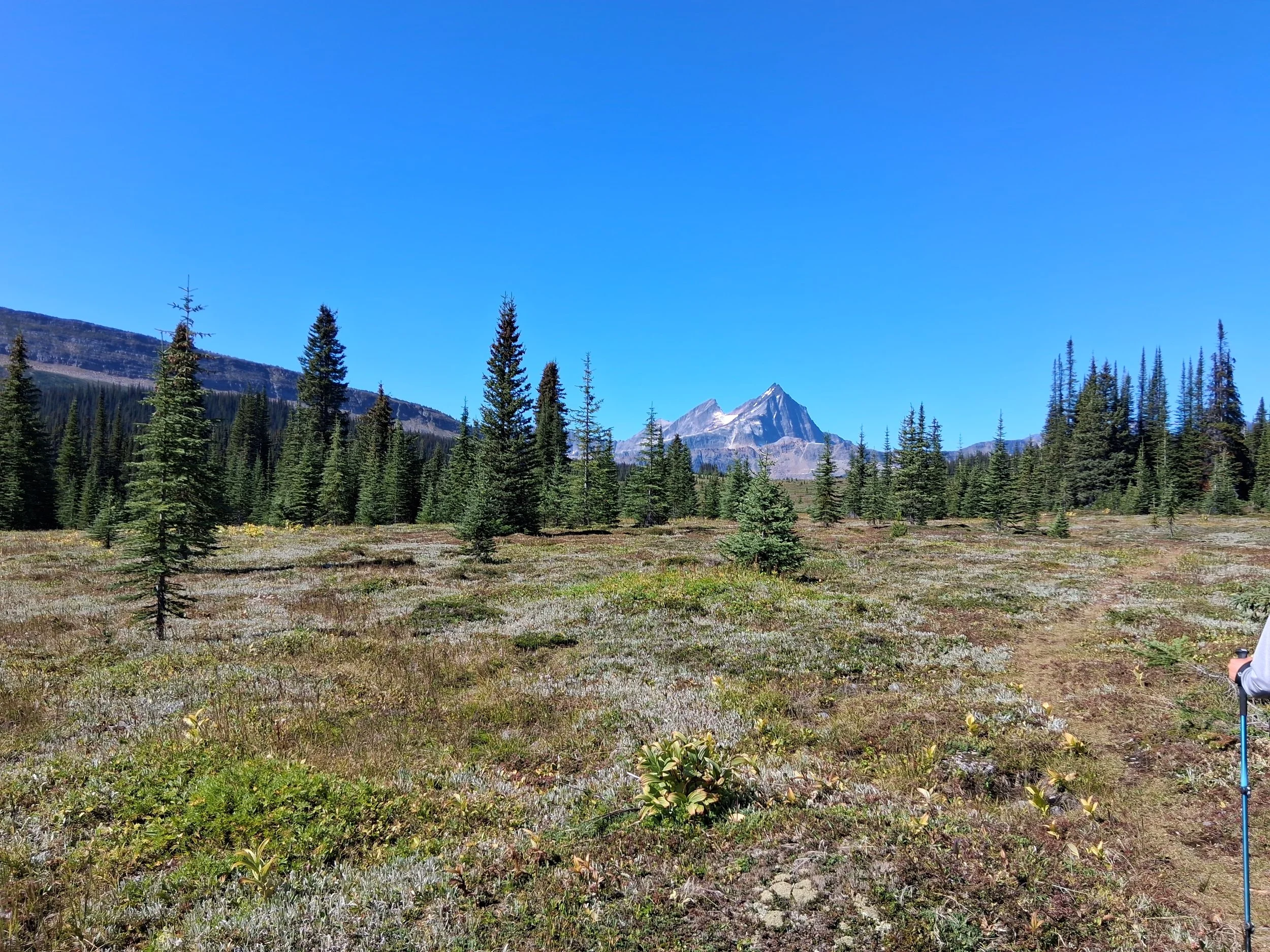
Section C - Boulton Creek to Field

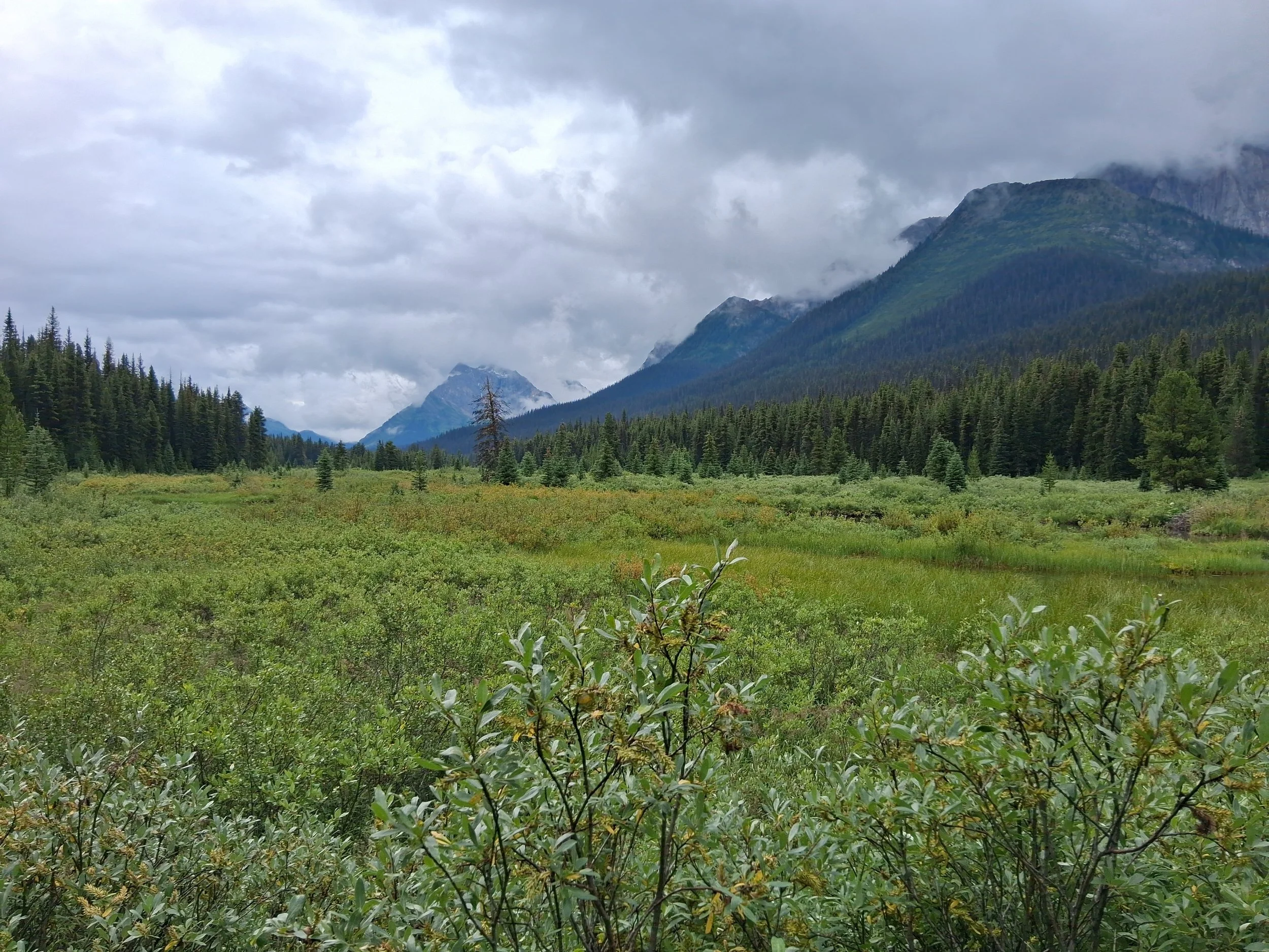
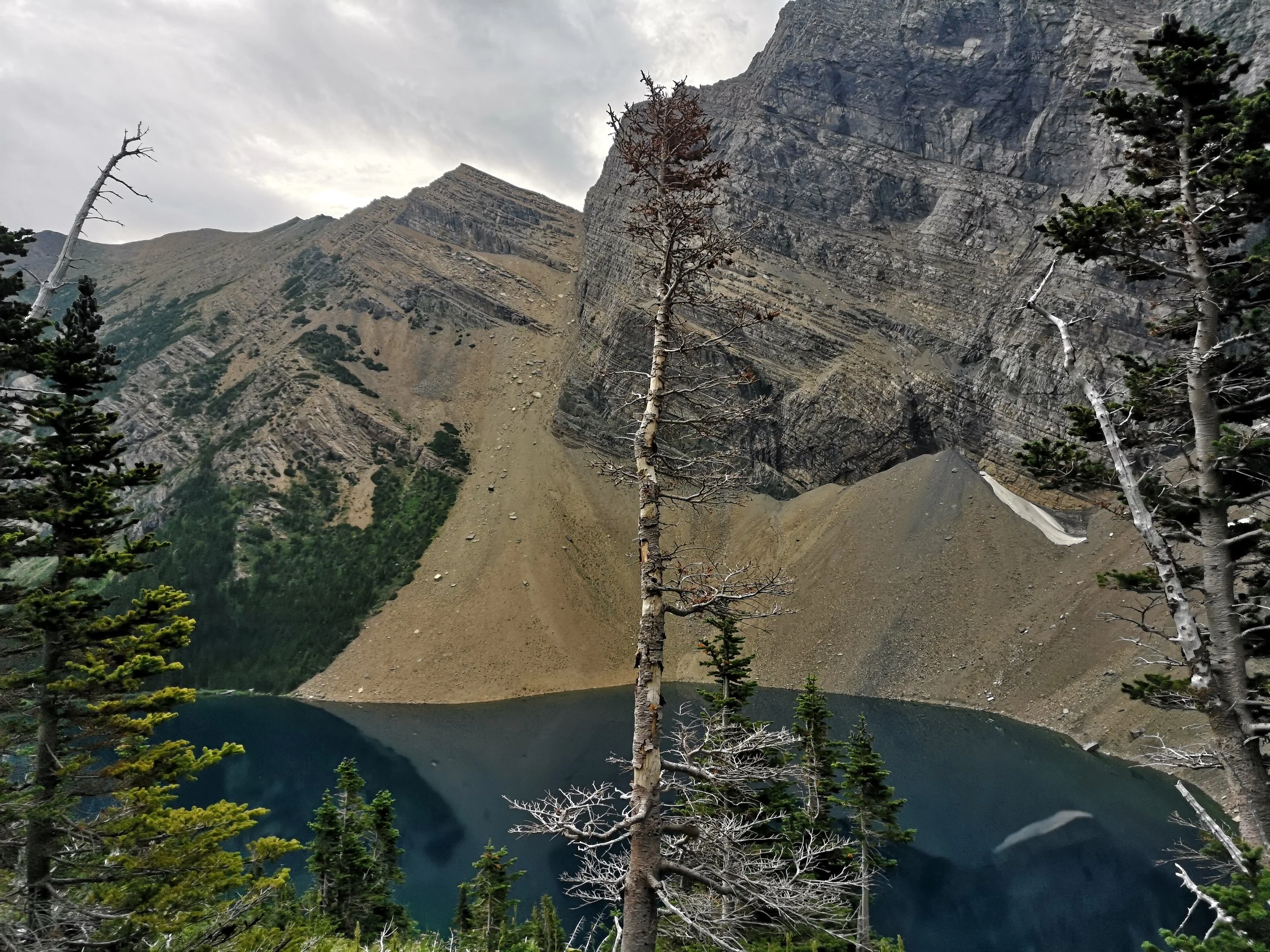
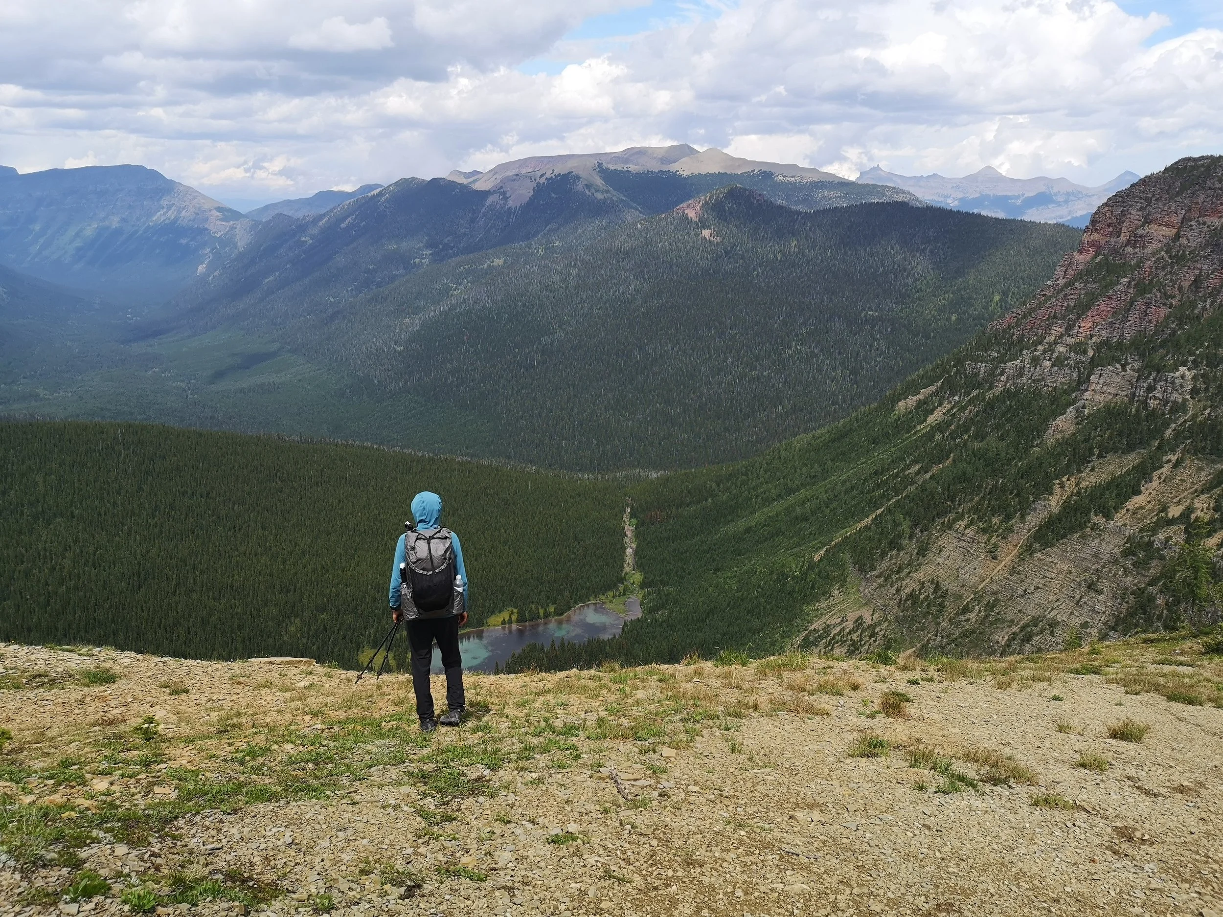
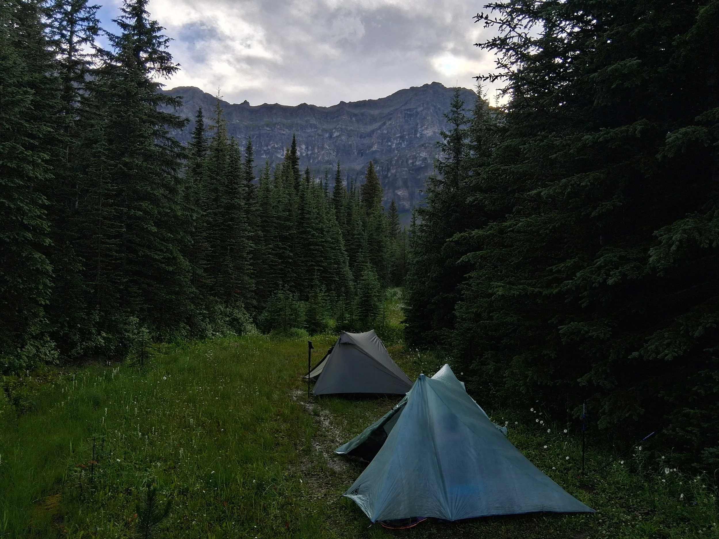
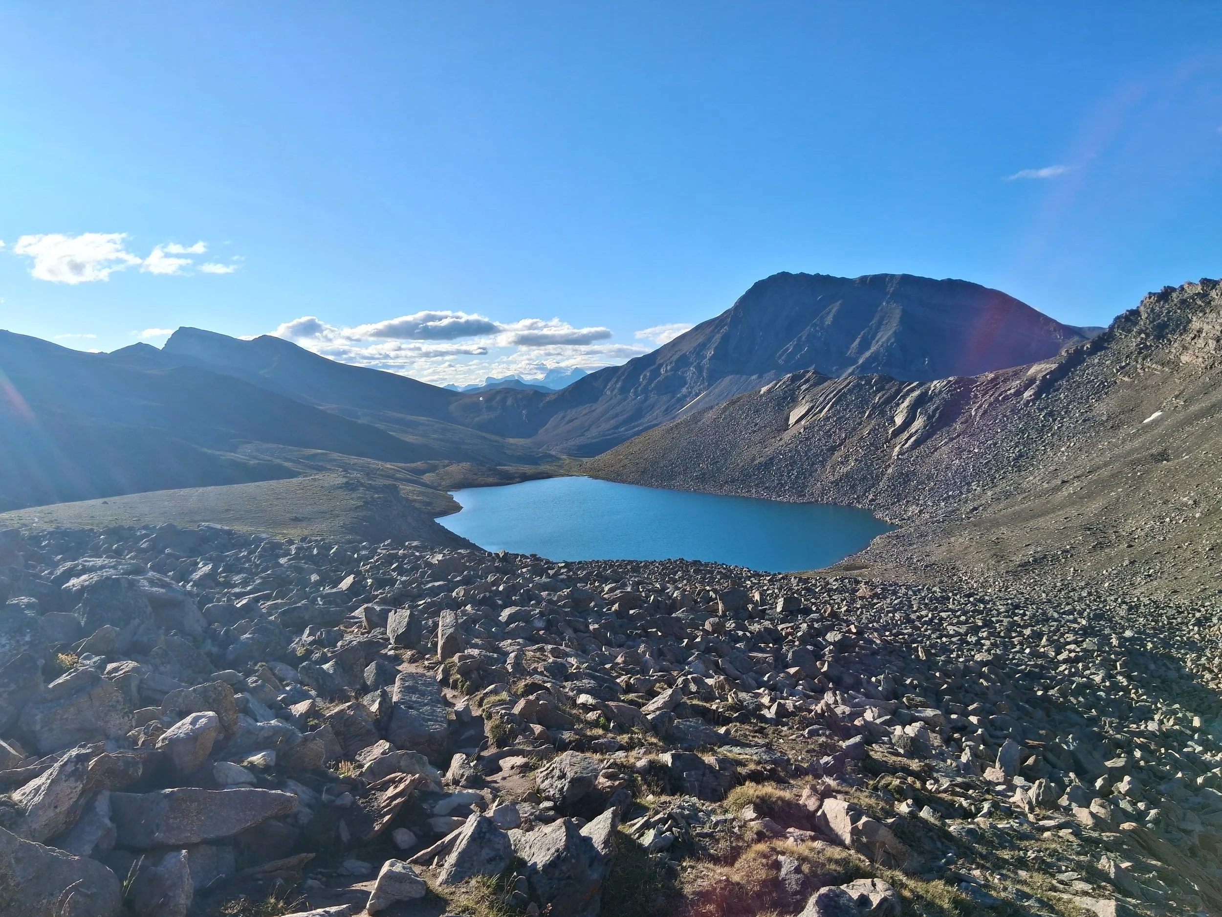
Some Photos from Section C
We spent just a single night at Boulton Creek before heading out onto section C on a hot sunny morning. As there was only a short hike to Forks campground that day, we stopped by Kananaskis lake for a swim and a cool off in the perfect blue, but freezing water. It is a worthwhile spot to stop and swim, if you have the time. From here we continued, crossing rivers and waterfalls by bridge until we reached the bank of a large river where we turned and headed up stream. The clouds started to close around us and a few spots of rain started. We rush to the campground and threw up our tent as quickly as possible just as the heavens opened. Being a busy camp site, we weren’t alone. As we sat listening to the rain we could hear lots of people scrabbling to throw their tents up as quickly as possible whilst getting soaked through. As the rain eased we were able to quickly eat our dinner huddled under the trees and soon called it a night when the rain failed to subside.
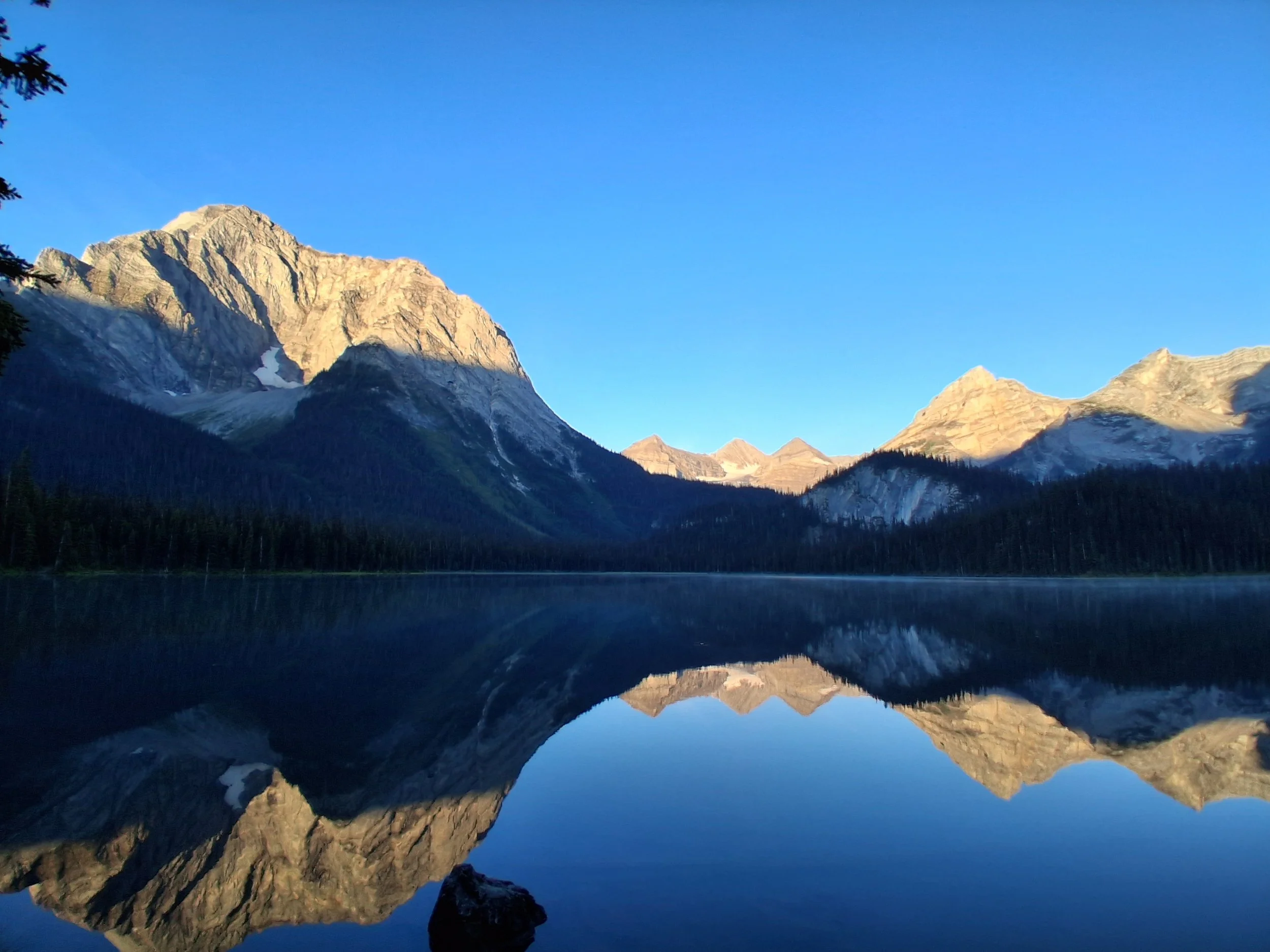
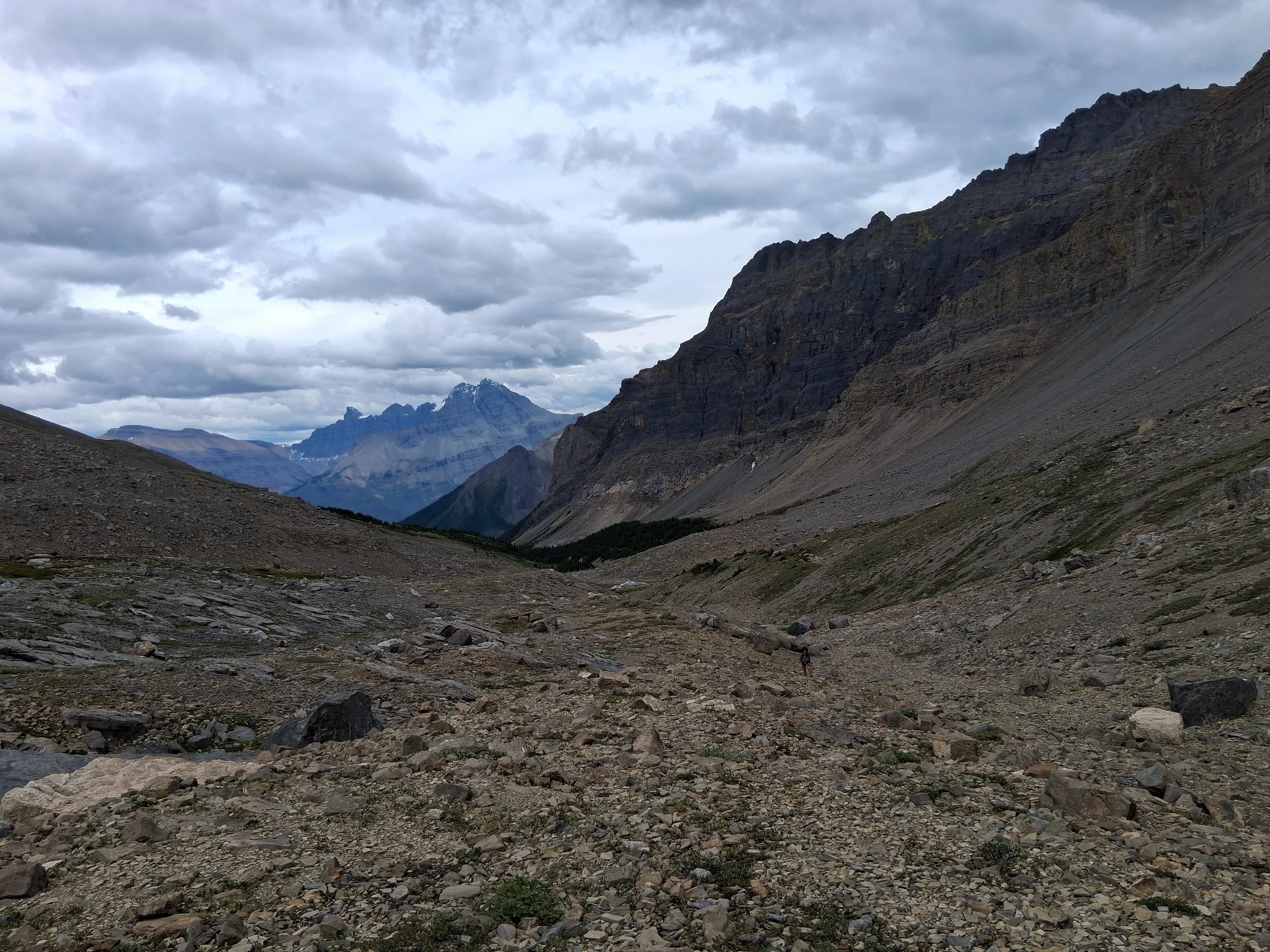
The next day was a fairly straight forward, and yet another beautiful hike to Palliser Pass. It took us past some crystal clear alpine lakes and across some equally stunning rivers and over the pass into an epic valley with far reaching views of the mountains and forests. Once we had reached the bottom, the climb up to Palliser Pass was quite overgrown and steep but not overly bad going. We reached a clearing by a lake just below the pass and decided to set up camp, keeping off the highest area after our previous luck with thunderstorms. It is very buggy here, lots of mosquitoes, so don’t forget your head net! The following morning we continued up and over the pass to a lake we had to cross and on through the forest and open valleys eventually to a valley filled with willows. This is by far the worst mosquitoes we have ever encountered, head nets and full waterproofs on and we still got covered in bites and bumps. Its prime moose country too so we did hang around hoping to spot one, so that’s probabaly why we got bitten so badly. From there we followed the trail to McBride’s camp, which is a good alternative to Marvel Lake campground that books up very fast.
The following morning we headed into the meadow behind the campground and took the route round there back to Marvel lake. It was one of our favourite spots on the GDT with views of the river and mountains stretching away from us in the mist. We reached Marvel Lake and it began to get much more busy. We followed along the lake and up over the pass towards Assiniboine, which of course was beautiful but busy. Continuing on, it significantly quietened down and the views back up the valley to Assiniboine improved. From here there was a rocky section that jumped up and down, then down again into the valley to Porcupine campground, which was very busy. The next morning we left very early to reach Sunshine Village where we had posted a resupply, but also, as we had just recently found out at this point, there is a 20 CAD all you can eat breakfast buffet if you arrive before 10am. It is very much worth it to ward off the hiker hunger for a couple hours! The hike out of porcupine was steep but on towards Sunshine Village it opened up and flattened out allowing for good and extensive views the entire way. After our lengthy buffet breakfast, we continued over a few passes to Egypt lake where we turned off towards Shadow Lake Lodge. We stayed at the lodge as there was no space at Ball Pass which is doable if you want a night out of the tent but be prepared for a long day the next day. Our next day was to Numa Creek which started out as a stunning hike round Shadow lake and over Ball pass. The hike along the Rockwall trail, we were told, would be one of the best bits of the entire trail, with stunning views and beautiful alpine lakes. Well, just before we reached Floe lake it clouded over and the rain began to fall. It got harder and harder the closer we got to Floe lake and the view when we arrived was non-existent. We stopped and ate our dinner quickly before carrying on. We continued up and over Numa pass and started down the other side, sharing the beer we got at the lodge we intended on sharing in the sun at Floe Lake… that went well. We eventually reached Numa creek at 9pm after some nervy hiking through the dark in bear country. We threw up the tent and quickly went to bed.
The next morning the rain continued but even harder. Miranda had fallen ill that night and unfortunately it continued into the morning. We decided to pull out to the road there, also with our friends we met in section A, as the trail ahead was poor, the weather was equally foul and we had just a long day left. We took the shorter route out and managed to get a lift to Banff with a local. Now, we have never hitch hiked and never would have got in a “strangers” car before, but we were amazed at how kind and friendly the locals were. After a night in Banff, where we enjoyed a very nice meal, but the hostel was not quite worth the price… I suppose it is a popular spot. We got a bus the next morning to Goldens, Dreamcatcher Hostel, which we would highly recommend. The staff were very helpful, the kitchen is massive and just turned out to be a really nice place to stay if you’re taking a zero day before section D.
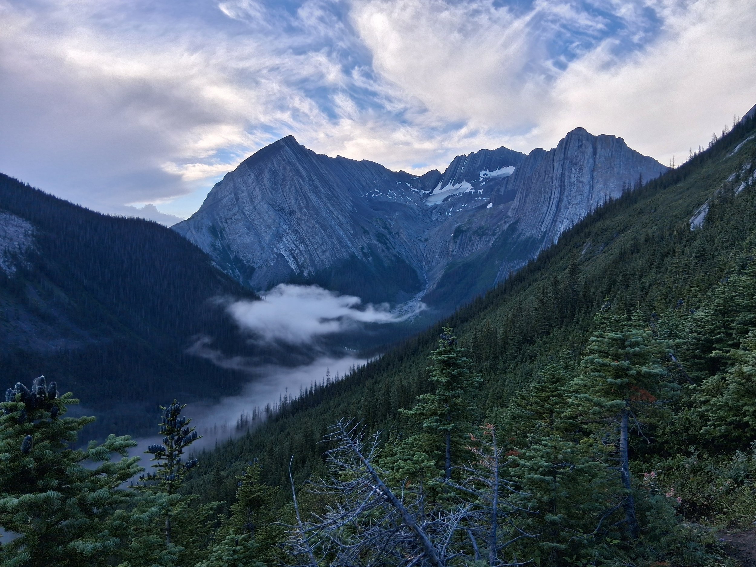
Section D - Field to Saskatchewan River Crossing
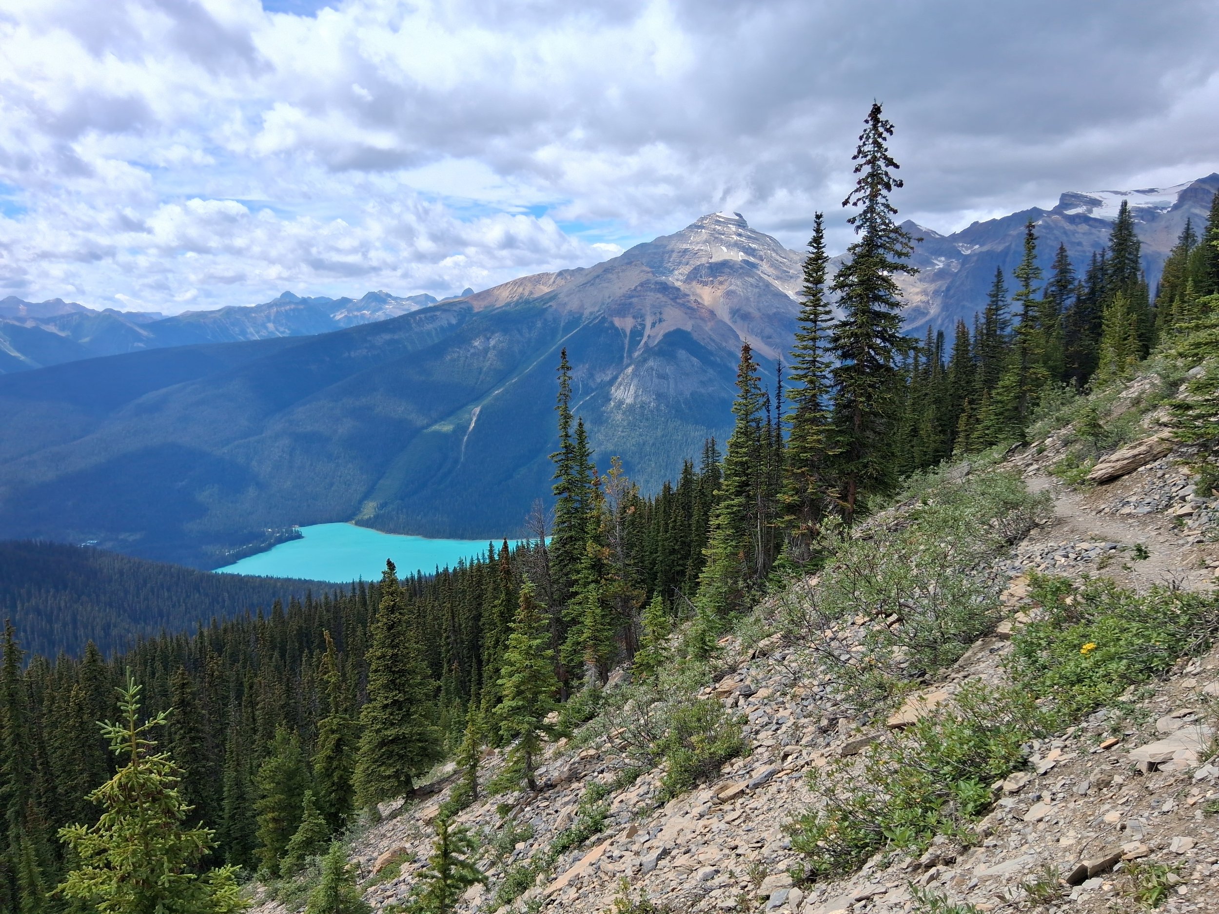

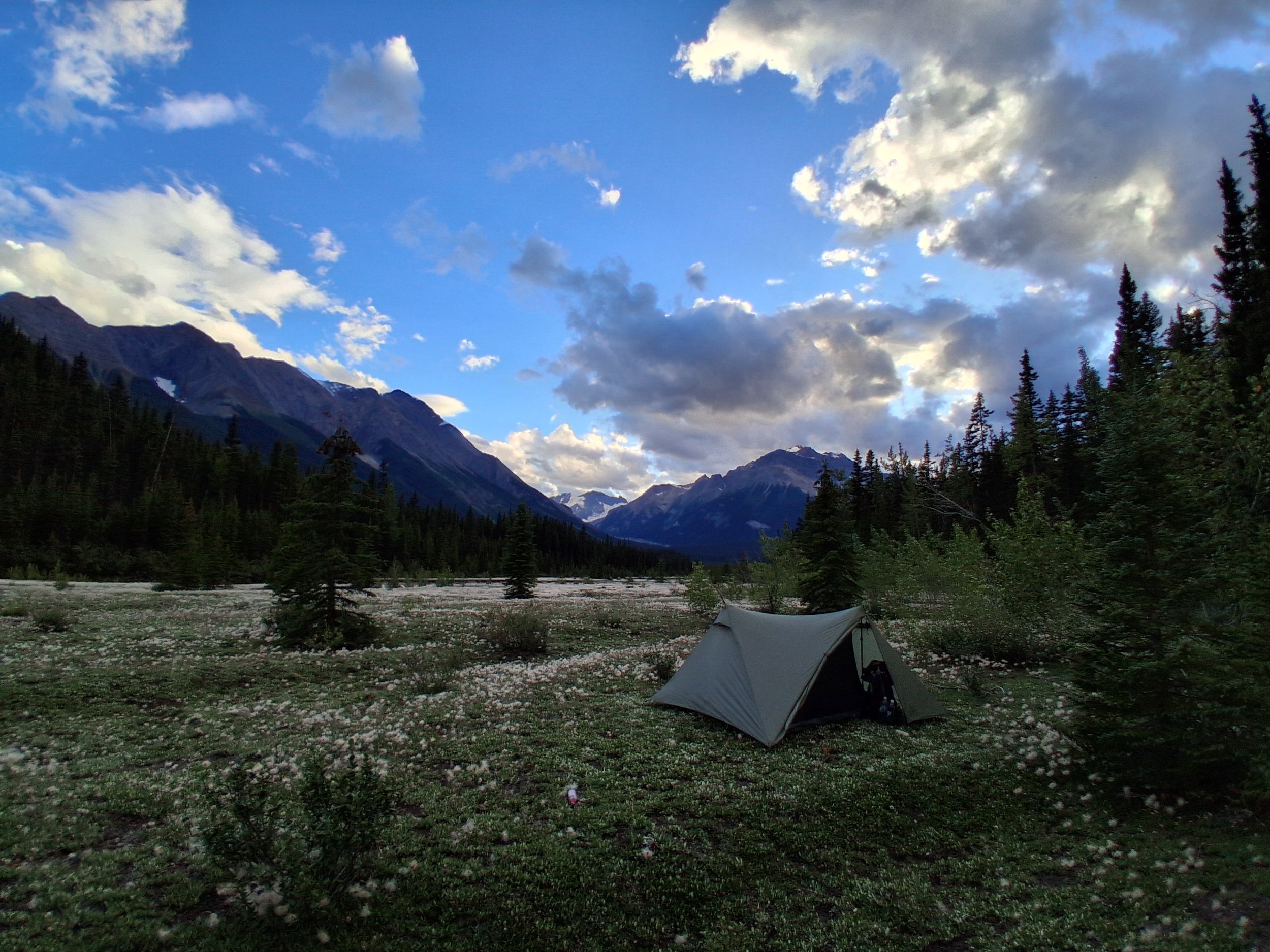
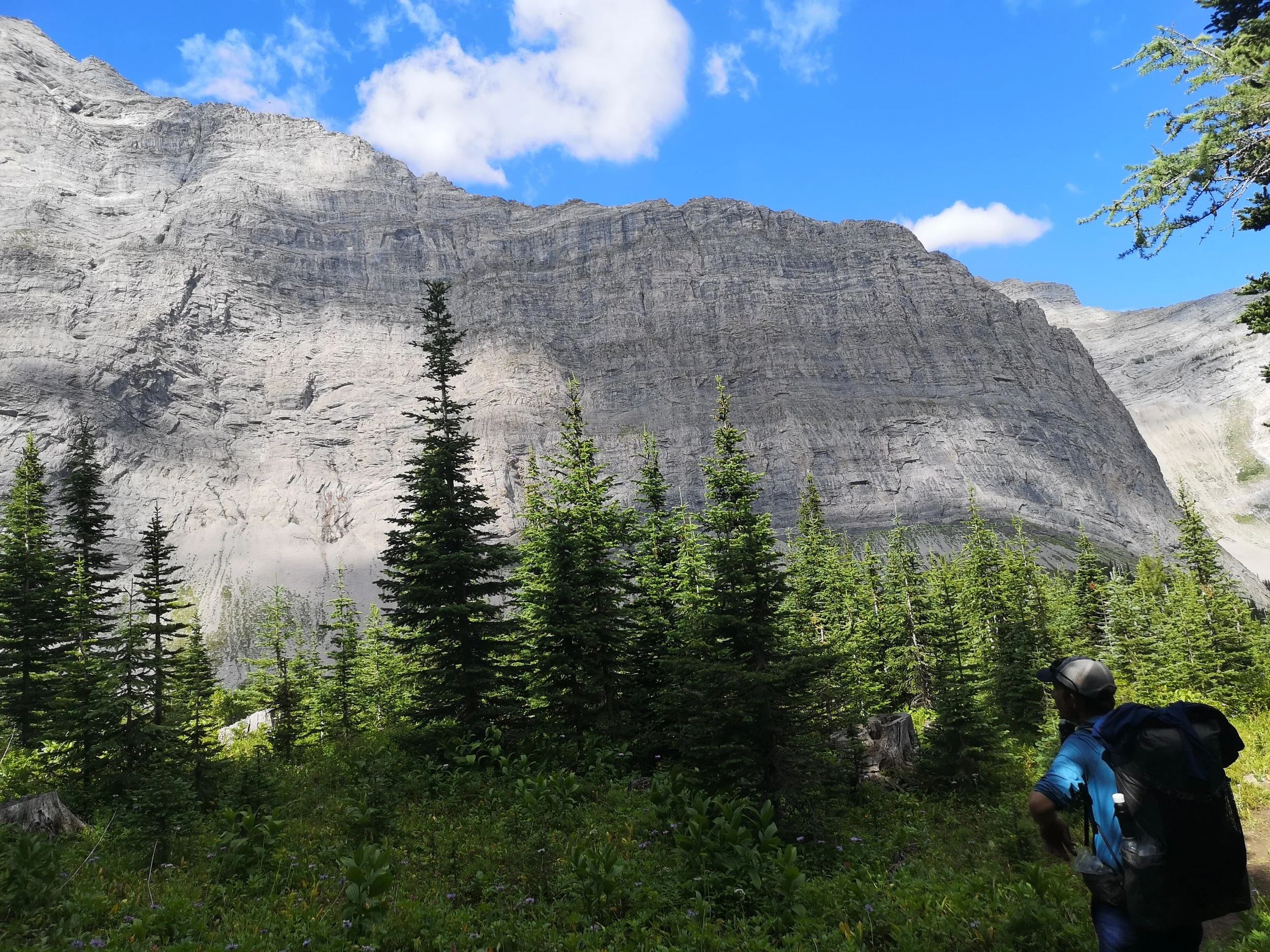
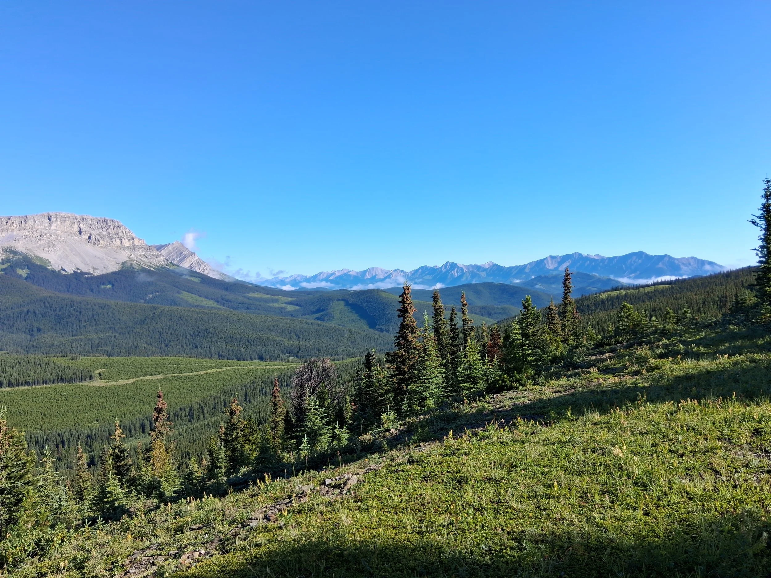
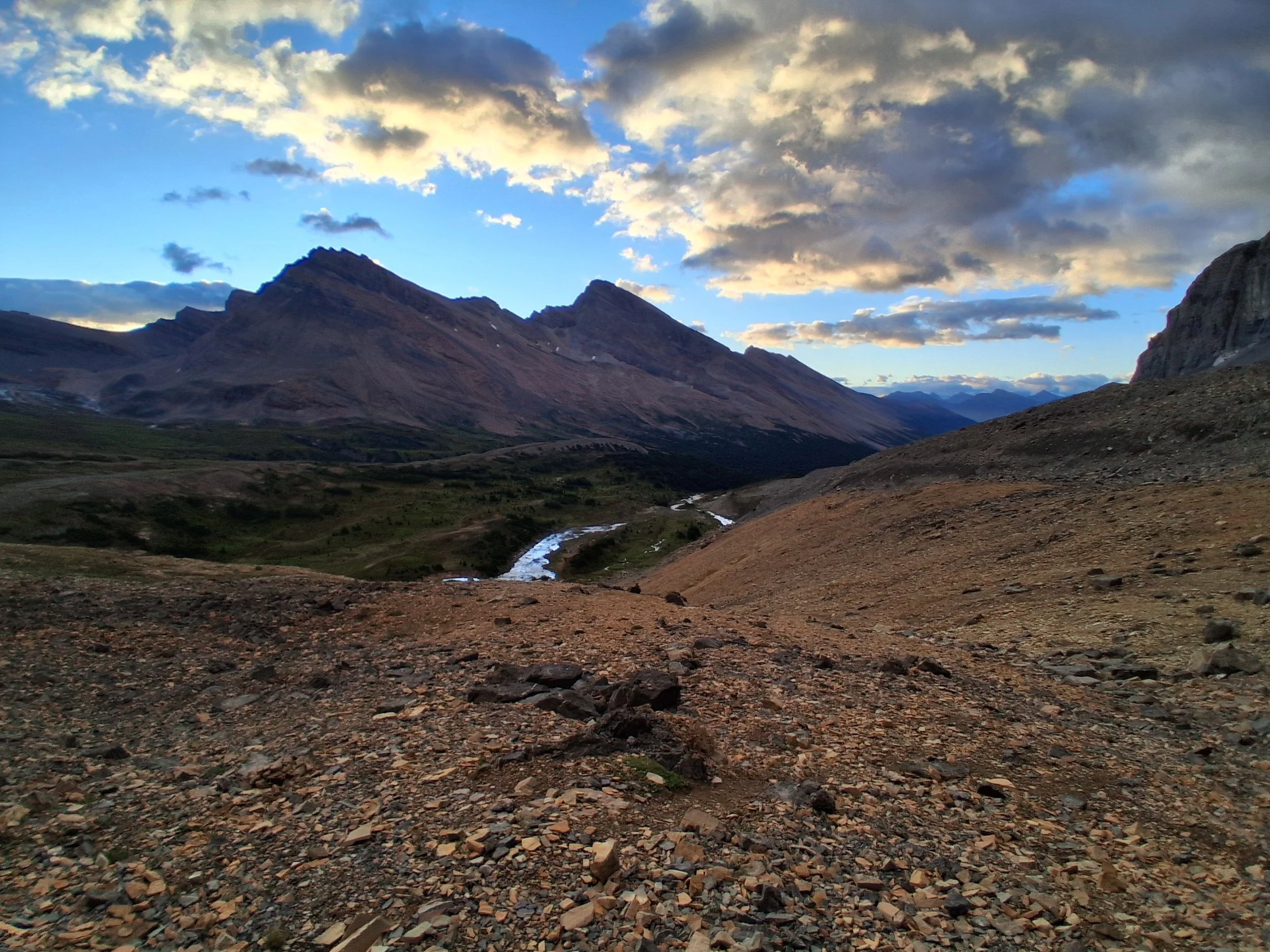
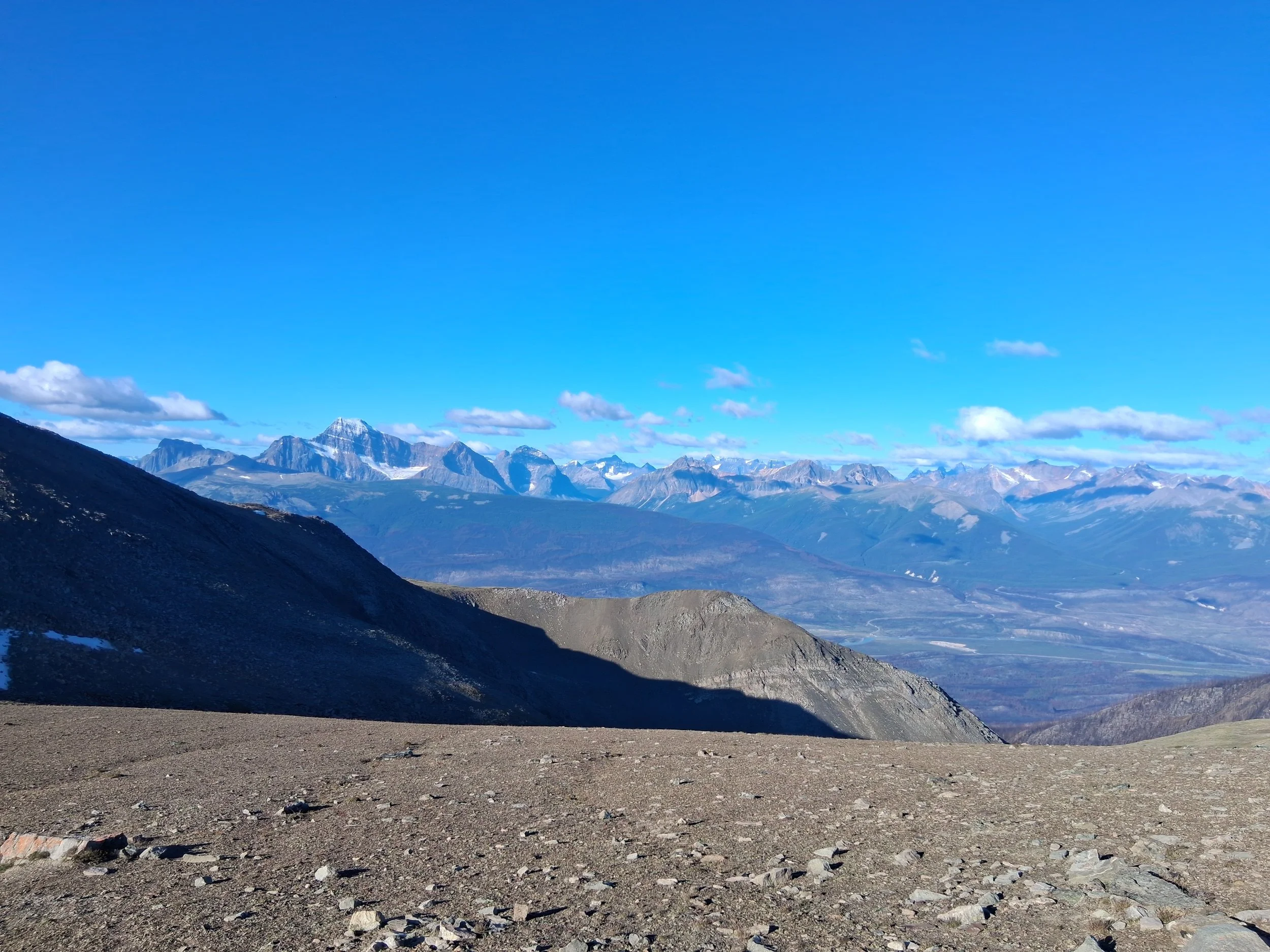
Some Photos from Section D
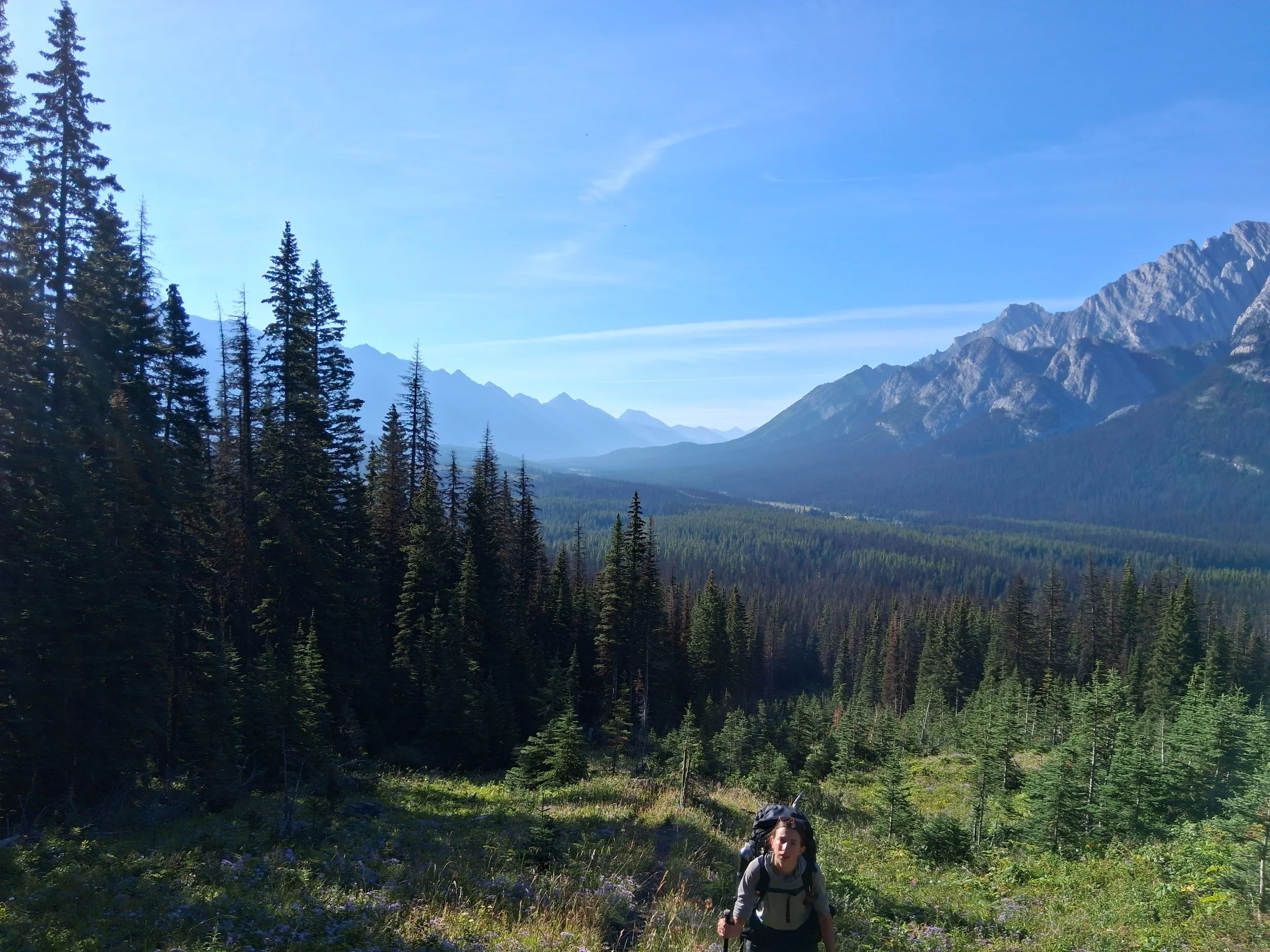
Section D was the shorter of the sections but a challenging and beautiful stretch. First we had to get back to Field where the trail head was and we thought we would try for a hitch and if we had no luck within an hour, we’d get a taxi. Thankfully we were picked up within 10 minutes by a man travelling the Rockies for the weekend in his car. Currently living in Vancouver but originally from China, he was very kind in taking us and it was fascinating to hear all about his travels and the history and culture of his home country. Genuinely must be the best and most interesting car journey we’ve ever been on.
Once we reached Field we started on the Kiwetinok alternate, which will soon likely become the main route anyway, up the pass and over the aptly named, Emerald Lake. We stayed the night at Yoho lake and woke early to start round the rest of the alternate. We reached Takakkaw Falls for sunrise, which was up there with the best views on the trail (there’s been a lot of those). We continued up towards Kiwentinok Pass which offered further stunning scenery, but a seriously steep climb (don’t slip). The route down however, was quite a struggle. Very rocky and steep so it took some time to clamber over and navigate around larger rocks. From here it drops into forest where there is an occasionally visible trail but the most deadfall trees we’d seen on the trail, probabaly anywhere even. It dragged on forever climbing over and under what felt like hundreds of trees but we finally popped out on the main trail again, which looked like an old forestry road. There were two river crossings then a wild meadow just off the trail where we decided to make camp for the night. It had been a long day and we were all shattered after that climb down. The following morning started with an icy river crossing then followed up the valley and over a nearby pass. We then dropped down what looked like a recently burnt forest, that did however have lots of berry bushes, down to the main river that we crossed and continued up stream. Further up there was a slightly interesting bridge. Three logs bound together over quite a wide gap with a lot of water rushing beneath and just a rope overhead to hold onto for stability. So we took our time edging our way over the bridge and the raging torrent. We soon realised what a raging torrent it was. As we continued upstream the trail was completely flooded. Knee deep in places and just to add insult to injury, we assume, there had been an avalanche or landslide, so most of the forest that was previously standing to our left was piled high on the trail. So what was quoted as some good and straight forward trail, turned out to be climbing up over and under piles of downed trees in deep water.
After this, the trail improved up to the top of the pass where we had planned to camp, but soon decided to move on. There were two reasons we did so. 1, there weren’t brilliant or many places to camp, and 2, we were pretty sure there was a bear on a kill nearby. When we reached the top of the pass, there was a strong constant smell of something dead and decaying. Also, just a few steps later round the corner, something big, brown and bear shaped ran off through the trees! We had been talking loudly so pretty sure that’s what scared it off, thankfully. Needless to say, we continued on quickly. We stopped for our dinner at the next river crossing then went on to the start of the flood plain where we set up camp. We went for a swim in the nearby river and sat watching the sun set over the best camping spot of the entire trail! Our old friend the thunderstorms came back in that night so it was a rather sleepless one.
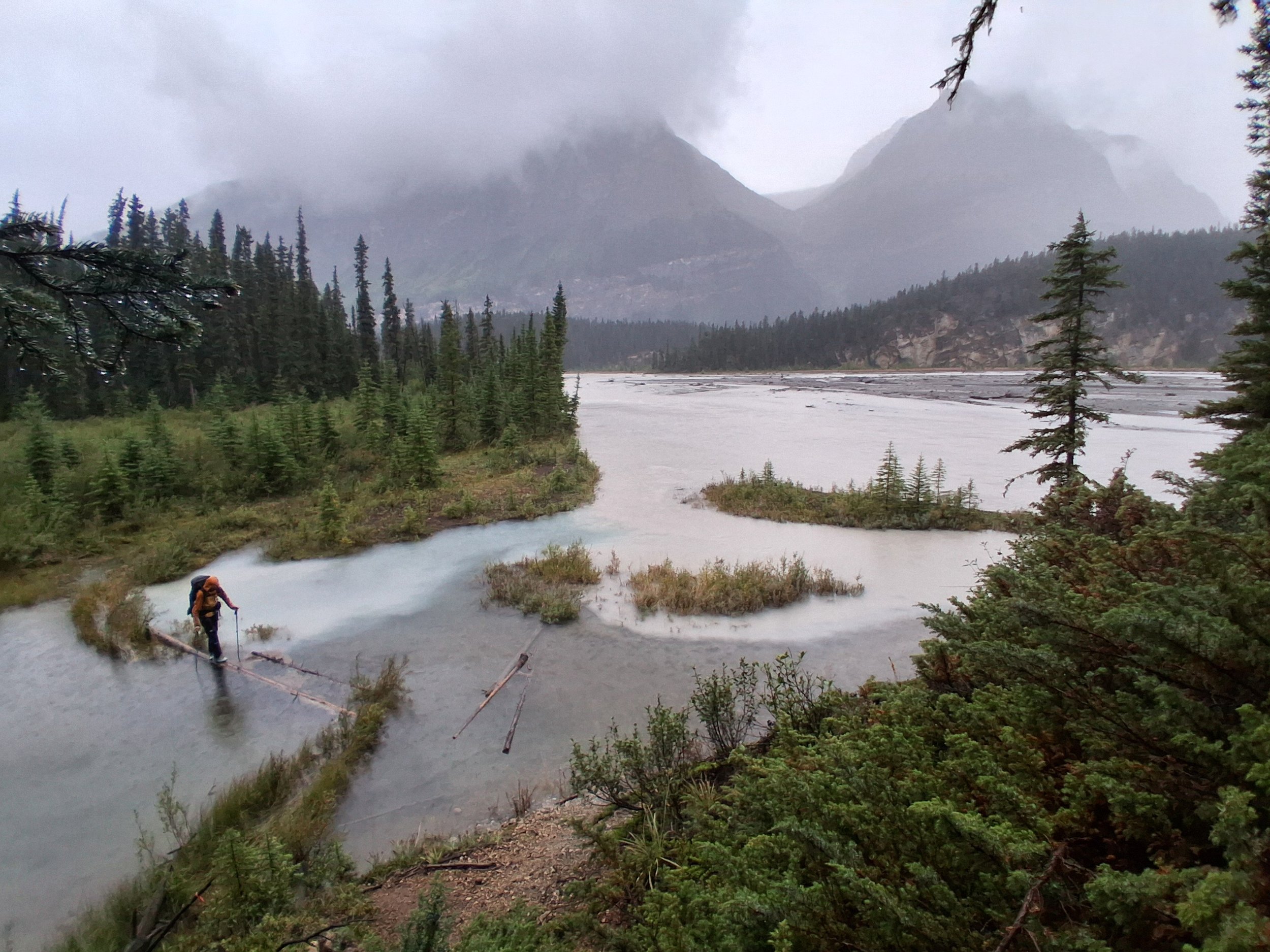
The next morning was meant to be a straight forward, fairly flat walk along the floodplain and down the road to Saskatchewan River Crossing. Well, the thunderstorms bought with it lots of rain! The flood plain had… flooded, kind of inevitable I suppose but this made the going tough. We ended up crossing rivers and flood water 20+ times that day with some seriously deep water in places that almost warranted swimming. Much of the trail up to the side of the floodplain had also come away in a landslide so again, this made the going extremely tough. In the end we pretty much decided to stick to the floodplain and just walk up through the water. Once we finally reached the road, we were extremely wet but still, a couple miles down the road, we managed to get a hitch from a lovely local to the the River crossing. We picked up a resupply and shared a room with our friends for the night as a quick rest and shower before section E.
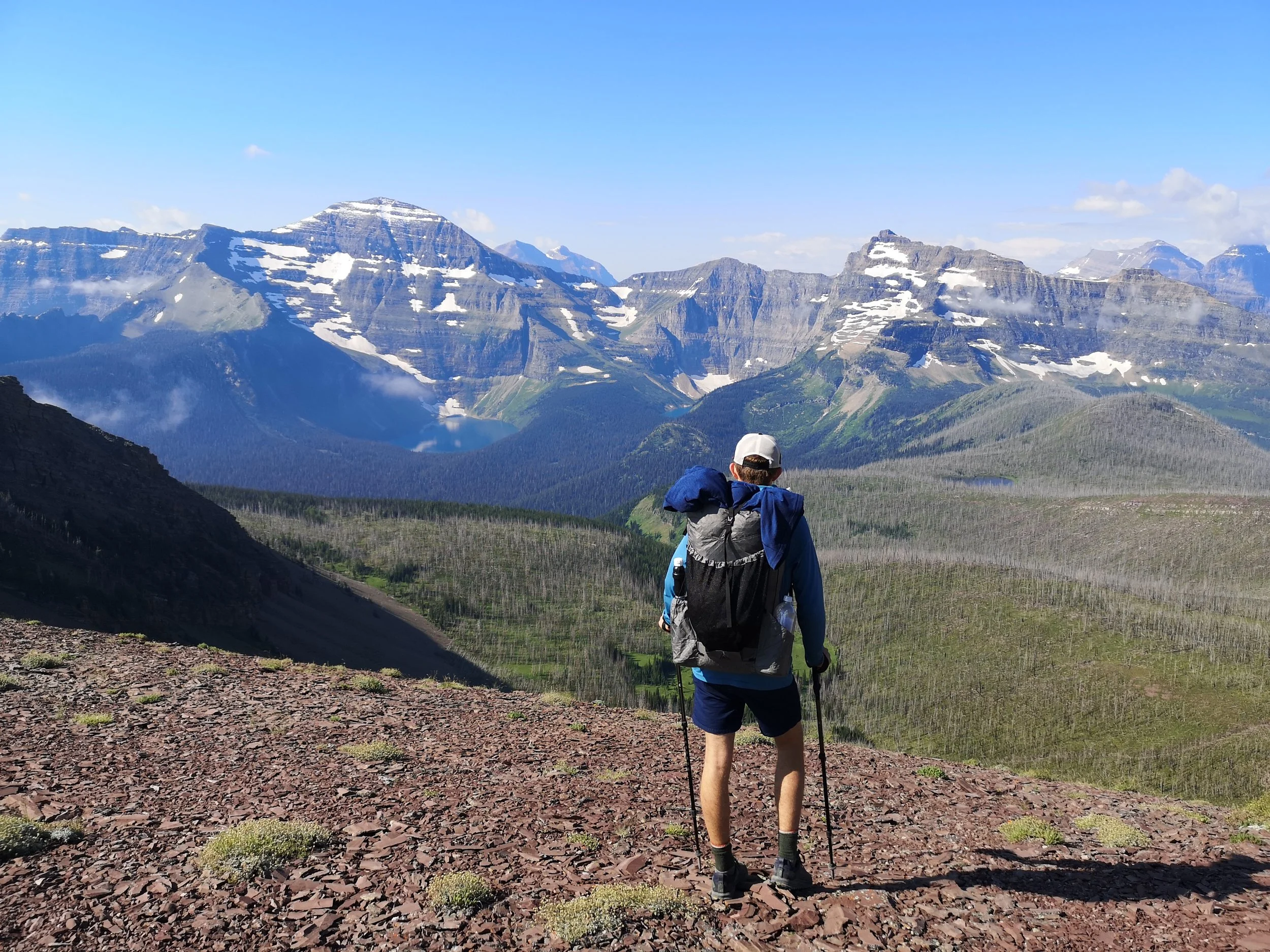
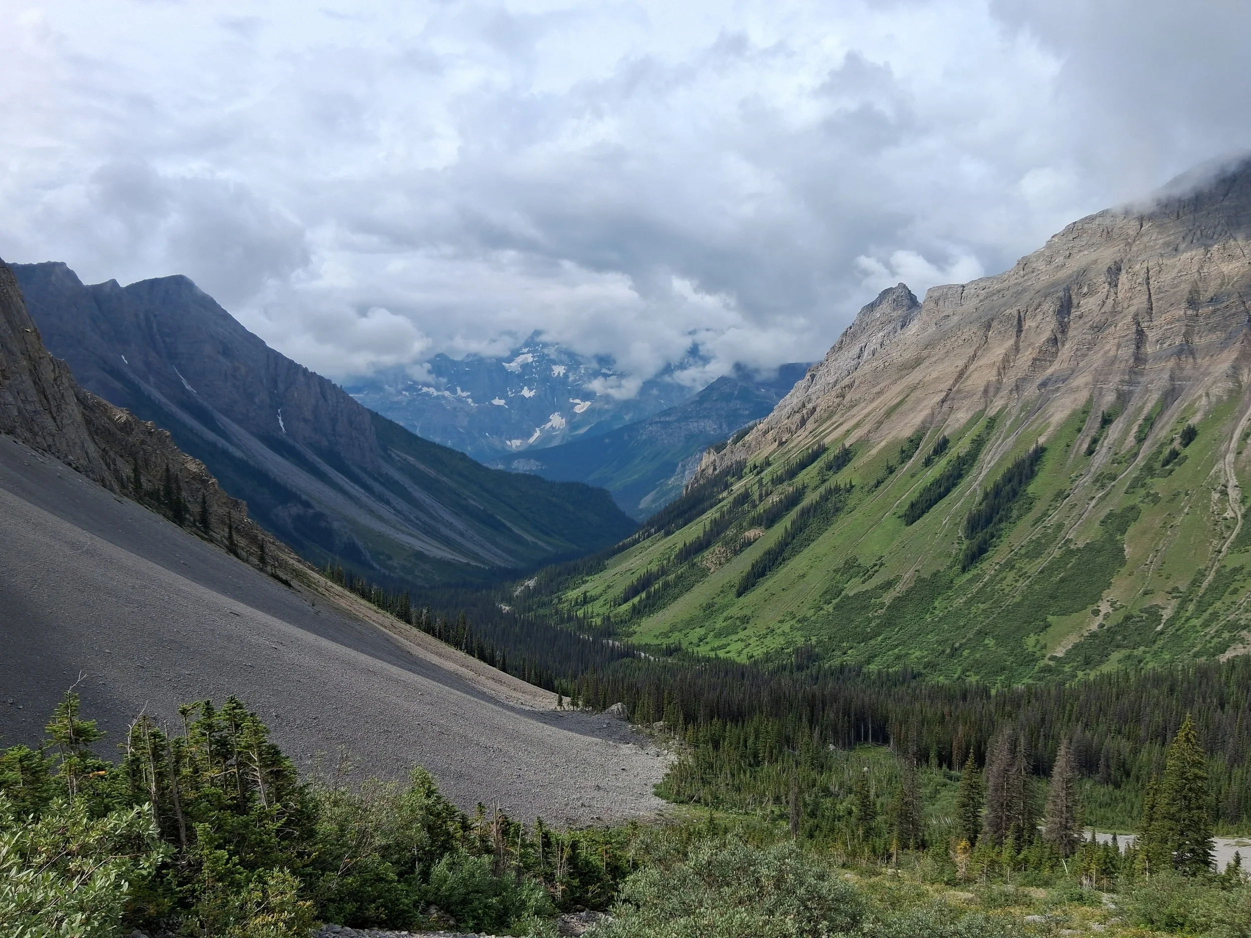
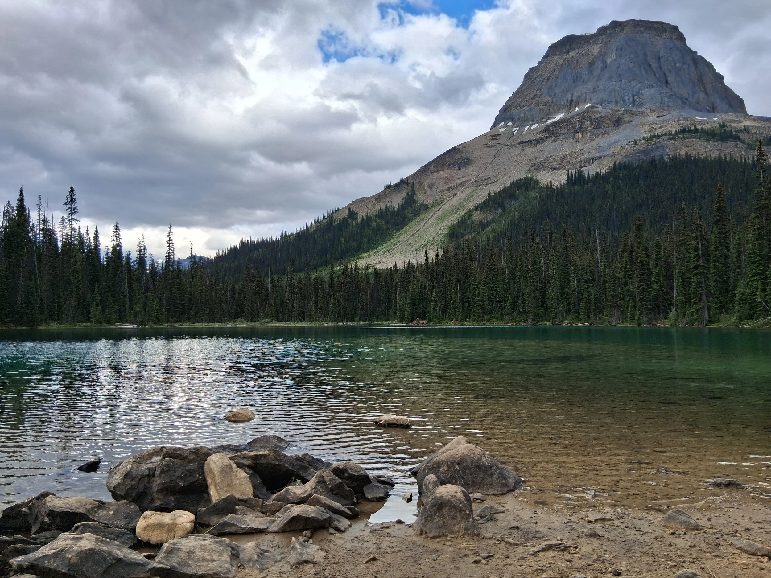
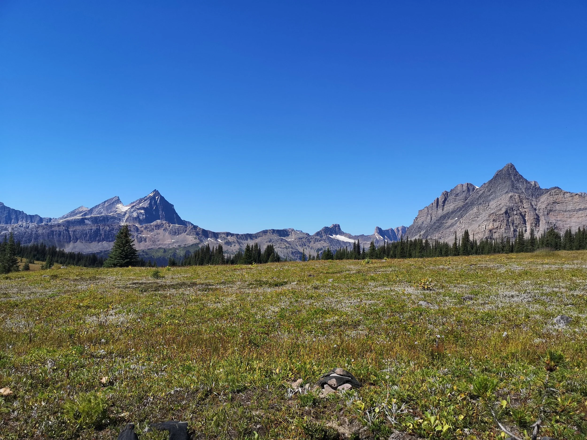
Section E - Saskatchewan River Crossing to Jasper
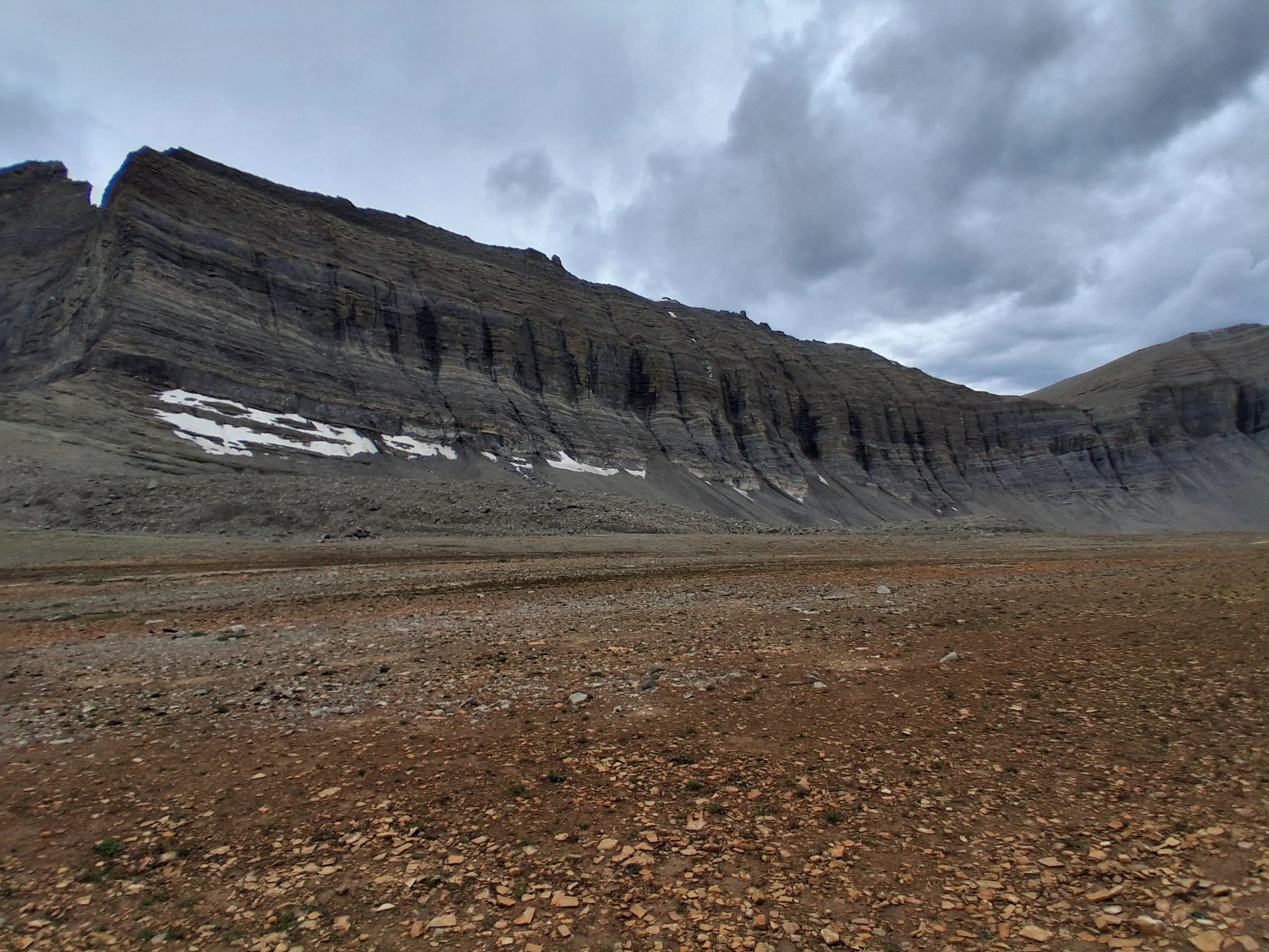

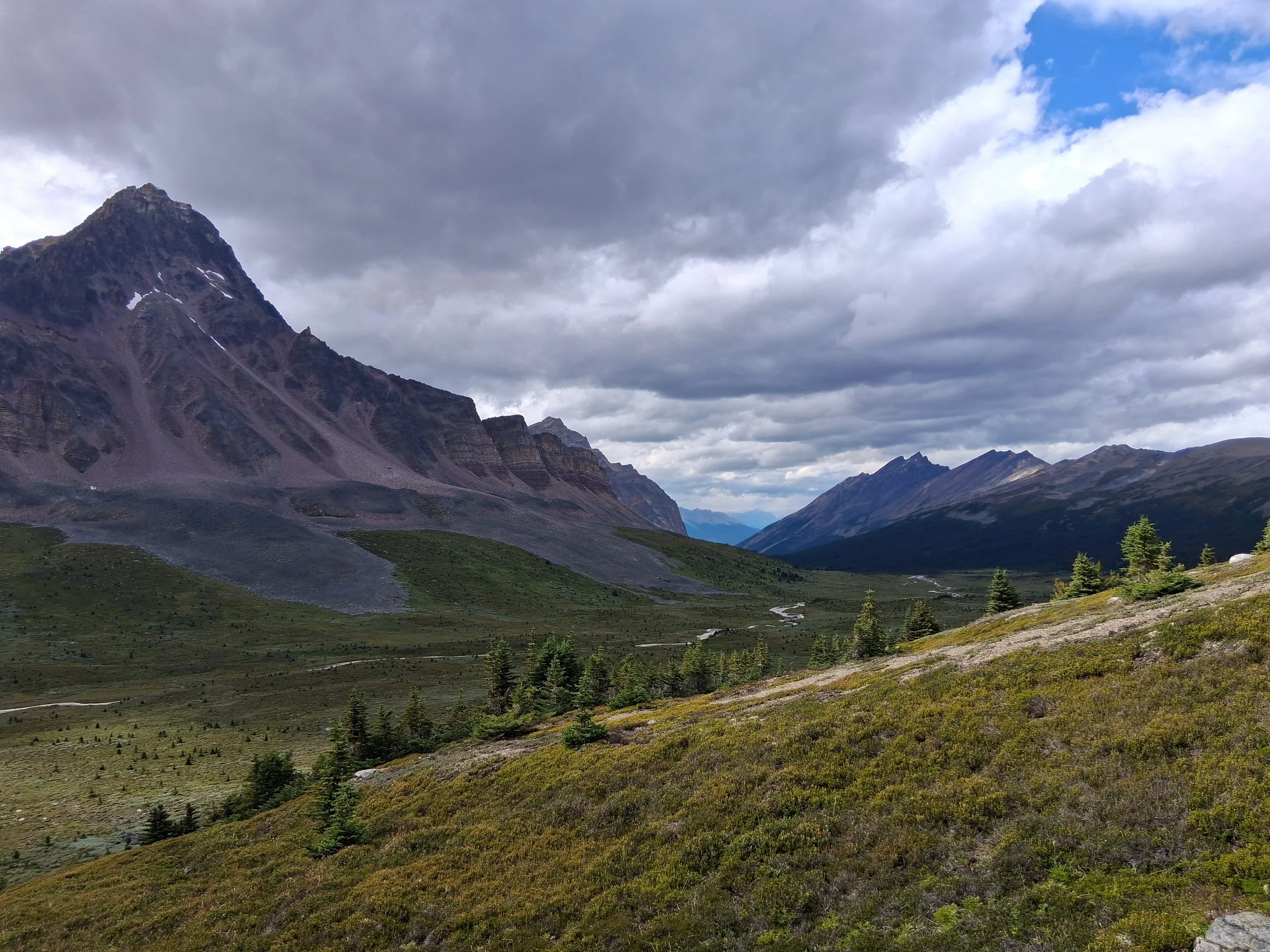

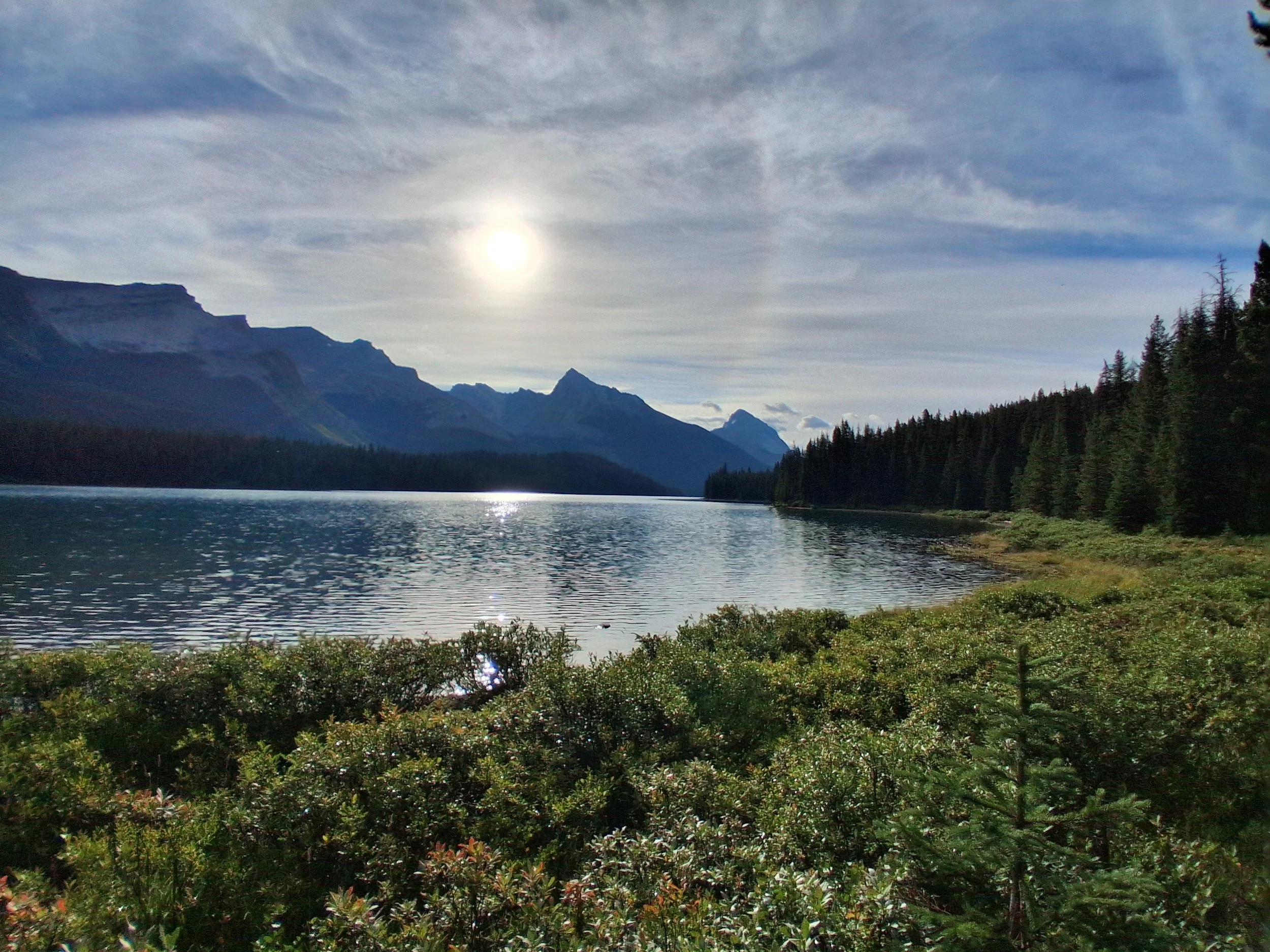
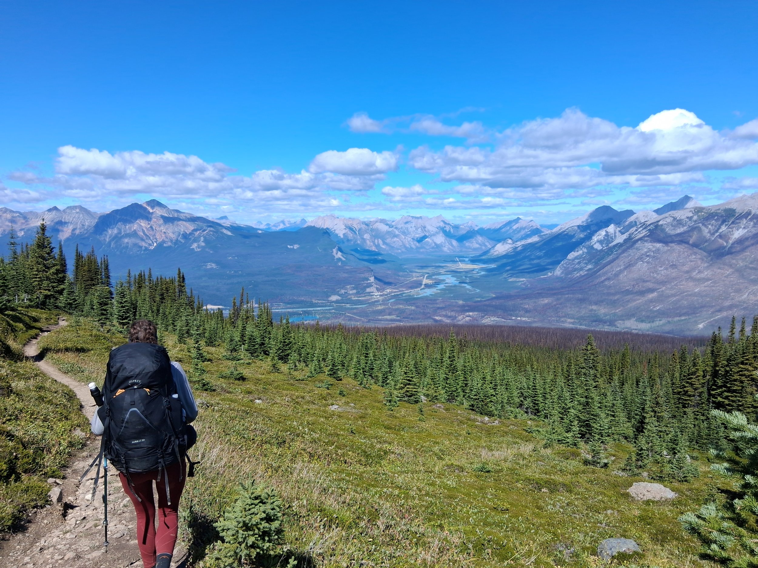
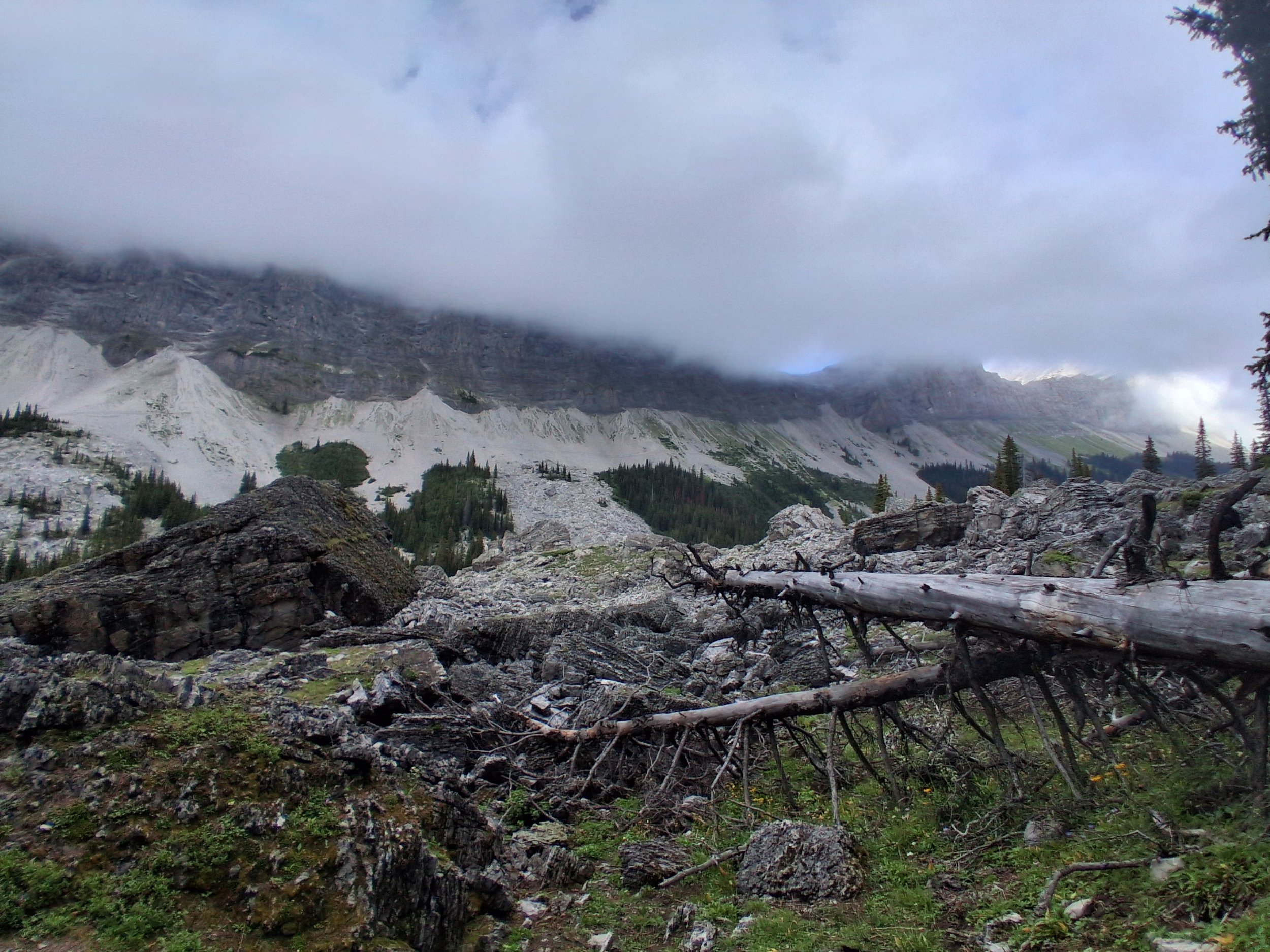
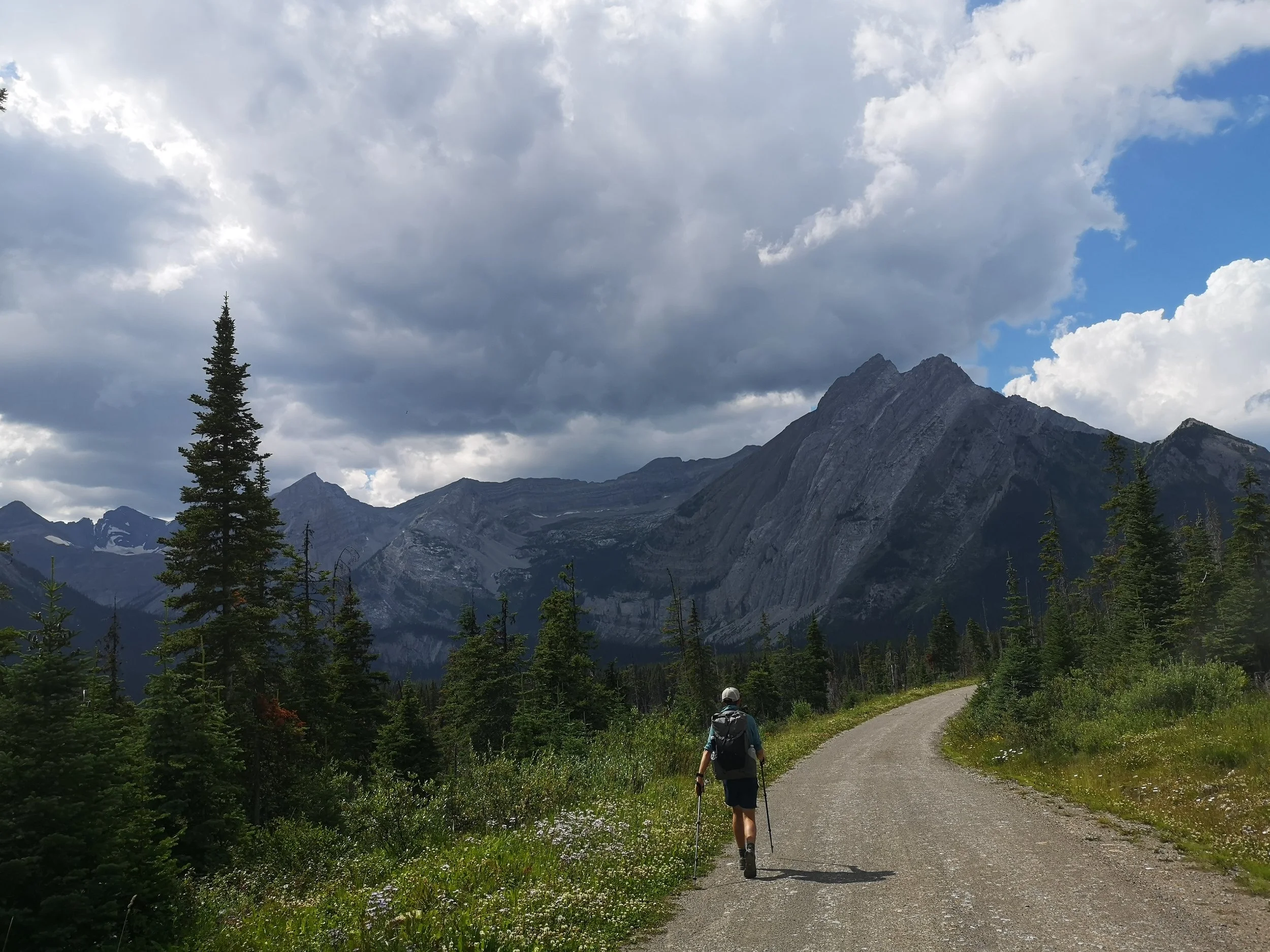
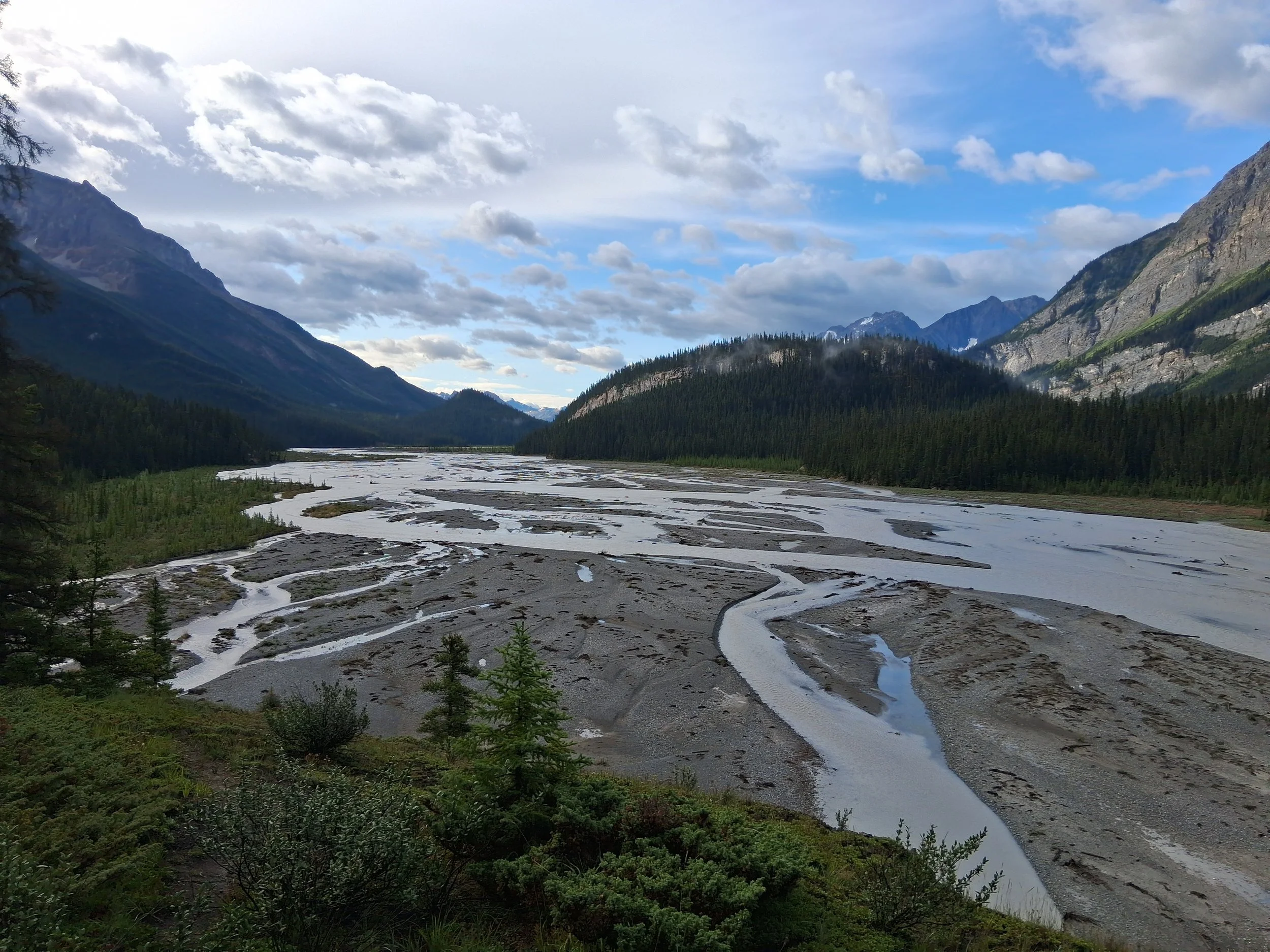
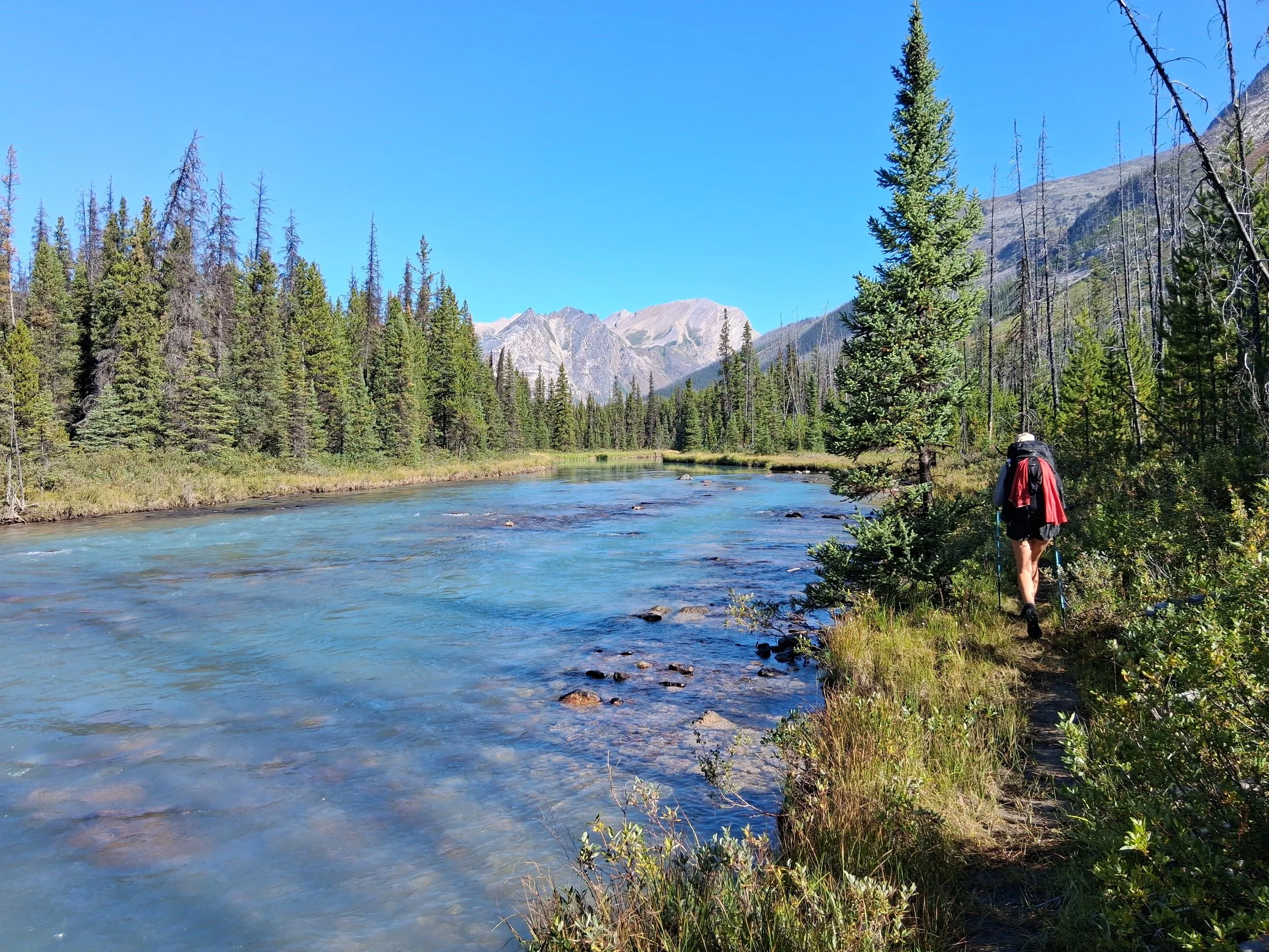
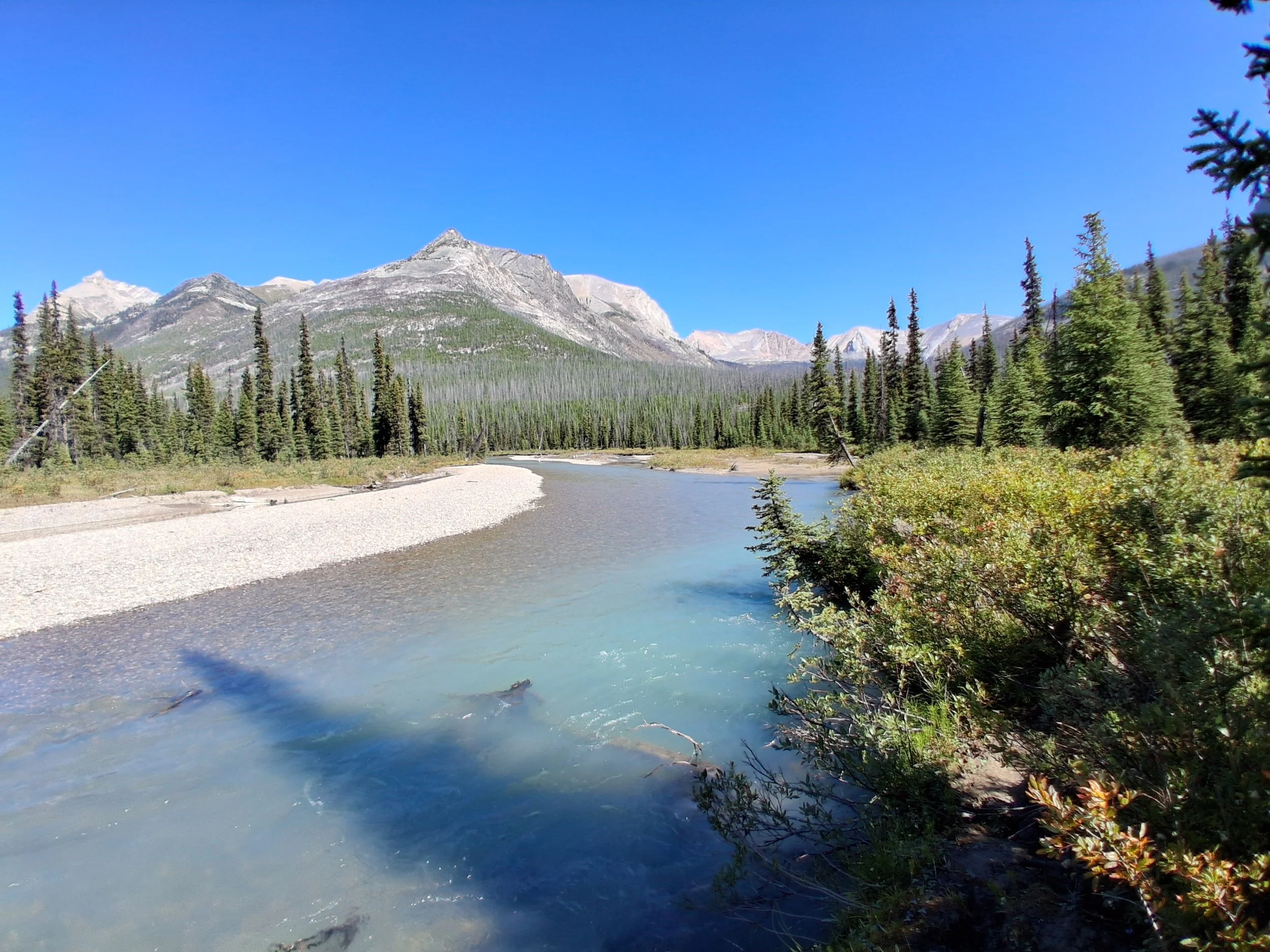
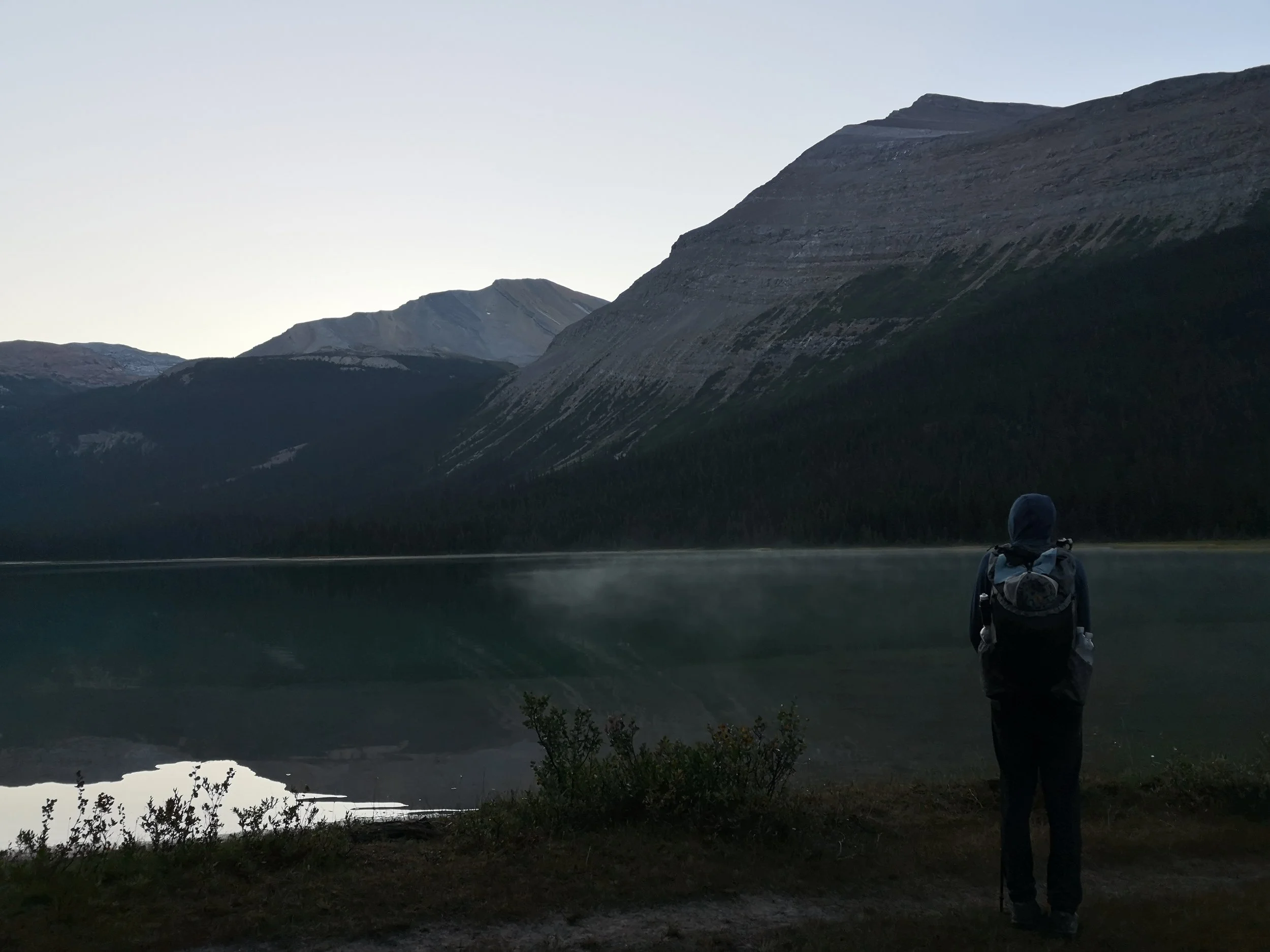
Some Photos from Section E
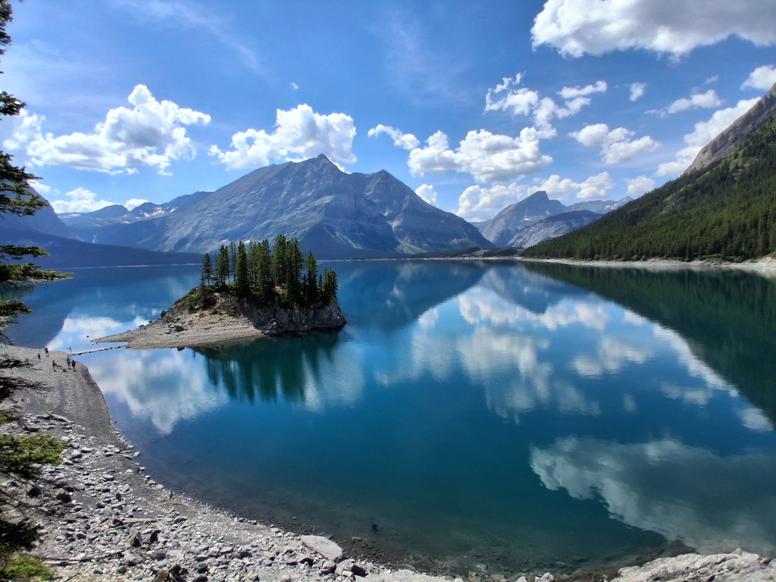
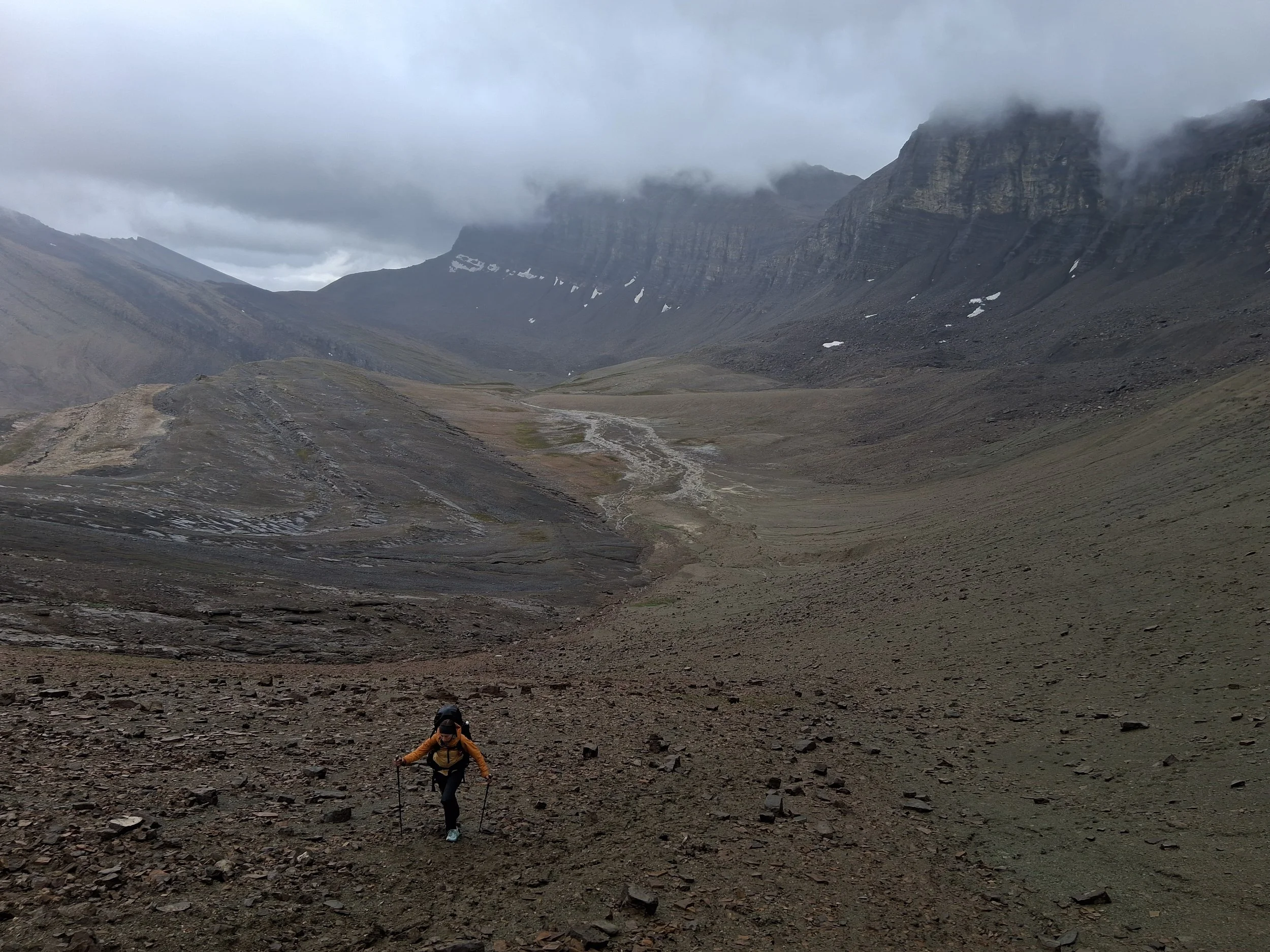
We left Saskatchewan river crossing late morning after taking full advantage of the all you can eat buffet breakfast at the crossing, we highly recommend the French toast! The first leg of our journey consisted of walking along the side of highway 11 which was rather quiet in terms of traffic and unfortunately no chance of a hitch. Once we had made it to Owen Creek trail head, we followed the river up stream and stopped for lunch on a beautiful spot next to the river. The trail up the pass seemed straightforward and was marked with the usual trail markers, however, there had been a landslide which had washed away part of the trail making it a little more challenging to navigate. Our advice for this part would to be FOLLOW THE RIVER. Do not be like us and take the trail which goes up off the bank and into the forest, where once you realise you have gone wrong it is hard to climb back down and find the trail again. We did manage to safely get back on to the trail, but it added over an hour to our day and was rather tiring ahead of the rest of the climb up the pass. Once we had got back on the trail we followed the river and markers up the pass until we reached the top. The top was unlike any scenery we had experienced on the trail containing wide open gravely mountain landscape with no vegetation. The temperature near the two lakes before reaching the campsite dropped significantly and we prepared for a cold night’s camping. The campsite itself was set after the second lake and there were more sheltered camp spots just below a small cliff which is where we chose to spend the night. It was the coldest night’s camping we had on trail but thankfully our quilt was more than up to the job, and we stayed perfectly warm throughout the night. One interesting thing about this campsite was that tallest feature for miles, that isn’t a mountain, is the bear lockers which look extremely out of place for the landscape.
Following a rather cold start the next day we set off across the barren but intriguing landscape, up over a gravely pass before descending into a more forested area passing a few other hikers coming the opposite way. After following the trail in the woods, we soon reached Pinto lakes north. This was a stunning place to camp whoever it was evidently popular with front country campers and there were signs of people including litter and food waste, so we headed onwards, towards Pinto lakes east campsite. After crossing the shallow river to reach the campsite we arrived at a empty site with stunning views over the lake. We set up and watched bald eagles flying nearby while filtering water at the lake. We turned into the tent early while it was still light and heard what we assumed were other campers arriving as we drifted off. The next morning, we awoke to find ourselves alone at the campsite, with a trail of bear prints going through the camp and out past the bear lockers.
We set of from pinto lakes east following the river with various crossings through forested areas until we reached a hiker logbook where we signed our names and continued on. The weather worsened throughout the day and by the time we got to cataract pass a storm was looming. We set up the tent just in time before the heavens opened. We managed to cook and eat in a slight break in the storm before diving back into the tent to escape the rain. The storm was so bad at one point we had to dig a trench around the tent to prevent the vestibules from flooding. The next day the weather had greatly improved and after refilling in the trench we had dug the night before we set off. Most of the morning was spent going down a series of passes on rocky terrain and we spotted a small mountain goat with kids. By late afternoon we reached the top of Jonas shoulder which boasted spectacular views all around, then made our way down and on to Jonas cut off campsite. This was a busy back country campsite, and we ended up talking to a very interesting Canadian couple who had previously lived north of Kakwa lake.
We set off from Jonas cut off the next morning, arrived at Pobokton late morning and had an early lunch at the campsite before moving on. We crossed a series of small shallow rivers and streams on our way to avalanche, removing our socks and shoes as for the first time that week they were dry! It wasn’t until we got to the last river crossing just in front of the campsite that someone (Ben) while trying to rock hop across, fell into the river and got completely soaked. The next day featured varied weather which switched from wet and miserable to lovely and sunny. The paths leading on to trapper creek were rather overgrown by willows in places so required a lot of bush whacking to get through. Crossing Maligne river for us was fairly straight forward as it wasn’t fast or too deep and was very clear, so was easy to find footing. Once we had made it to trapper creek, we noticed the bear hang had scratch marks along the side so, decided to find another tree to tie our Ursacks to. We also lit a fire in the fire pit at the camp to attempt to dry Ben’s clothes out from the night before and both of our socks.
We set off early the next day to make it to moose lake early to hopefully spot a moose, we had no such luck but did make it to Maligne lake visitors centre just before the waffle shop opened. The savoury waffles are something we would highly recommend as well as the food in the café next door, after eating most of our food the night before we stocked up on as much as we could carry. After leaving the cafe we began the start of the skyline trail which despite the rain was absolutely stunning with beautiful scenery and views. As we were heading towards curator campsite, we noticed a storm in the distant mountains and by the time we had arrived at the campsite the hail and snow had made its way to us, and we quickly ducked in for shelter under the trees at camp. The next day was spent following the rest of the skyline trail into Jasper, the weather was for once on our side and we had warm sunshine all day. Once we reached the end of the Skyline trail, we joined an ATV track where we stopped for lunch and met a very interesting American woman who was very interested in the GDT and gave us some fresh fruit which was a very exciting treat! We then continued and reached where the 2023 wildfire had burnt the forest that had once surrounded Jasper. Although it was sad to see all the burnt trees it was comforting that the forest floor was already covered in wildflowers and signs of the forest coming back. It was on this path we came across a parks Canada ranger and had our permits checked for the first time the whole trail! Once we had reached the main road, we decided to try and hitch the last section of road and after a few minutes of trying we secured one, well it was a however a little rustic in terms of hitchhiking. An American father and son in a large pickup pulled up and asked if we were okay travelling in the bed of their truck, along with their various bikes, fishing gear and underneath a roof tent. We accepted the offer and clambered into the back of the truck making sure to duck and hide within the bags at traffic lights and junctions. Once we reached Jasper they shouted out the window asking where we would like to be dropped off at, as they couldn’t hear our response, they pulled over in the middle of Jasper to ask and dropped us off right next to the hostel.
The following day was a zero day spent in Jasper restocking for the next section, catching up with various people we had met on the trail, also staying at the hostel and of course eating as much as we could in Jasper! We really recommend bear paw bakery which was just a short walk from the hostel, had a huge range of baked goods and amazing coffee! The hostel itself was very popular among GDT hikers and we met many people who were just a day or so before or behind us as well as those who were going North to South, so the hostel itself felt like a part of the GDT community.
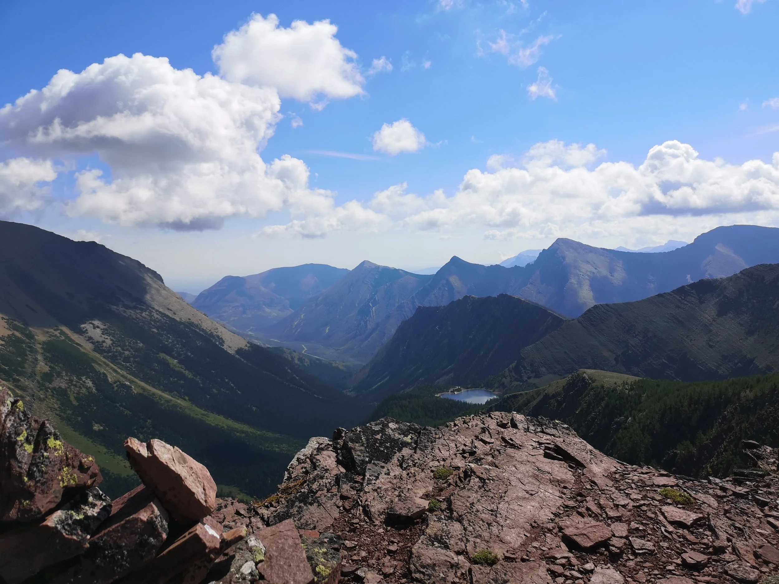
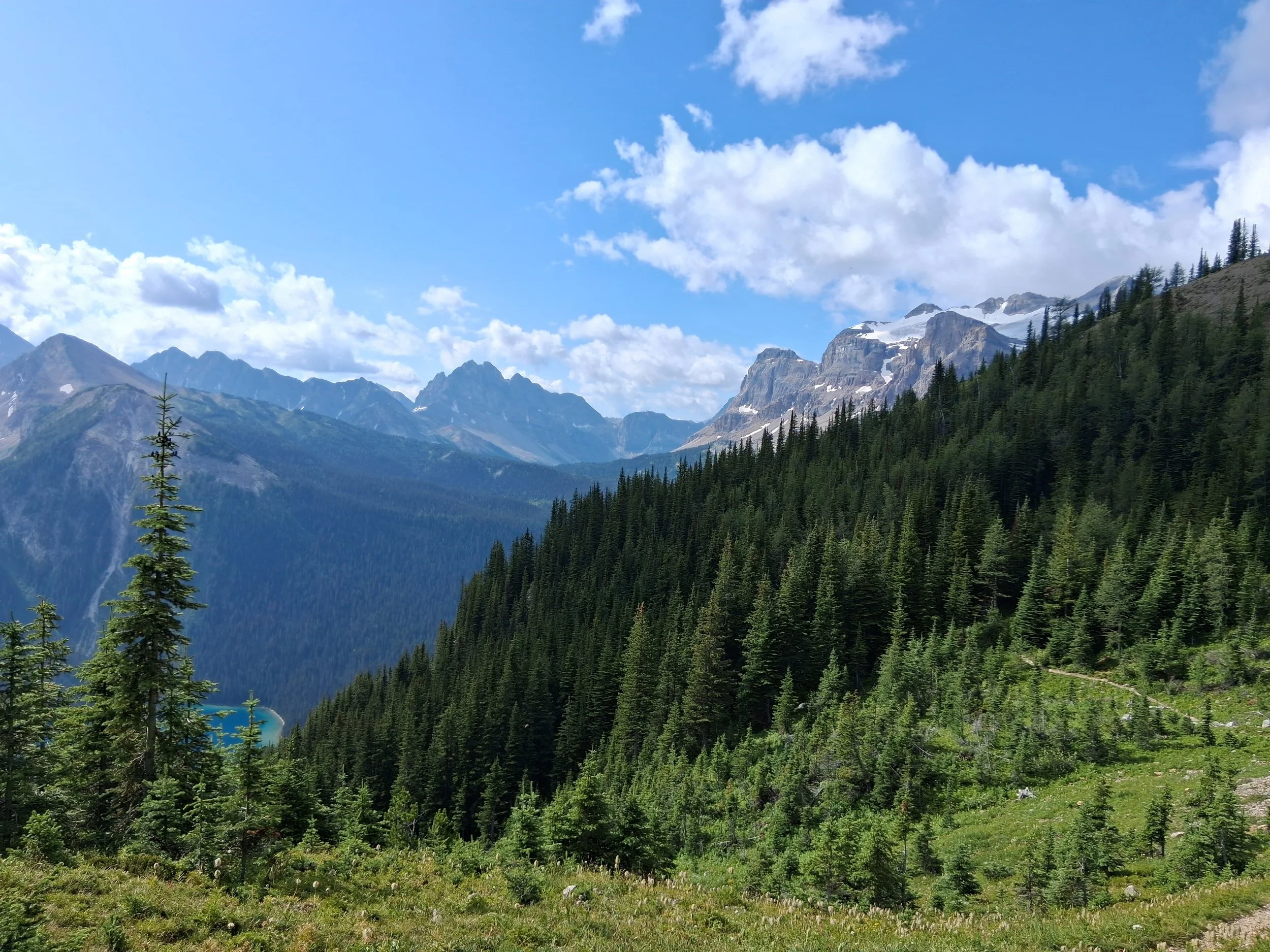
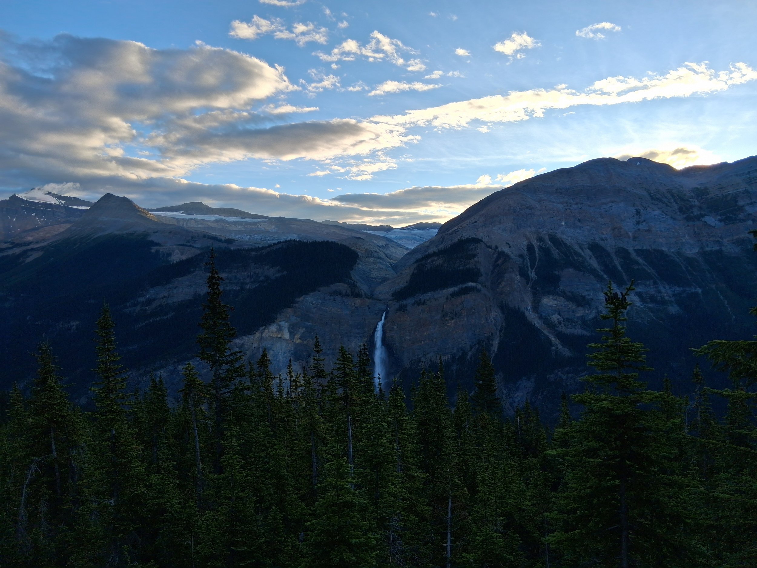
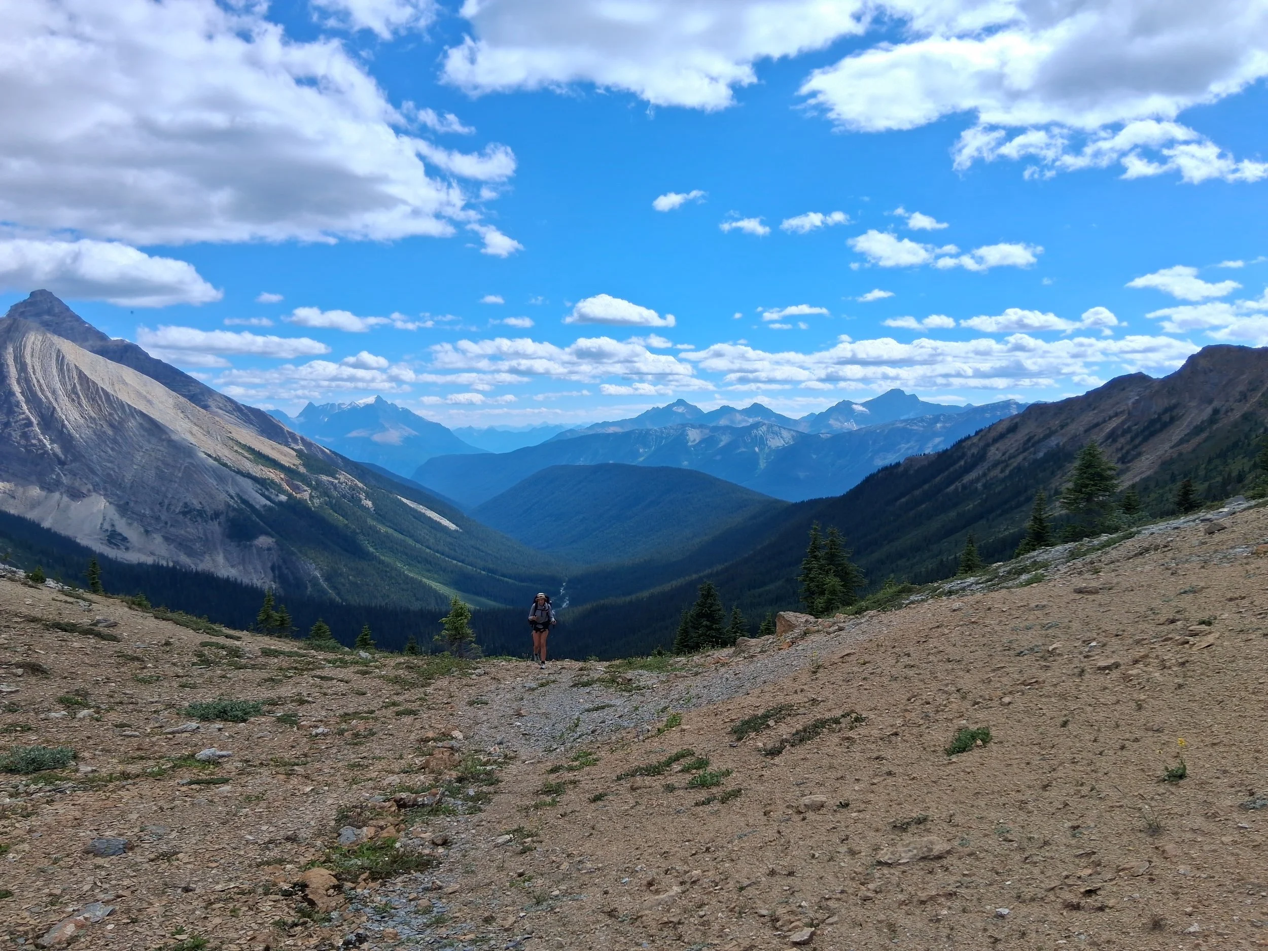
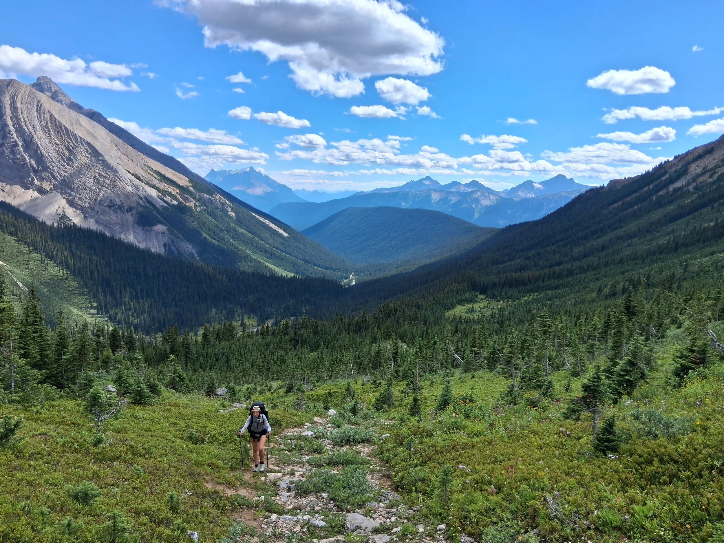
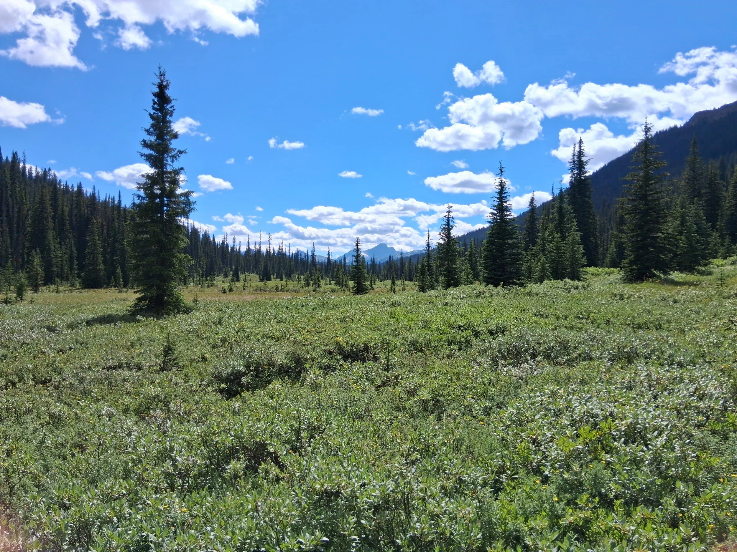
Section F - Jasper to Mount Robson
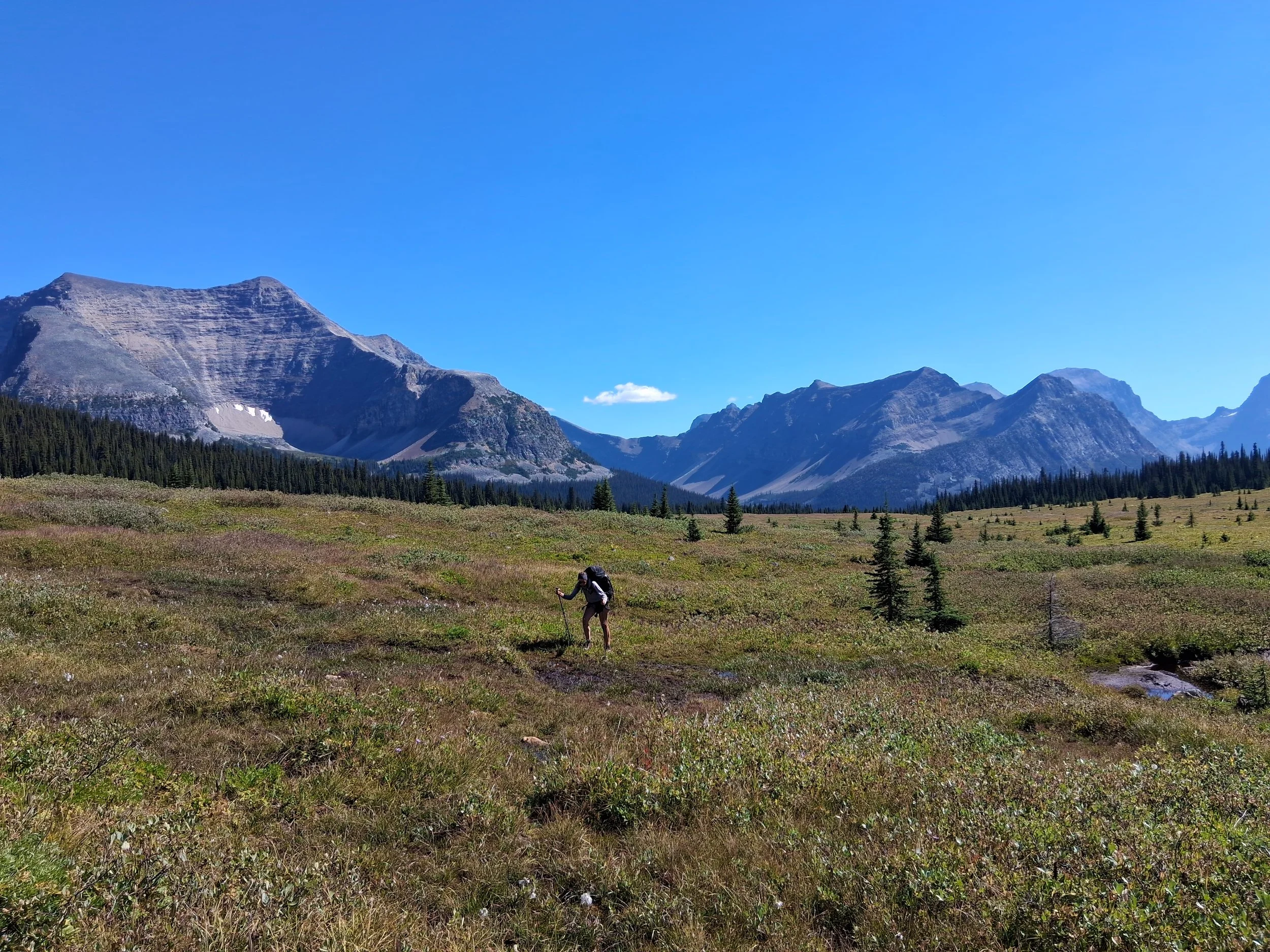
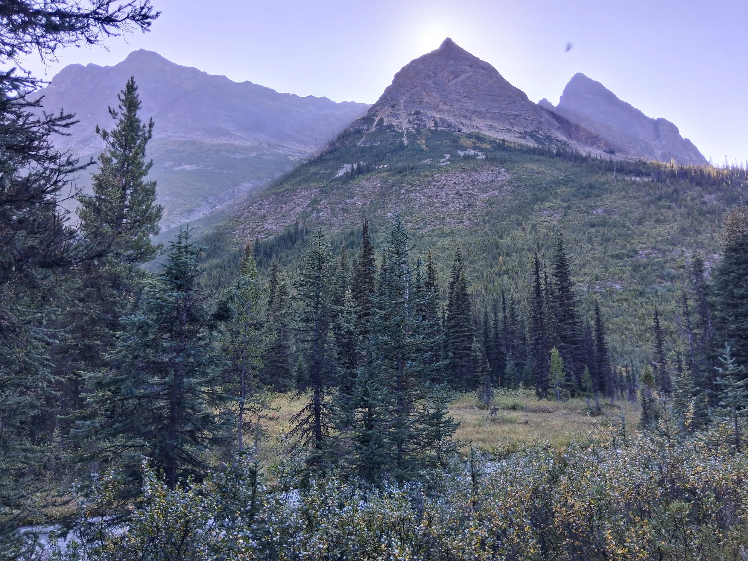
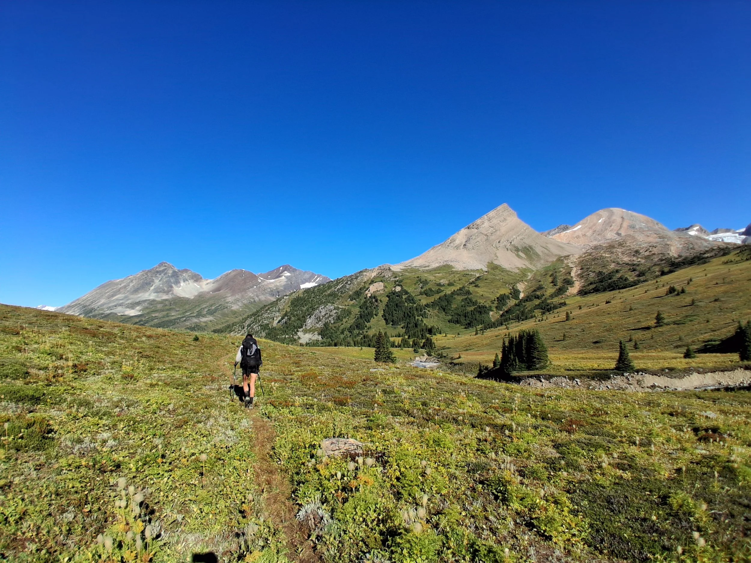
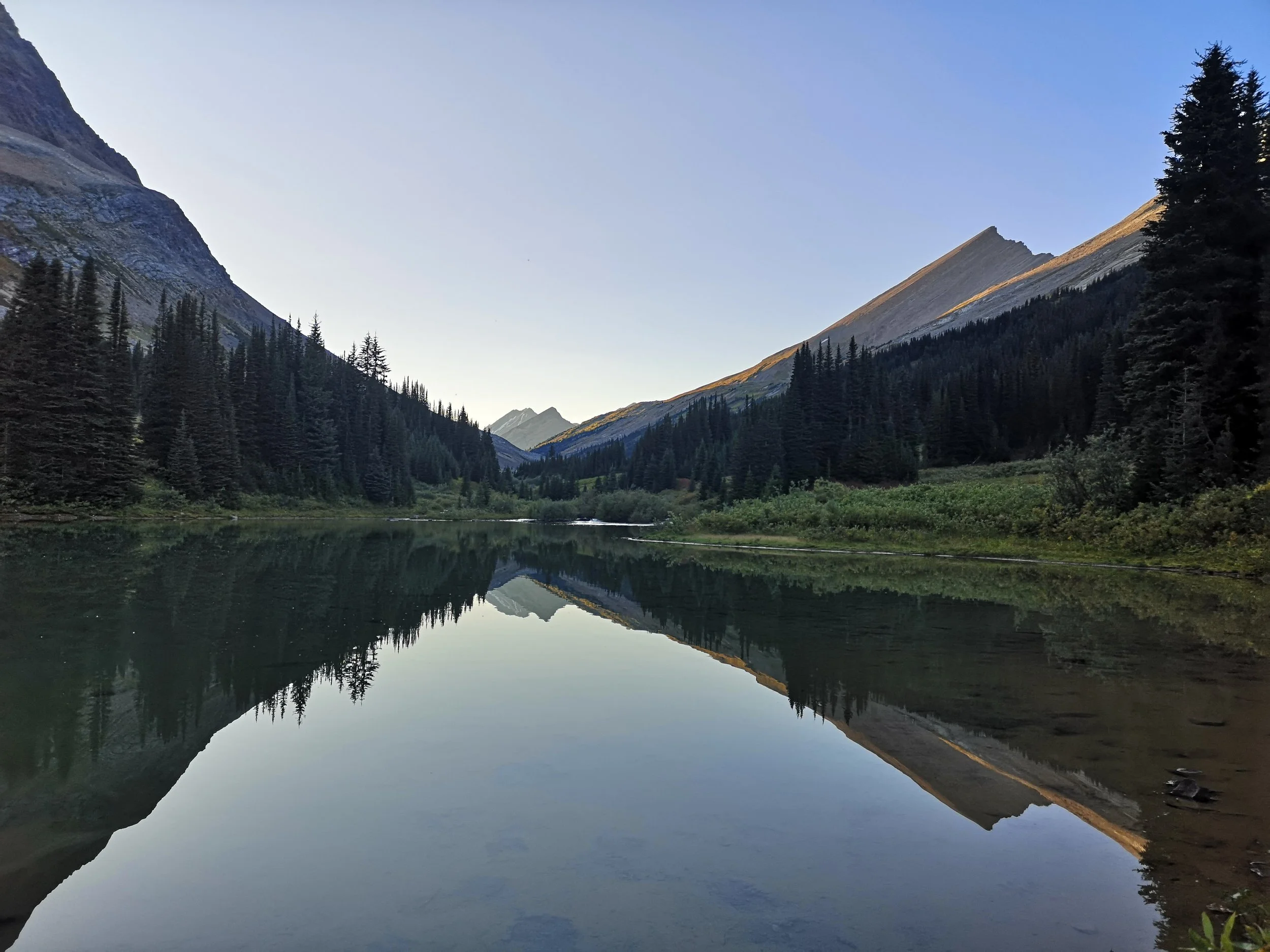
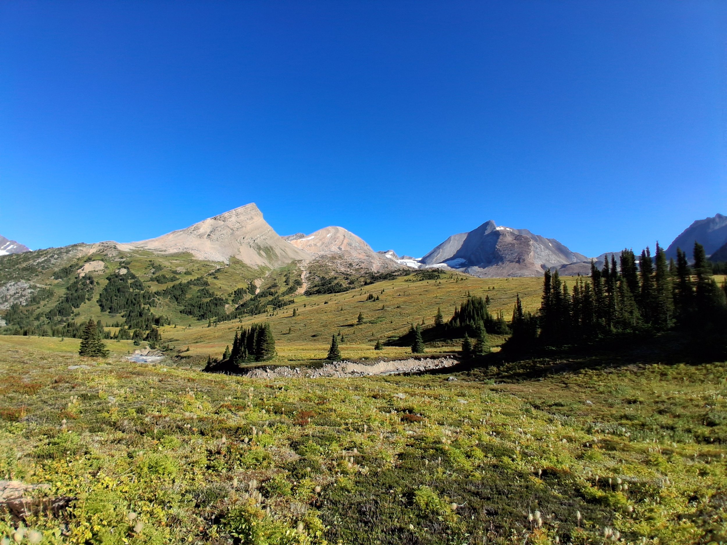
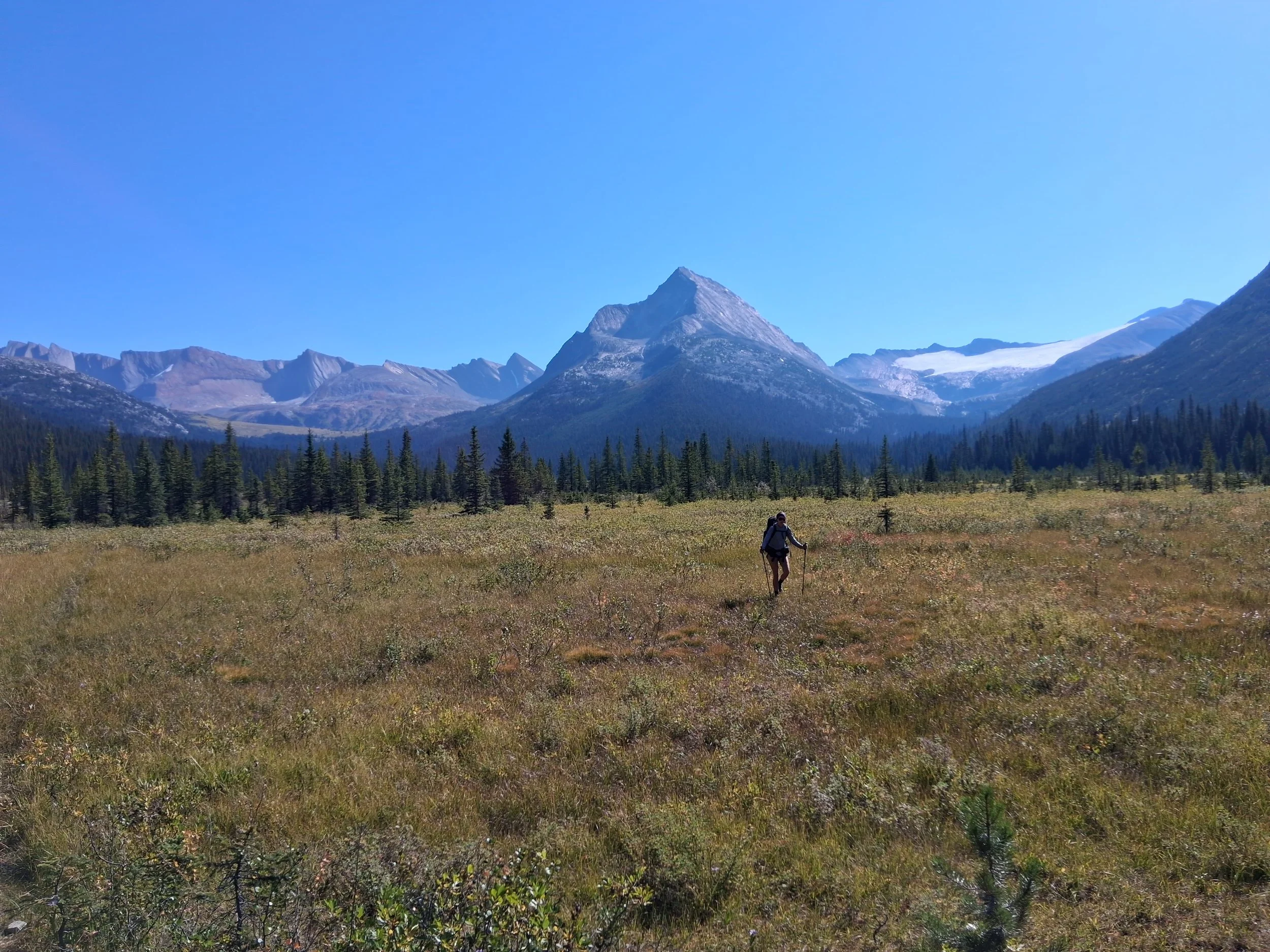
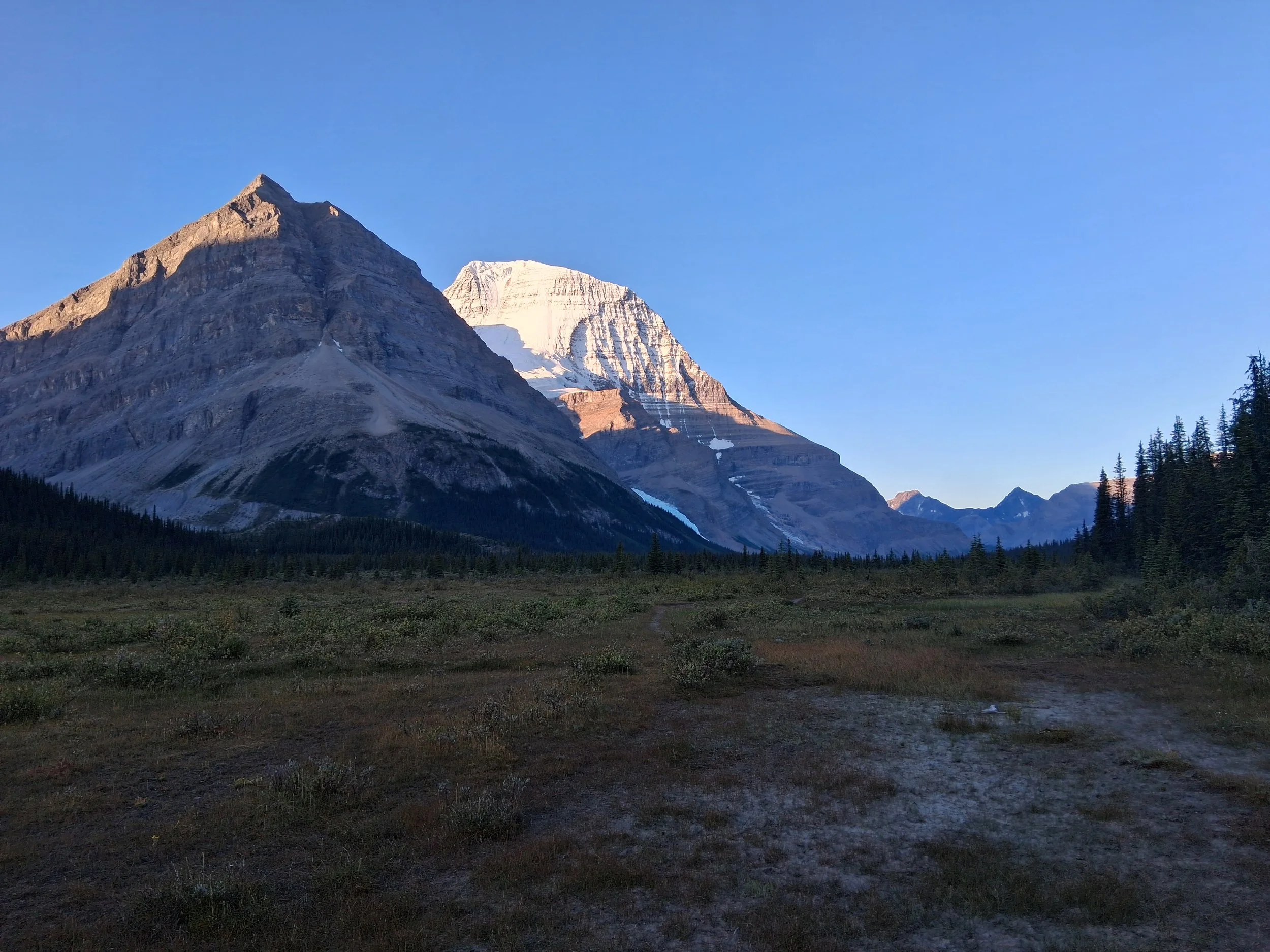
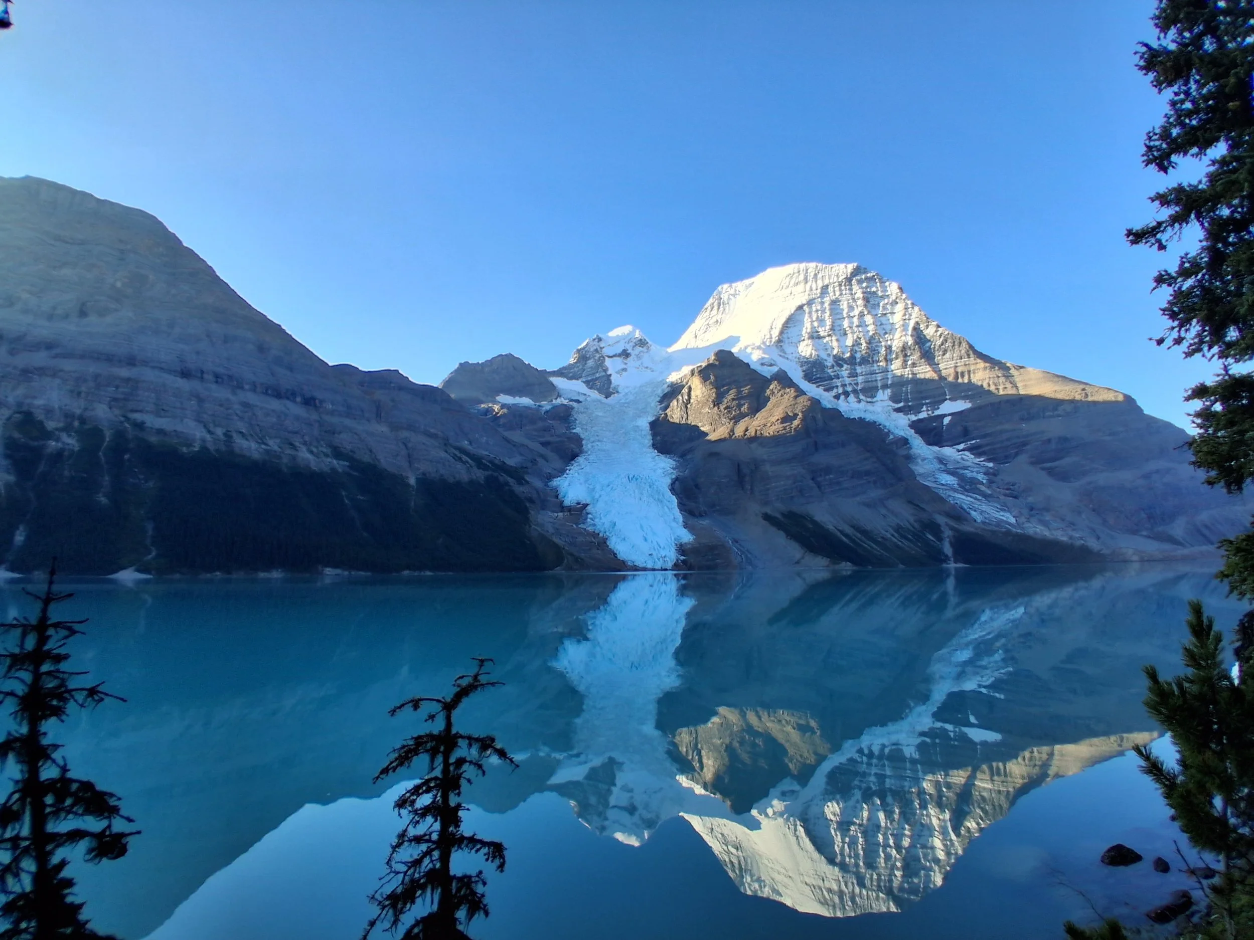
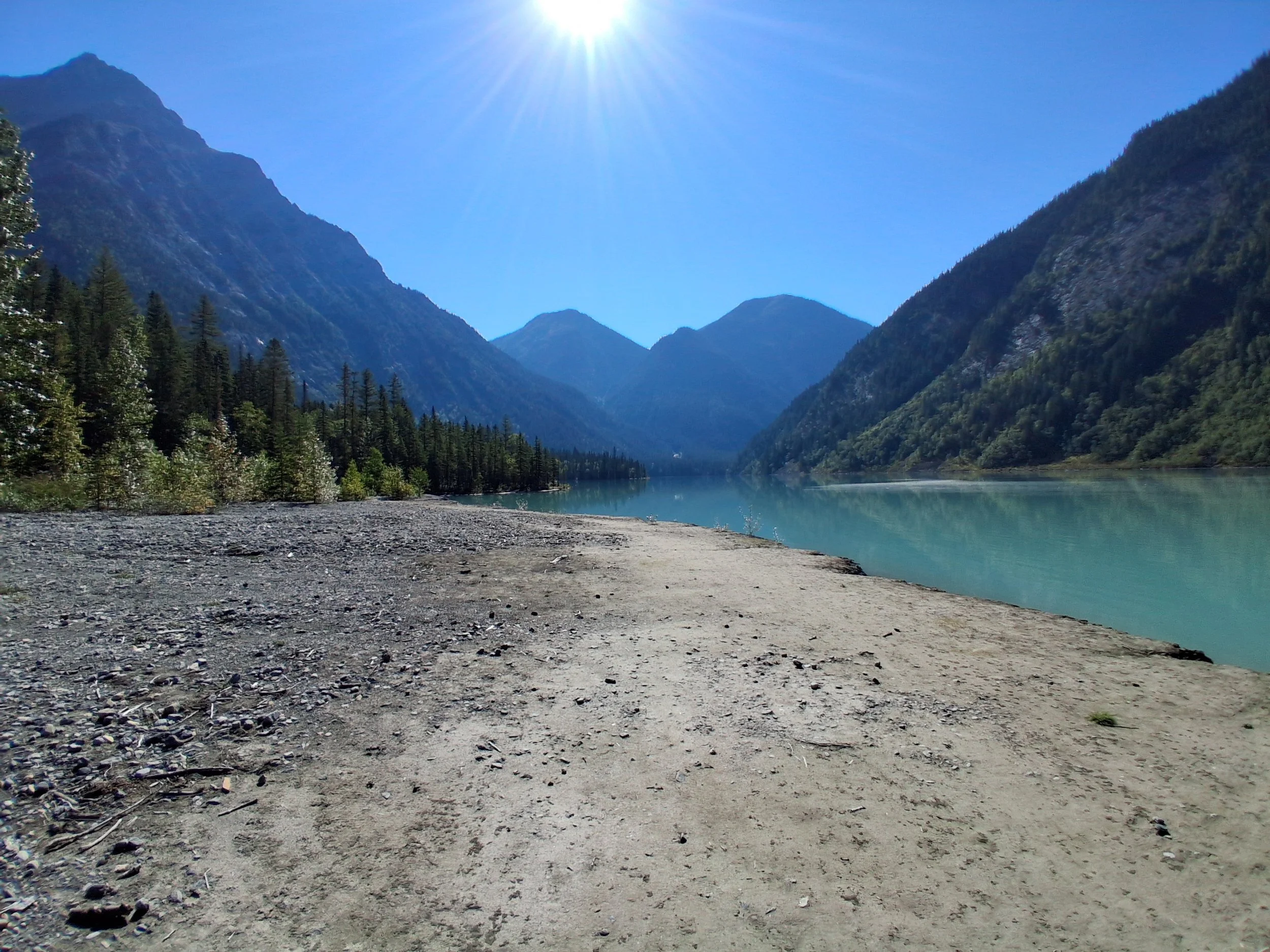
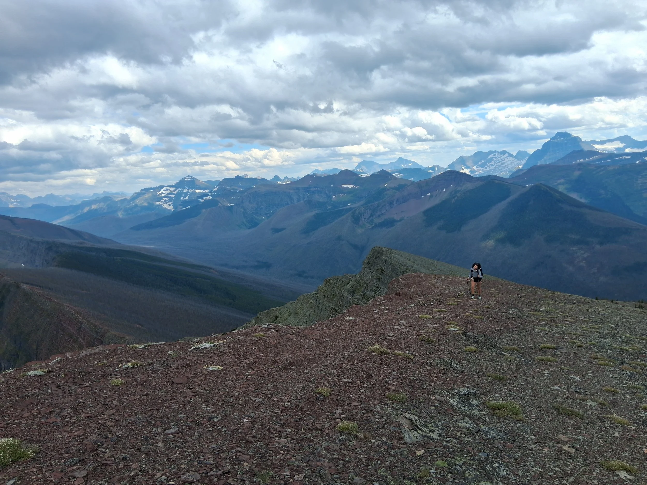
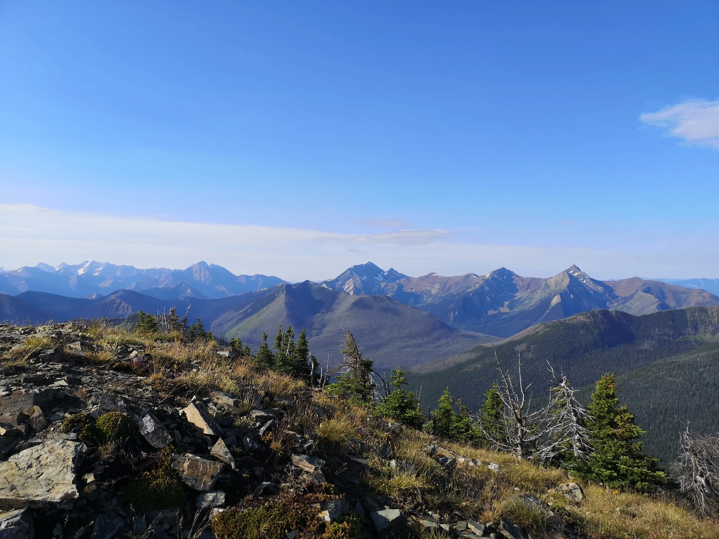
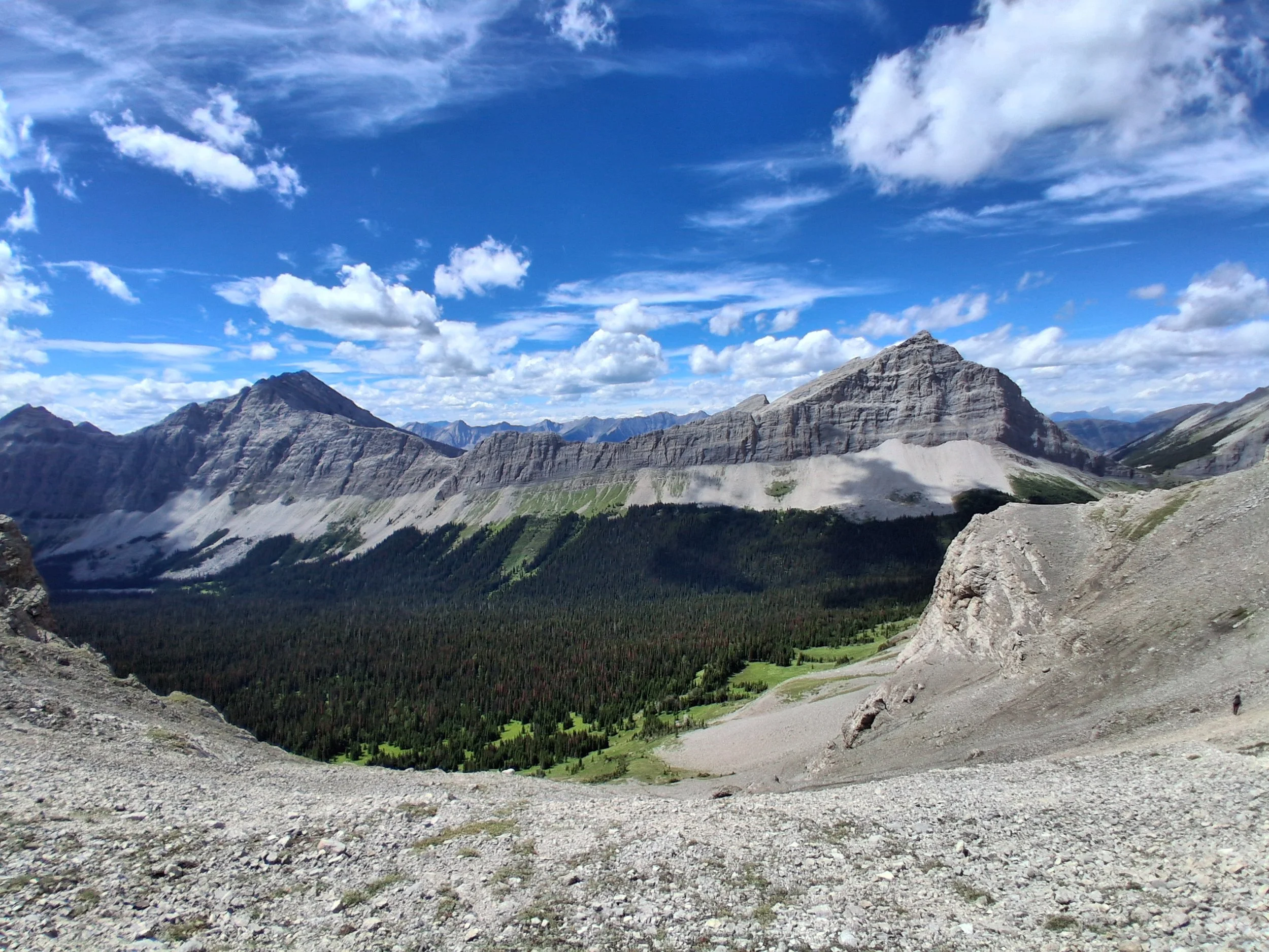
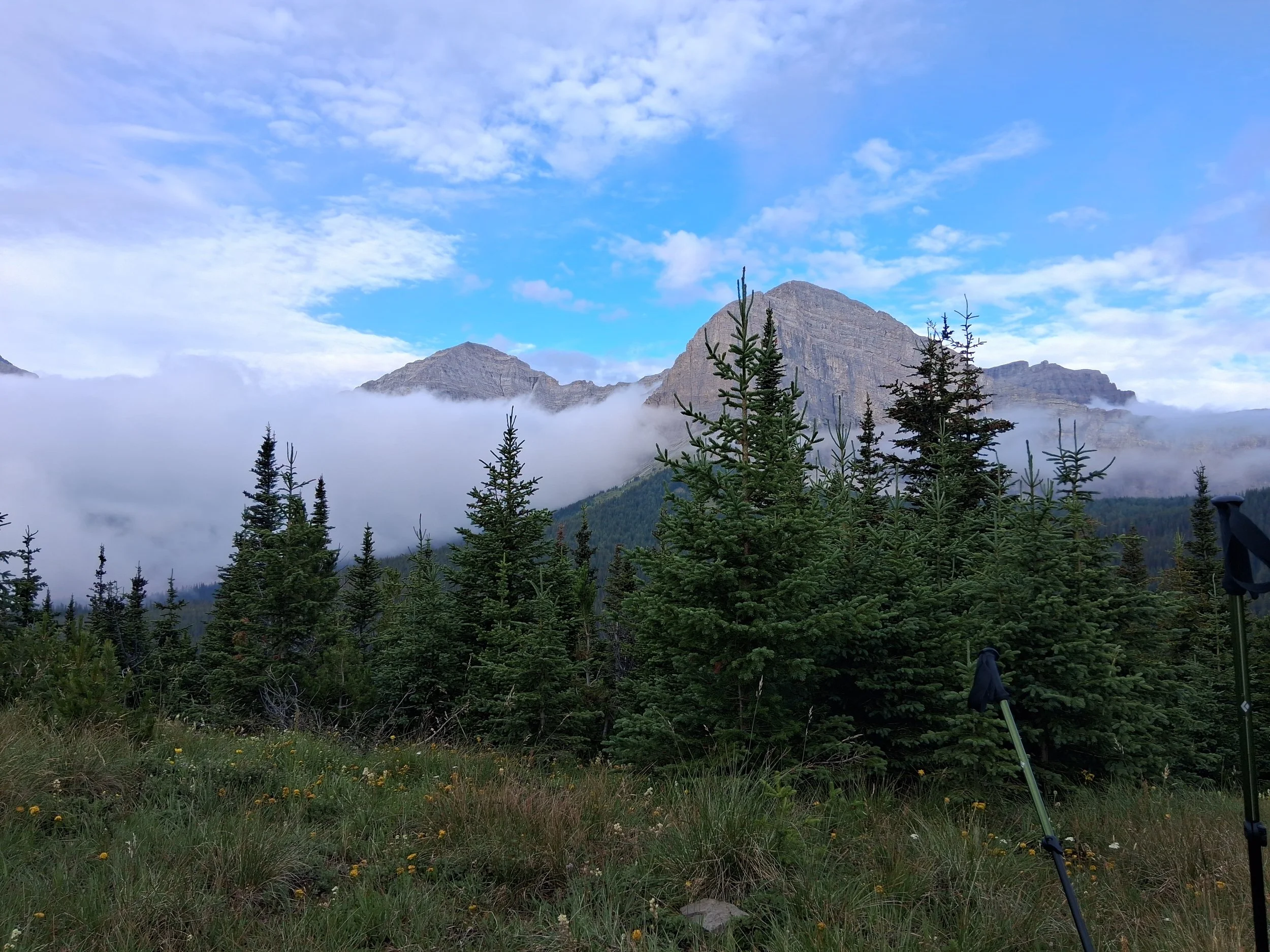
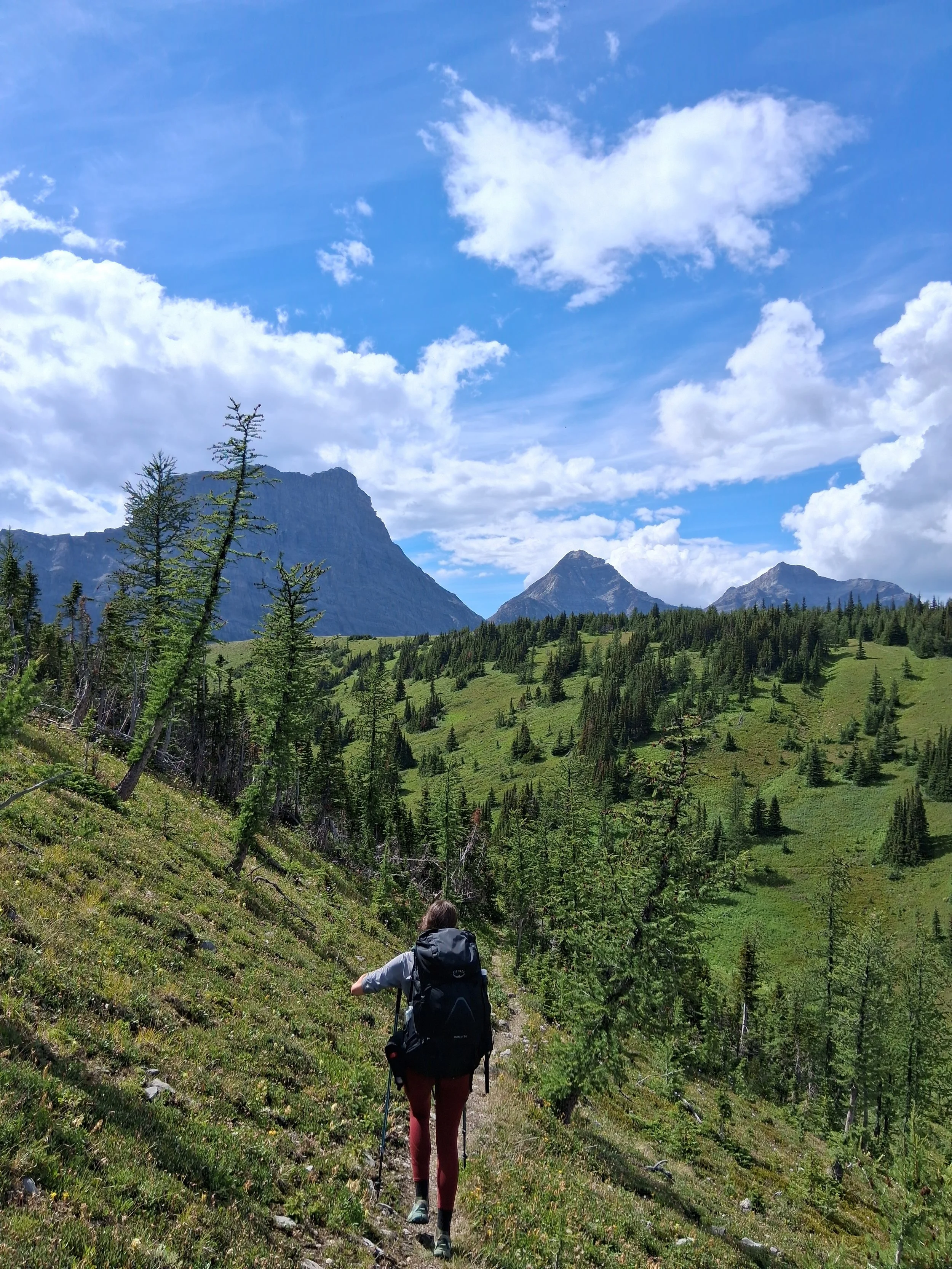
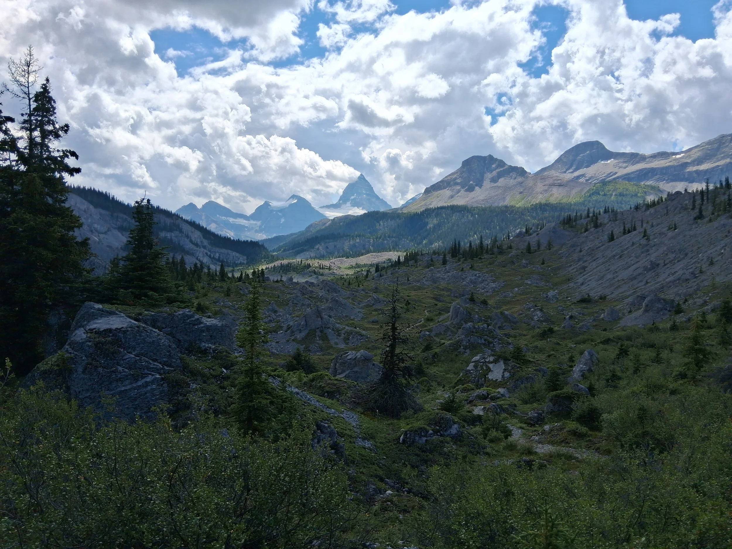
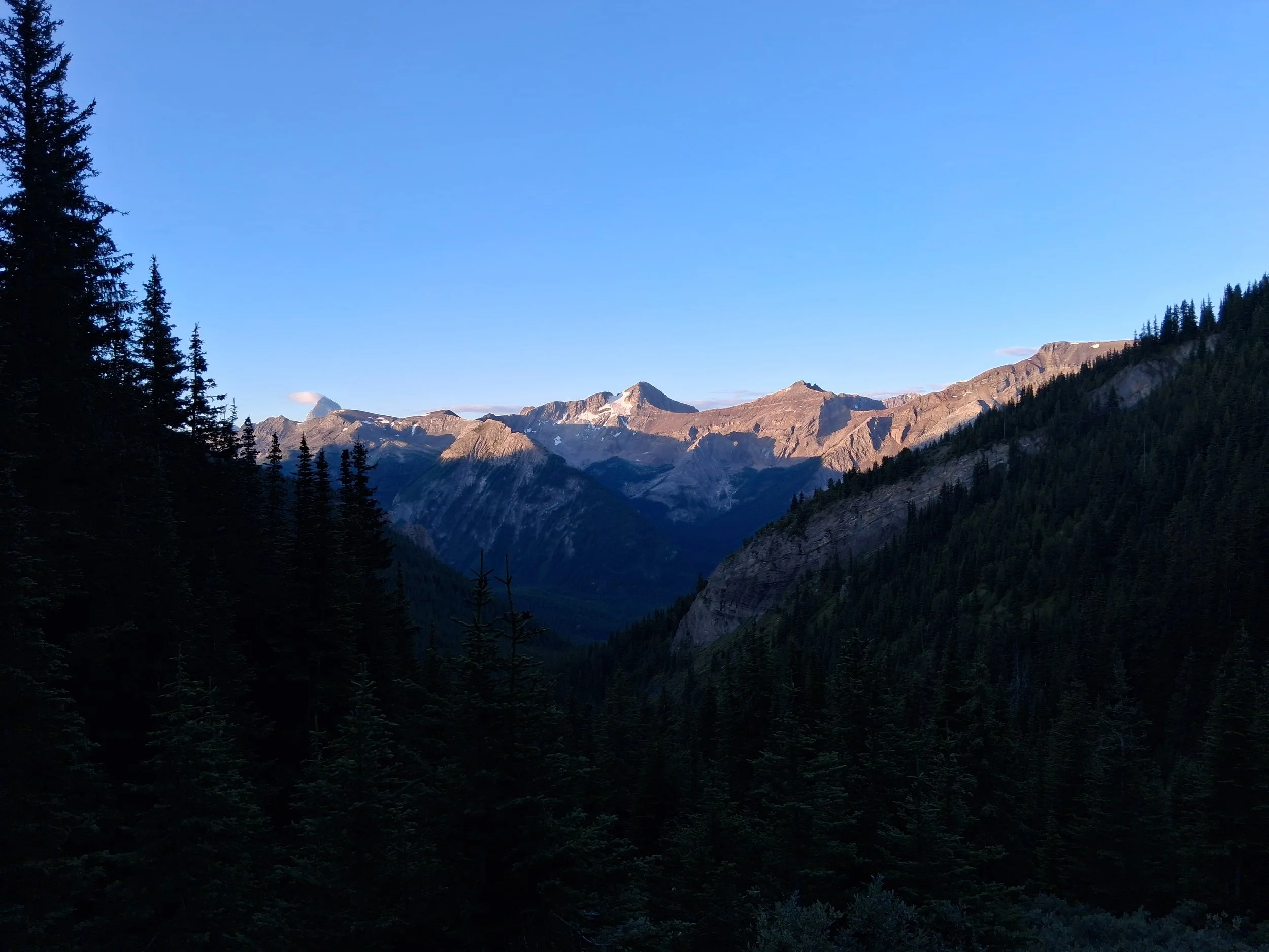
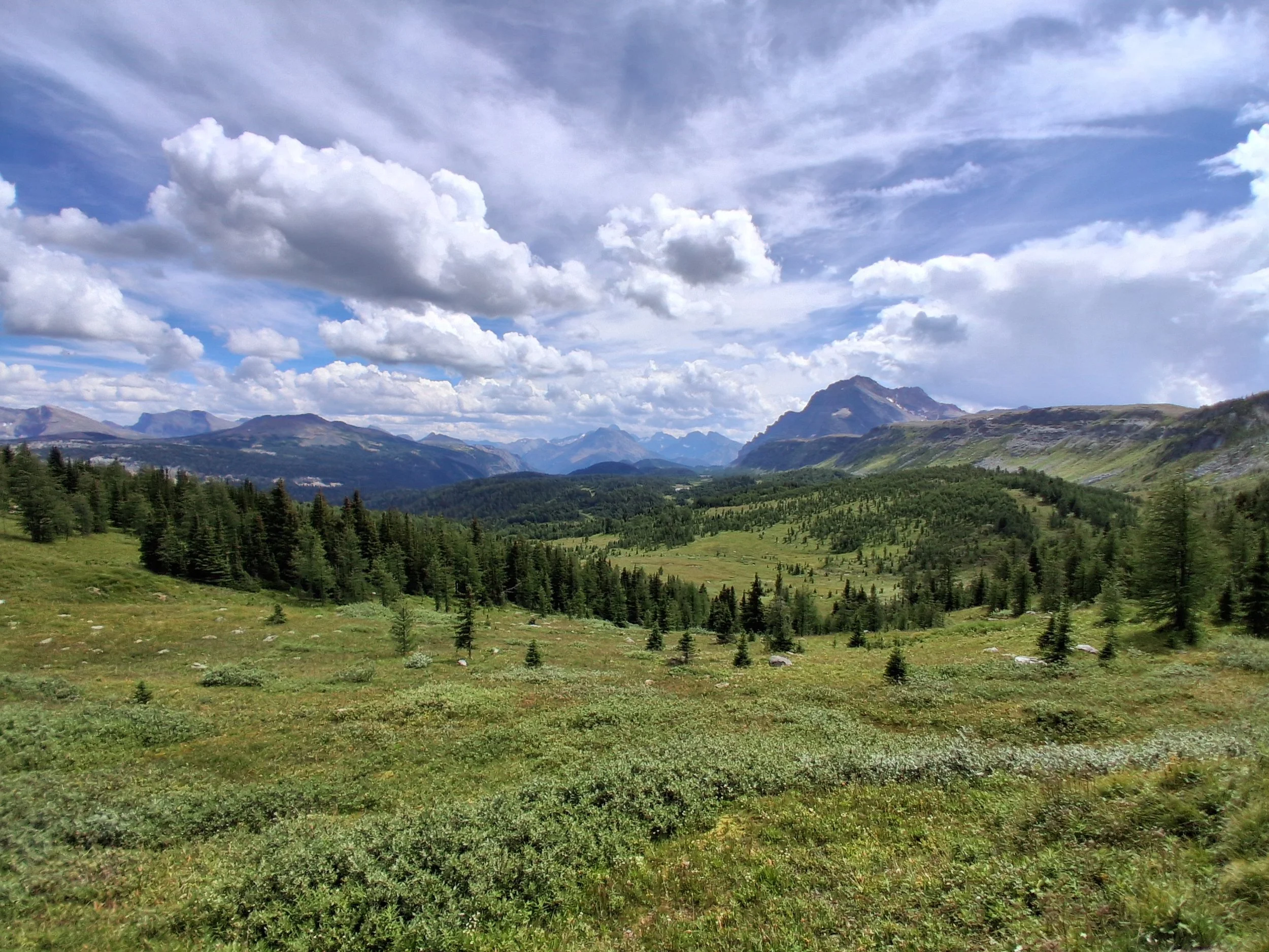
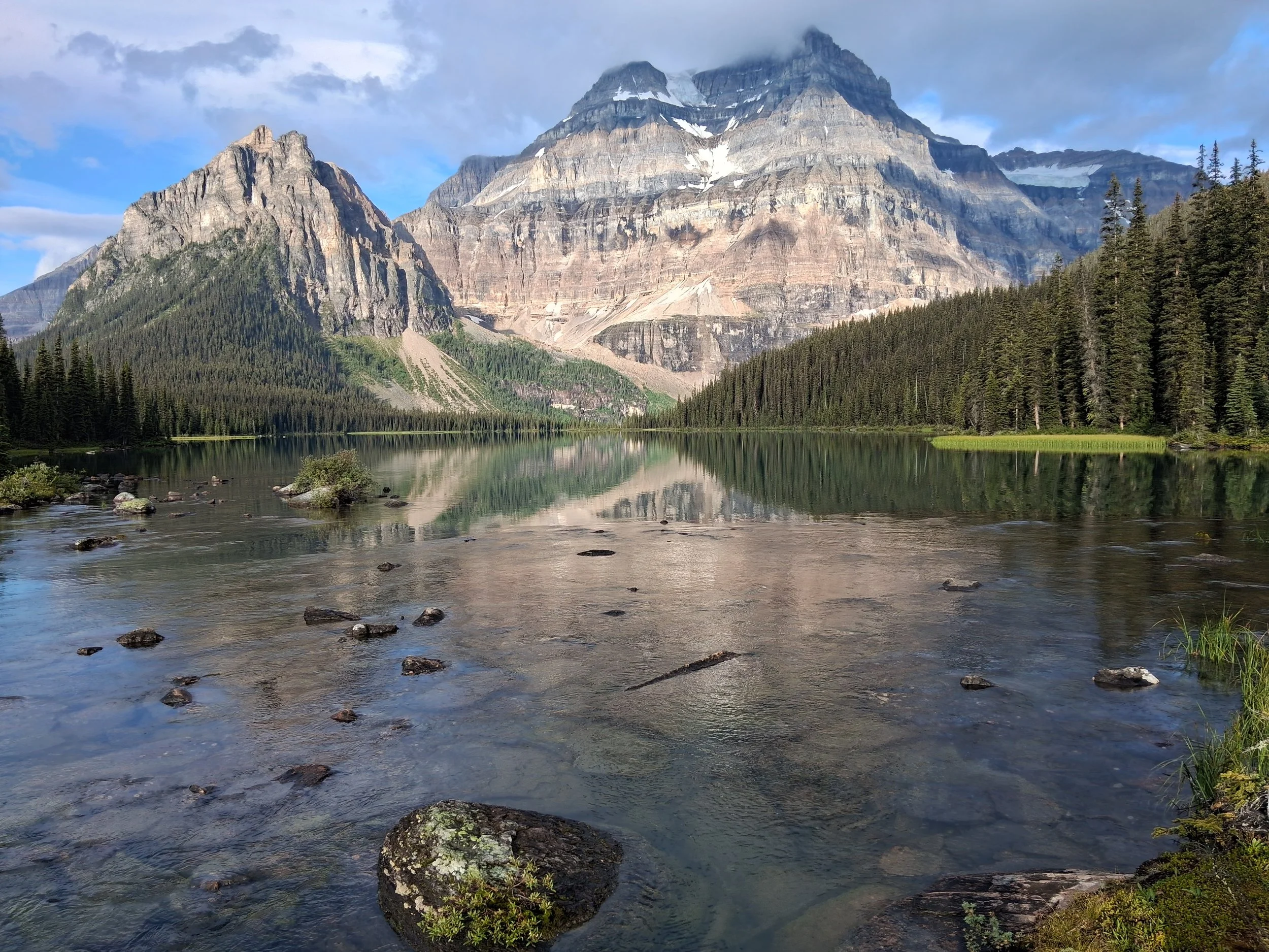
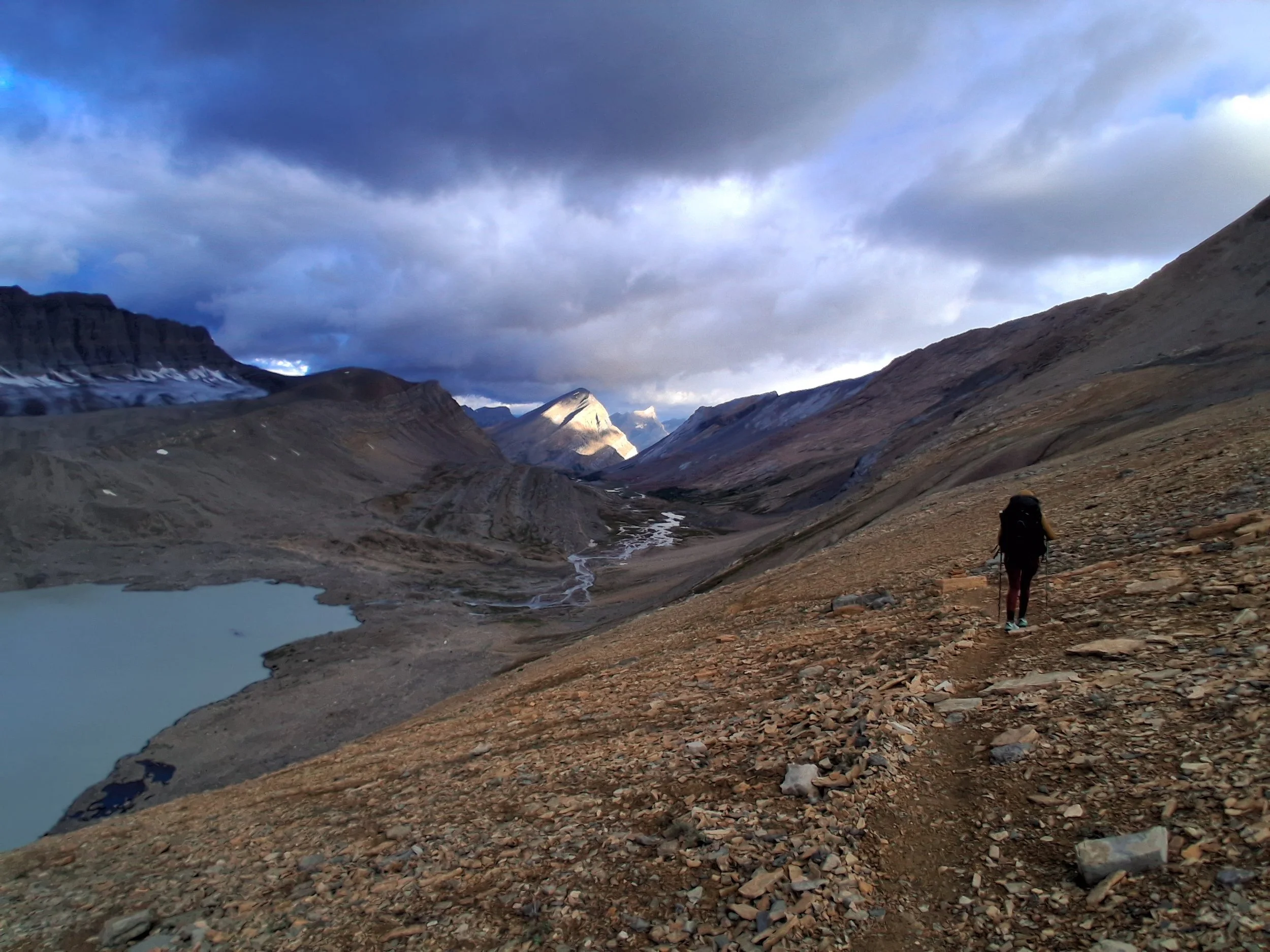
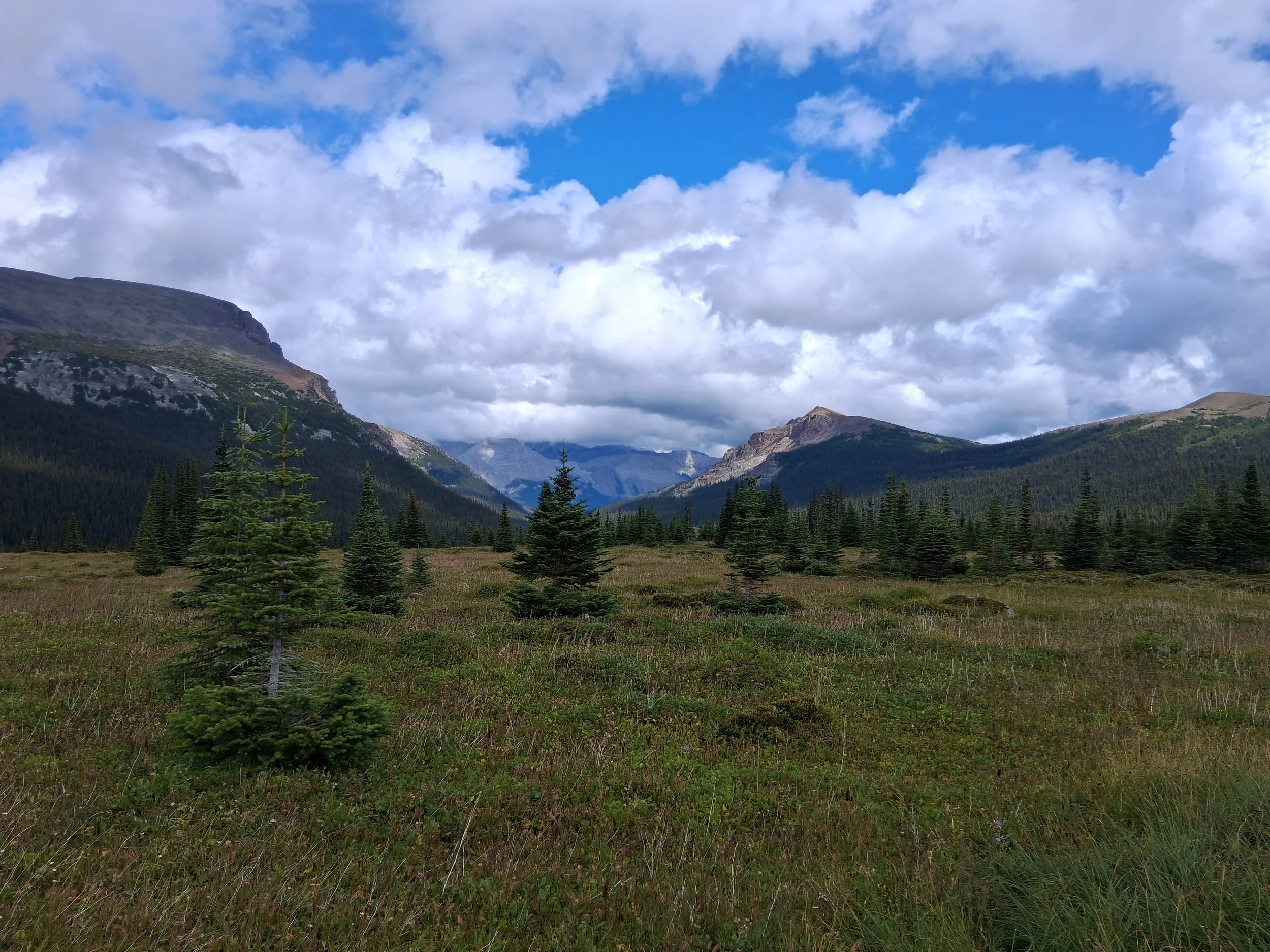
Some Photos from Section F
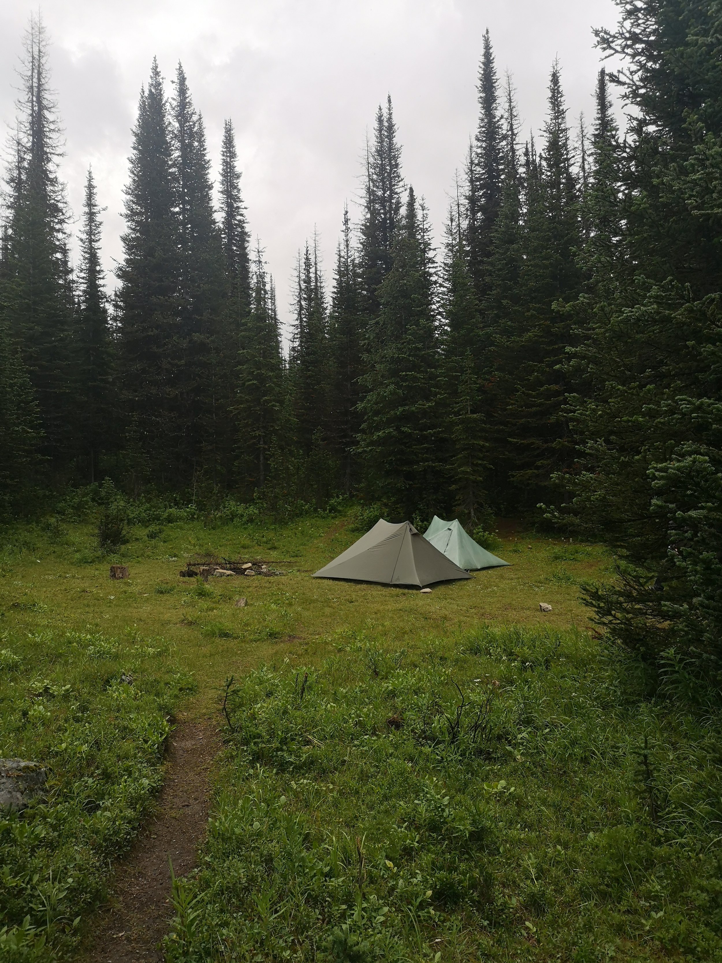
Section F was our final section to Mount Robson; we didn’t do section G right to Kakwa lake as we had left it open for decision in Jasper. We later realised how much planning the final section would take and it would only leave us 2 or so days with family in Saskatchewan before returning home. We do however plan to go back to re-hike section F and hike section G and maybe even H. But, finishing at Mount Robson was very much worth it; a beautiful spot and something we wanted to see regardless of the trail. Section F was by far my (Ben) favourite section. It felt more wild and remote and somewhat more untouched than the rest of the trail. Also, the landscape changes. It opens up into more grassy valleys with distant views of big mountains. The First day saw us sharing a taxi to the trailhead with 2 other GDT hikers we met in Jasper and we also packed out some beers for the first night. It was a straight forward hike along an ATV track then off onto a more overgrown path through the woods that took us up to the first campsite at Miette River. From here we continued up towards Miette Pass and through some beautiful wide open grass valleys with extensive views of huge mountains and old forests. We stopped at our favourite spot for lunch and really took our time in these openings to enjoy our surroundings. This was the point where we began to really feel like we were going to miss the trail. We didn’t want it to end and wish we had the time to continue on further north. It seemed the further north we hiked, the better and more enjoyable it got.
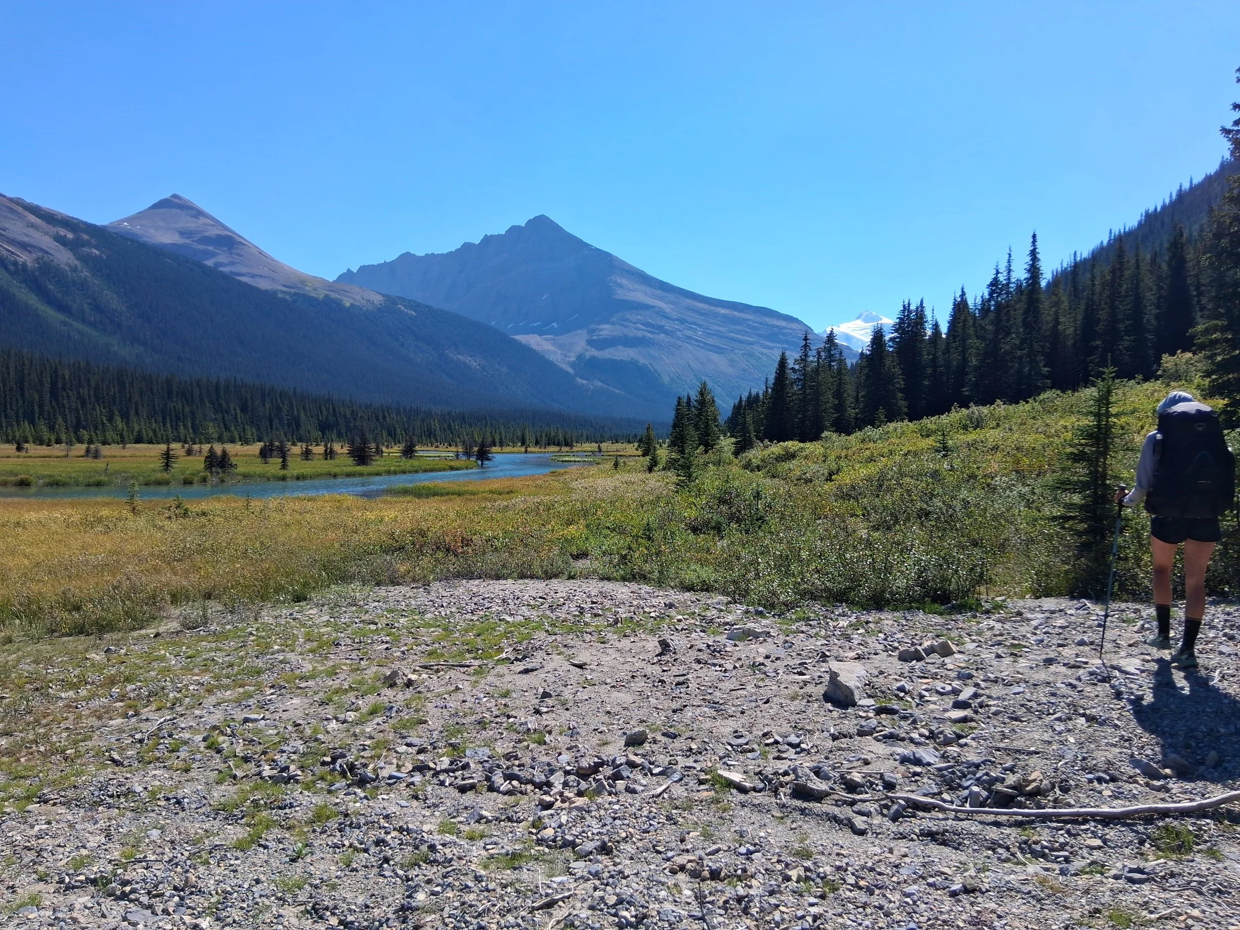
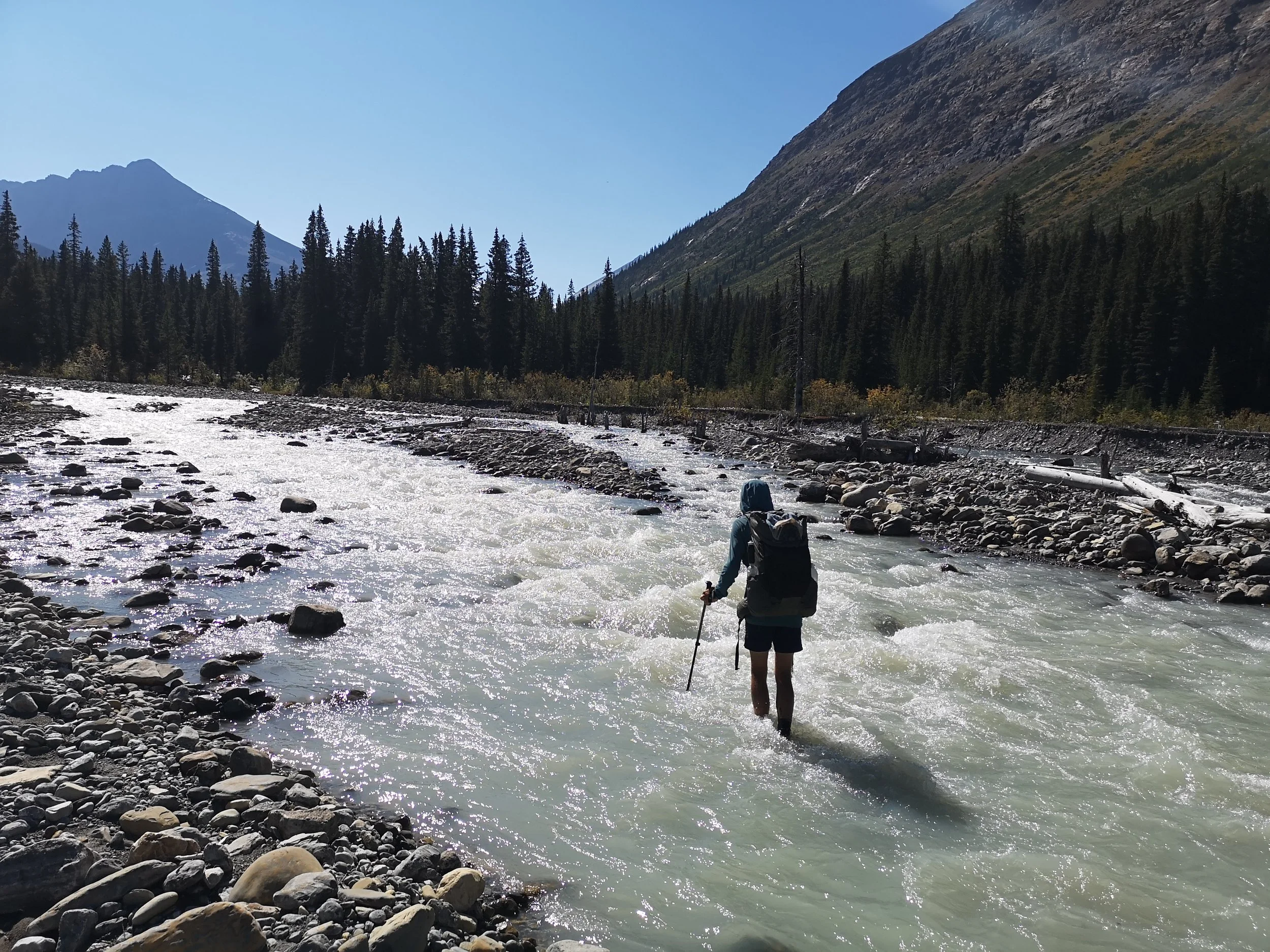
We continued after lunch hiking through a mixture of old forest and open plain with one or two river crossings, depending on whether you take the right route, to eventually reach Colonel pass, where we set up camp for the night. We set up and went for a swim in the freezing yet beautiful water. We hadn’t seen anyone at all on this day and this lovely solitude continued. The next morning was cold and icy as we began up the pass into the sun. We dropped down through some burnt forest and over many fallen trees to the Moose river. From what we could tell there were two maybe three crossings of this river on the trail… More like 10 or so. Thankfully it was a hot day and very nice to be cooled off in the river, including one fall that landed me chest deep in water. Eventually, we cleared the river crossing, which were actually quite enjoyable, and sat in the shade admiring the view, and keeping out the really hot sun. After a quick break we continued up the next pass towards Slide where we set up for the night. We had seen on the FarOut comments that there was a porcupine that liked to chew tents, bags, shoes, anything it could get hold of really. Thankfully someone had already constructed most of a log fortress around a previously used tent spot. We re-erected some of it and dropped down to the mirror still lake for dinner. It was a breath-taking and silent spot to sit and really take in all we had done so far. We sat until dark, where the stars reflected perfectly on the lake and even woke and looked out to see the sky at night. Coming from the UK, we had never seen stars like it.
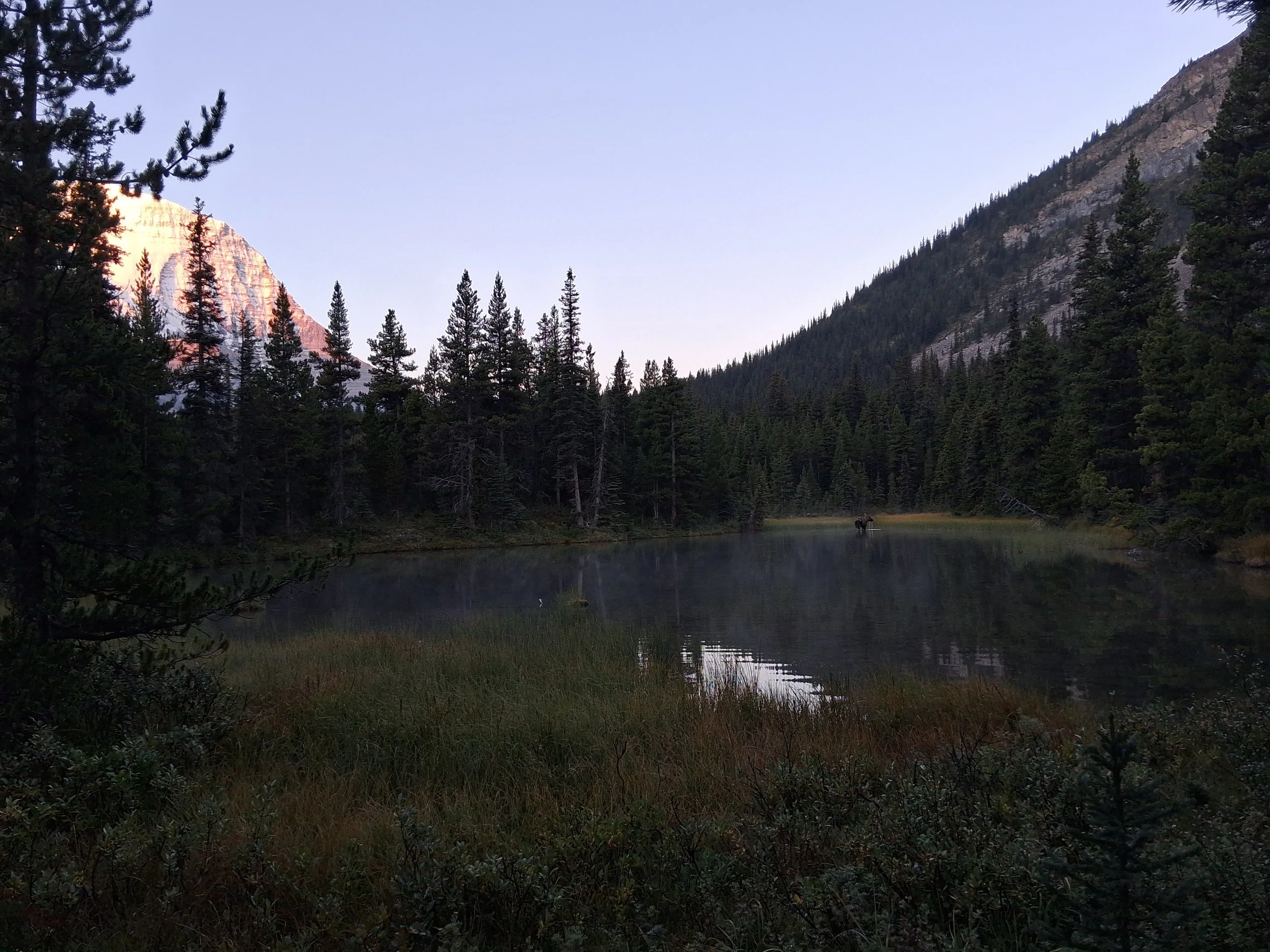
The next day we continued up the valley to the top of the pass where the views of the hanging glaciers in front of us was staggering. However, after a little research, it is sad to see how far they have receded even in our lifetime. From here we continued down to the final river crossing, which we had seen on comments was particularly deep and fast flowing. But luckily, we’d had dry weather for the lasty few days meaning the level had dropped. We crossed and stopped by the river for lunch and our last moments on the actual GDT trail. After lunch we turned of towards Mount Robson passing a beautiful meadow with beaver dammed rivers on towards Adolphus where we set up for the night. As we had arrived early, we walked down to Adolphus lake for a swim with the backdrop of Mount Robson and Rear Guard Mountain. It was a fantastic moment and beautiful swim that summed up our time on the trail. Stunning views, lots of fun… but cold water! As if it couldn’t get any more perfect there was a moose on the far bank grazing on weed in the shallows. We later met this moose on our way back to the camp, and again, when we got in our tent, it very nearly joined us!
The next morning there was ice on the quilt and lining the inside of the tent. Once we set off, we saw the moose again, and continued into Mount Robson National Park where it started to get busy. The views of Mount Robson however, lived up to expectation with a perfect mirror reflection in Berg Lake. The trail continued down, well graded and easy going, past waterfalls and rivers down to Kinney lake. We stopped here for our last lunch on the trail then hiked to the road. Not sure what we would feel when we finished but I think we instantly missed it. We hiked out to the main road, made a sign and got a hitch hike from a lovely couple from Florida. They gave us fresh fruit which was somewhat a treat after the trail. We were dropped off in Jasper where we went for a meal and headed to the local front country campsite for our last night in the Rockies. We had one more treat however. The local heard of Elk appeared just in front of us including the rather large bull. We kept a safe distance but it was quite a site to see. The next morning we caught a bus east to meet family in Edmonton and continue to their farm in northern Saskatchewan where an ease back into normal life began and start a new adventure there.
Conclusion
Well for us the GDT was a life changing adventure and one we would encourage anyone to take. The people we met, the beautiful landscape, the challenging weather, climbs and river crossings we did are really what made this trip. I (Ben) had a dream of hiking the GDT from when I very first heard about it and it turned out to be so much better than we could ever have imagined. We had already fallen in love with Canada but this really cemented that. We will be returning to the GDT and other parts of Canada again. Planning the trail was as much a challenge as hiking it and can be daunting for those wanting to attempt it. The GDTA and blogs (not just ours) are extremely helpful in ideas and giving advice from those who have done it themselves. Use this, leave a comment, email us, or message us on social media. We know how life changing this experience was for ourselves and we’d love to help make it happen for you. This was our adventure to fill the gap between University and a job, or adult life for us, but it became so much more. Its created a new lifestyle for us and a new idea of what we want our lives to look like. Who knew going for a walk could change a life!